Satungal is a village and former Village Development Committee that is now part of Chandragiri Municipality in Kathmandu District in Province No. 3 of central Nepal. Satungal is also known as Satyapur. At the time of the 1991 Nepal census it had a population of 2,730 people living in 464 households. By the time of the 2001 Nepal census the population had grown to 5,834, spread over 1,375 households. At that time 5,173 of the village population were literate - a literacy rate of 88.7%.
Mukhiyapatti Musharniya is a village development committee in Dhanusa District in Province No. 2 of south-eastern Nepal. At the time of the 1991 Nepal census it had a population of 4,621 people living in 436 individual households.
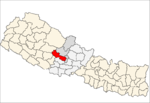
Chharka is a village development committee in Dolpa District in the Karnali Zone of north-western Nepal. At the time of the 1991 Nepal census it had a population of 552 persons living in 101 individual households. In the 2001 Nepal census it was found that 627 people identified as Buddhist and seven people identified as Hindu. It also stated that 544 people in 2001 were actually literate, 259 male and 285 female. there were also a total of 438 people who were non literate, 183 males and 255 females. Also according to the 2001 Nepal census there were a total of 634 people living in Chharka. Over one third of this population were in the age group of 4–19 years of age while only roughly about 9% of the population were the age of 50 or over.

Parche is a town and Village Development Committee in Kaski District in the Gandaki Zone of northern-central Nepal. At the time of the 1991 Nepal census it had a population of 3,182 persons living in 669 individual households.
Salyan is a town and Village Development Committee in Kaski District in the Gandaki Zone of northern-central Nepal. At the time of the 1991 Nepal census it had a population of 3,254 persons living in 665 individual households.
Sunkhani is a village development committee (VDC) in Nuwakot District in the Bagmati Zone of central Nepal. At the time of the 1991 Nepal census it had a population of 2340 people living in 437 individual households.
Babiyachaur is a village development committee in Surkhet District, Karnali Province, of mid-western Nepal. At the time of the 2011 Nepal census it had a population of 8517 people living in 1589 individual households.Brahman, Chhetri, Magar, Kami, Damai are the major ethnic groups.
Parewadanda is a village development committee in Lamjung District in the Gandaki Zone of northern-central Nepal. At the time of the 1991 Nepal census it had a population of 2633 people living in 528 individual households.

Dudhauli is a municipality of the Sindhuli District in the Janakpur Zone of south-eastern Nepal.
Karjanha is a village development committee in Siraha District in the Sagarmatha Zone of south-eastern Nepal. At the time of the 1991 Nepal census it had a population of 5296 people living in 954 individual households.
Sakhuwanankar Katti is a village development committee in Siraha District in the Sagarmatha Zone of south-eastern Nepal. At the time of the 1991 Nepal census it had a population of 2594 people living in 419 individual households.
Maharanijhoda is a village development committee in Jhapa District in the Province No. 1 of south-eastern Nepal. At the time of the 1991 Nepal census it had a population of 10,743 people living in 1811 individual households. There are mainly Brahman, Chetris living in this VDC. Manaranijhoda village development committee consists of 9 wards. The major occupation of the people of the maharanijhoda is farming.
Bangai is a village development committee in Kapilvastu District in the Lumbini Zone of southern Nepal. Locally, there are two places known by the name of Bangai, Gherawa Bangain in the east and Koili Bangain in the west, separated by the distance of 1 km. Mahendra Highway or East-West highway passes through it. The Banganga river marks the south boundary of Bangain. Manoharipur is the first adjacent village in the south of it which lies in the Kopawa V.D.C. Locally, Bangain is famous for its funeral site on the bank of Banganga known as Laxmanghat. It is also a major shopping hub within 5 km of its radius due to its proximity with the highway. At the time of the 1991 Nepal census it had a population of 2983 people living in 528 individual households.
Dhankauli is a village development committee in Kapilvastu District in the Lumbini Zone of southern Nepal. At the time of the 1991 Nepal census it had a population of 6435 people living in 1084 individual households.
Hardauna is a village in the sub-metropolitan municipality of Maharajganj in the Kapilvastu District of the Lumbini Province. The village is in a terai region in southern Nepal. It is on the Banganga, a river which arises on the southern slopes of the Sivalik Hills and flows across the terai, reaching into Uttar Pradesh state in India.
Ganeshpur is a village development committee in Kapilvastu District in the Lumbini Zone of southern Nepal. At the time of the 1991 Nepal census it had a population of 4286 people living in 734 individual households.
Mahendrakot is a village development committee in Kapilvastu District in the Lumbini Zone of southern Nepal. At the time of the 1991 Nepal census it had a population of 5367 people living in 901 individual households.
Gauri is a village development committee in Kapilvastu District in the Lumbini Zone of southern Nepal. At the time of the 1991 Nepal census it had a population of 2935 people living in 447 individual households.
Pathari Shanishchare (पथरी-शनिश्चरे) is a Municipality in Morang District in the Koshi Zone of south-eastern Nepal. It was formed by merging three existing village development committees i.e. Hasandaha, Pathari and Sanischare in May 2014.

Sundar Haraicha is a municipality in Morang District of Province No. 1 in Nepal that was established on 10 March 2017 by merging the former municipalities Sundar Dulari and Koshi Haraicha. At the time of the 2011 Nepal census, the localities formed had a joint population of 80,518 people living in 18,610 individual households.