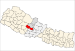
Baglung District, a part of Gandaki Province, is one of the seventy-seven districts of Nepal. The district, with Baglung as its district headquarters, covers an area of 1,784 km2 (689 sq mi) and has a population (2011) of 268,613.
Bongadobhan is a village development committee in Baglung District in the Dhaulagiri Zone of central Nepal. At the time of the 1991 Nepal census it had a population of 4,537 and had 904 houses in the town.
Narayansthan is a village development committee in Baglung District in the Dhaulagiri Zone of central Nepal.It is located above the bank of Kali gandaki River. Now, it has become one of the major important place in baglung. They have planned to construct the domestic Airport. At the time of the 2011 Nepal census it had a population of 2,876 and had 781 houses in the town. The major castes living in the VDC are Brahman, Chhetry and Newar. There are 2 high schools - Janatadhan Higher School and Ganesh Secondary School and one campus. Krishna Gandaki Campus is at the premises of Janatadhan HSS. Ganesh Secondary School, one of the best schools in the region is known for its quality education movement. Established in 1957 [2014 BS] by Soldier Board (India), Ganesh Secondary School is one of the oldest schools. In 1964 [2021 BS], the Indian Soldier Board stopped its grant. Since there was no school support mechanism developed from the Government of Nepal, the school passed through many ups and downs. After Modern Education Act came in effect in 1971 BS [2028 BS], the school merged with Janatadhan Higher Secondary School. In 1980 [2037 BS], the school was reopened.
Kebalpur is a village development committee in Dhading District in the Bagmati Zone of central Nepal. At the time of the 1991 Nepal census it had a population of 4674 and had 907 houses in it.
Mahamadpur is a Village Development Committee in Bardiya District in Lumbini Province of south-western Nepal. At the time of the 1991 Nepal census it had a population of 8,191 and had 1152 houses in the town.
Neta is a village and municipality in Gulmi District in the Lumbini Zone of central Nepal. At the time of the 1991 Nepal census it had a population of 2375 persons residing in 451 individual households.
Paudi Amarahi is a town and municipality in Gulmi District in the Lumbini Zone of central Nepal. At the time of the 1991 Nepal census it had a population of 4136 persons living in 742 individual households.
Chapakot is a village and Village Development Committee in Kaski District in the Gandaki Zone of northern-central Nepal. At the time of the 1991 Nepal census it had a population of 2,966 persons residing in 574 individual households.
Gilung is a village development committee in Lamjung District in the Gandaki Zone of northern-central Nepal. At the time of the 1991 Nepal census it had a population of 2110 people living in 419 individual households.
Dandagaun, Rapti is market center in Sharada Municipality in Salyan District in the Rapti Zone of western-central Nepal. The place formerly existing as Village Development Committee was annexed to form a new municipality since 18 May 2014. At the time of the 1991 Nepal census it had a population of 4198 people living in 740 individual households.
Pipal Neta is a village development committee in Salyan District in the Rapti Zone of western-central Nepal. At the time of the 1991 Nepal census it had a population of 1780 people living in 315 individual households.
Dubring is a village development committee in Rolpa District in Lumbini Province of north-eastern Nepal. At the time of the 1991 Nepal census it had a population of 4005 people living in 736 individual households.
Kusumkhola is a village development committee in Palpa District in the Lumbini Zone of southern Nepal. At the time of the 1991 Nepal census it had a population of 1809 people living in 349 individual households.
Mainadi is a village development committee in Palpa District in the Lumbini Zone of southern Nepal. At the time of the 1991 Nepal census it had a population of 1315 people living in 273 individual households.
Palung Mainadi is a village development committee in Palpa District in the Lumbini Zone of southern Nepal. At the time of the 1991 Nepal census it had a population of 2675 people living in 445 individual households.

Siluwa is a village development committee in Palpa District in the Lumbini Zone of southern Nepal. At the time of the 1991 Nepal census, it had a population of 4616 people living in 827 individual households. Villages within it include Romandi. Maslang is one of the main village ward no 1 which is mostly occupied by Ale magar Thar people you can find the Rana magar and masrangi magar aswel, one of the old school shree janamarga higher secondary school also in Maslang
and in siluwa, it coveres Darsing bhanjyang, Hatiya, and siluwa, all cast Bhahun, Magar, Newar, Darji, and Biswakarma people leaving in siluwa, Mandali baraju world famous temple also there in Siluwa ..
Nanda Nagar is a village development committee in Kapilvastu District in the Lumbini Zone of southern Nepal. At the time of the 1991 Nepal census it had a population of 4740 people living in 808 individual households.
Guthisuryapura is a village development committee in Nawalparasi District in the Lumbini Zone of southern Nepal. At the time of the 1991 Nepal census it had a population of 4945.
Galkot is a municipality in Baglung district of Gandaki province of Nepal. It consists of several VDCs. Nearby cities include Gulmi and Pokhara. Its geographic coordinates are 28°13'24"N 83°25'29"E.

Bhotkhola is a rural municipality (gaunpalika) out of five rural municipality located in Sankhuwasabha District of Province No. 1 of Nepal. There are a total of 10 municipalities in Sankhuwasabha in which 5 are urban and 5 are rural.