Narayansthan

Last updated
Narayansthan
नारायणस्थान
CountryFlag of Nepal.svg    Nepal
Zone Dhaulagiri Zone
District Baglung District
Population
 (2011)
  Total2,876
  Religions
Hindu
Time zone UTC+5:45 (Nepal Time)

Narayansthan is a village development committee in Baglung District in the Dhaulagiri Zone of central Nepal.It is located above the bank of Kali gandaki River. Now, it has become one of the major important place in baglung. They have planned to construct the domestic Airport. At the time of the 2011 Nepal census it had a population of 2,876 and had 781 houses in the town. [1] The major castes living in the VDC are Brahman, Chhetry and Newar. There are 2 high schools - Janatadhan Higher School and Ganesh Secondary School and one campus. Krishna Gandaki Campus is at the premises of Janatadhan HSS. Ganesh Secondary School, one of the best schools in the region is known for its quality education movement. Established in 1957 [2014 BS] by Soldier Board (India), Ganesh Secondary School is one of the oldest schools. In 1964 [2021 BS], the Indian Soldier Board stopped its grant. Since there was no school support mechanism developed from the Government of Nepal, the school passed through many ups and downs. After Modern Education Act came in effect in 1971 BS [2028 BS], the school merged with Janatadhan Higher Secondary School. In 1980 [2037 BS], the school was reopened.

Hatiya, the oldest bazaar of the VDC lies in ward no 5 & 6. Thulakhor is emerging as new bazar along with Garlung. The VDC is only 9 km away from district headquarter, Baglung. Two gravel roads (Baglung - Kusmisera & Kaligandaki Corridor) pass through the VDC. A cable car joins Narayansthan to Kusma, the district headquarters of Parvat. A suspension bridge from Badgaun, Kusma to Kaiya (Narayansthan-9) is another way to travel to Narayansthan. Kaiya has fertile land.

Related Research Articles

Baglung District District in Gandaki Province, Nepal

Baglung District, a part of Gandaki Province, is one of the seventy-seven districts of Nepal. The district, with Baglung as its district headquarters, covers an area of 1,784 km2 (689 sq mi) and has a population (2011) of 268,613.

Bajura District District in Sudurpashchim Province, Nepal

Bajura District, a part of Sudurpashchim Province, is one of the seventy-seven districts of Nepal. The district, with Martadi as its district headquarters, covers an area of 2,188 km2 (845 sq mi) and had a population of 108,781 in 2001 and 134,912 in 2011. The district has nine municipalities, 9 Ilakas and 1 constituency areas. The district is situated in Longitude between 81° 10′ 20″ to 81° 48′ 27″ East and Latitude 29° 16′ 21″ to 29° 56′ 56″ North. Geographically the district is divided in three distinct regions from north to south viz. Higher Himalayan Region, Higher Mountain and mid – Mountains. The Higher Himalayan region comprises Saipal Himalayan range; High Mountain region comprises Doha Lekh and Ghori Lekh. Similarly, Mid-Mountain range comprises different ranges of mountains e.g. Badimalika Temple. The District has started from 300m to 6400m in height. The annual rainfall is about 13,433 mm and temperatures vary from 0 °C to 40 °C. The livelihood of more than 80% of the district population depends on agriculture farming, mainly small scale livestock. Due to low level of agricultural production, the majority of the households face acute food shortages for a large part of the year. According to the National Census 2011, the total population of the district is 134,912 comprising 69,106 female (51%) and 65,806 male (49%) residing in 24,908 households. Bajura district has an average population density of around 62 people per square km. The average family size is 5.4. Life expectancy of the people is 58 years. The average literacy rate is about 32%. Bajura district has a multi ethnic composition with Chhetri, Kami, Thakuri, Brahman, Damai, SarkI and Sanyashi. The common language is Nepali (96%) followed by Bhote Sherpa (0.46%) and Tamang (0.42%). Although accessibility to Bajura is very poor, this is improving rapidly. The Government strategy is mainly focused on the connection of VDC headquarters with all-weather motor able roads to SRN or District headquarters. Moreover, the DDC body of Bajura district has given higher priority on rural roads.

Gorkha District District in Gandaki Province, Nepal

Gorkha District, a part of Gandaki Province, is one of the 77 districts of Nepal, which is the fourth largest district of Nepal and connected historically with the creation of the modern Nepal and the name of the legendary Gorkha soldiers. The district, with Gorkha Municipality as its district headquarters, covers an area of 3,610 km2 (1,390 sq mi) and has a population of 271,061 according to the 2011 Census of Nepal. Gorkha district is the site of the Manakamana Temple. The temples of Gorakh Nath and Gorakh Kali are found in the district. Several major rivers—the Chepe, Daraudi, Marsyangdi, Budi Gandaki, and Trishuli—run through the district.

Parbat District District in Gandaki Province, Nepal

Parbat District (Nepali: पर्वत जिल्ला[pʌɾbʌt], is a hilly area of Nepal. It is a part of Gandaki Province and one of the seventy-seven districts of Nepal. The district, with Kusma as its district headquarters, covers an area of 494 km2 and has a population of 157,826. It is the fourth smallest district of Nepal with 47 VDCs currently. It is mainly known for the Gupteshwar Cave, which is visited by thousands of pilgrims during Shivaratri. Patheshwari Temple a notable temple in Kushma located at Katuwa Chaupari of Kushma-09. Patheshwori Mandir has many sub-temples inside like Ram Janaki Mandir, Bhagwati, Devi, Hanuman, and others. Alapeshwar cave is a cave in this district. It is also noted for the Dahere Deurali Temple, which is visited by thousands of pilgrims during Balachaturdanshai. Kamadhenu Mandir is another temple of Parbat district which is located in Khurkot development committee. Recently the Modi hydro project of 10 M.W. has been constructed in this district. Parbat's biggest playground lies in Phalewas village named Majhi Chour and Indra Chour.

Baglung Place in Dhaulagiri Zone, Nepal

Baglung is a municipality in western Nepal, 275 km (171 mi) west of Kathmandu. It is the administrative headquarters of Baglung District and Dhaulagiri Zone. Baglung serves as the major center for business, finance, education, service and healthcare for the people of mid-Kali Gandaki valley that encompass Beni, Jaljala, Baglung, Kushma, Kathekhola, Galkot, Phalewas and Jaimuni local bodies. The city is located at the cross-section of Kaligandaki corridor highway and midhill highway that transverse Nepal in north–south and east–west directions respectively.

Bandipur Rural Municipality Place in Gandaki Province, Nepal

Bandipur is a hilltop settlement and a rural municipality in Tanahun District, of Nepal. Because of its preserved, old time cultural atmosphere, Bandipur has increasingly been coming to the attention of tourism. At the time of the 2011 Nepal census it had a population of total 15,591 people living in 3,750 individual households. Bandipur is famous for Newari people and their cultures.

Amalachaur Place in Nepal

Amalachaur is a village development committee in Baglung District in the Dhaulagiri Zone of central Nepal. At the time of the 1991 Nepal census it had a population of 5,055 and had 943 houses.

Burtibang is a village development committee in Baglung District in the Dhaulagiri Zone of central Nepal. Burtibang is the second-largest commercial city in the district after Baglung.

Sarkuwa Village development committee in Dhaulagiri Zone, Nepal

Sarkuwa is a village development committee of the Baglung District of the Dhaulagiri Zone, situated in western Nepal. At the 1991 Nepal census it had a population of 2,516 and 495 houses.

Syaulibang Village Development Committee in Mid-Western, Nepal

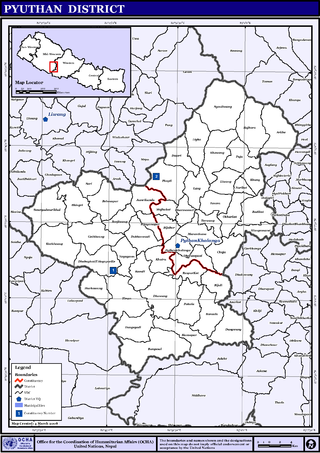
Syaulibang is a village and Village Development Committee in Pyuthan, a Middle Hills district of Rapti Zone, western Nepal.

Dhikur Pokhari Former Village Development Committee in Gandaki Zone, Nepal

Dhikurpokhari is a suburb and former Village Development Committee in Kaski District in the Gandaki Province of northern-central Nepal. At the time of the 1991 Nepal census it had a population of 7,392 persons living in 1,427 individual households.

Hemja subdivision of Pokhara in Gandaki Province, Nepal

Hemja is a former Village Development Committee in the north of Pokhara in Kaski District in the Gandaki Province of northern-central Nepal. In 2014, Hemja was annexed to Pokhara City as ward number 27. Hemja is now under Pokhara Municipality ward #25. At the time of the 2011 Nepal census, it had a population of 12,262 living in 3,019 households.

Duradanda Village development committee in Gandaki Zone, Nepal

Duradanda is one of the mid-hills in Lamjung District. Lamjung is one of districts in Gandaki in central Nepal. Duradanda used to have former six village development committees (VDCs) namely Chandreshwor, Duradanda, Dhuseni, Ishaneshwor, Neta, and Purankot. The new constitution has restructured the local bodies and these VDCs are formally non-existent. The name 'Duradanda' is composed of two terms: Dura= historical Dura tribes + danda= hill in Nepali. Duras inhabited this place from the historical times and were important political game players in the past, especially when Nepal was fragmented into 22–24 Kingdoms, known as Bayise Chaubisi rajyas. Duradanda is considered to be the place of origin of the 'Dura' tribe. Duras have their own language and culture but are being forgotten because of an increasing influence from other cultures. Dura language, in fact, is no longer in use as the tribe uses the Nepali language. Only old generations knows the language, and not many people of this generation are alive at this time. Thus, Dura language is in danger of being lost completely. Apart from Duras, Duradanda is also known for famous historical movements called 'Halo Kranti ' and 'Siksha Kranti '. Sarvodaya High School was one of the oldest school in the entire region of Central Nepal. Thus, people from very far places used to come to Duradanda for formal school education from Sarvodaya High School. At that time, young people who wanted to come here seeking school education from far villages used to say: "Duradanda kei chhaina tadha, janchhu ma ta sikshya ko khojima" meaning that "Duradanda is no longer far and I want to go there seeking my education". There were no hostels, so the youngesters used to live as guests in locals' houses, preferably relatives. In return, they had to bring commodities or to provide labor services for household and/or farm works.

Darsing Dahathum Village development committee in Gandaki Zone, Nepal

Darsing Dahathum was a village development committee in Syangja District in the Gandaki Zone of central Nepal. At the time of the 2011 Nepal census it had a population of 6598 people living in 1671 individual households. Bayarghari Bazaar is the common market of this village development committee. The small bazaar Bayarghari is one of the fastest growing bazaars of Syangja District. Most of the people living in this VDC are in Indian Army. The national highway Siddhartha Highway passes by this VDC. There are several government schools including four private schools also. Main governmental school is Dahathum Higher Secondary School which is near Bayarghari.

Padampur, Nepal District in Nepal

Padampur is a municipality in Chitwan District in the Narayani Zone of southern Nepal. At the time of the 1991 Nepal census it had a population of 8,884 people living in 1,559 individual households. It was transferred in new location named Saguntol by Government of Nepal and completed with in 8 years i.e. from 2050 BS to 2058 BS. Previously it was at the lap of Rapati river and inside the Chitwan National Park. Flood of Rapati river in monsoon season destroy farmers crops. Wild animals also harmed their crops. Transportation, electricity, road and educational facilities were beyond people's access. It was known as one of the remote areas of the Chitwan district. In a view of agriculture, It was the best place for farmers. After the new dawn of democracy in 2046, New government was asked to shift this village for peoples safety and conservation of forest and wild animal. The cabinet of Girija Prasad Koirala was assured to shift in a convenience place soon and started the task immediately. This task was successfully done by the politician Baburam Puri of the Nepali Congress. The late Sailaja Acharya visited the people and understood their griefs and proposed to shift it next to Sagoontol near Jutpani VDC. This was a very difficult task to accomplish successfully. People from the Western Chitwan were stood against it but government took bold decision in favour of people of Padampur. Now it is about 2.5 km (1.6 mi) east to Bharatpur, district headquarters of Chitwan. Electricity, roads and transportation facility are comparatively better here. 2,800 households were there now. According to the 2001 census, the total population of the VDC was 11,336 with total households 2,137. Tharus are the dominant ethnic group with 45.89% of the total VDC population. Brahman, Kshetri, Tamang, Gurung and Newar are other castes here. Mainly banana, maize and oil are farmed here. Except ward no 1 there are deep tubewells to Irrigate farmlands. Poultry, dairy, epiculture, mushroom farming and goat keeping have great potentials here. A campus, A higher secondary school, a secondary boarding school and other 7 primary and lower secondary schools are providing education here. Health post, and Post office are too doing their best for providing services to locals. Drinking water is provided in better and modern way. Pipelines of drinking water are available within all roads (113 km) of Padampur. An NGO veterinary office is also serving and helping farmers. Since last 5 years this VDC is starting to be known as one of pocket areas of commercial banana farming of the nation. Nobody is landless here and this is the special feature here. Padampur is very attractive location for migratory view and daily people are migrating here. It is like a colonial place for settlement of people. Government has sifted it in a well planned way and that is why it is the second model VDC of Nepal. Now this village has merged in Kalika Municipality and shares 4 wards in it i.e. Kalika -9, Kalika-10, Kalika-11 and Kalika-12.

Jaidi is a development committees of Baglung District of Gandaki Province, situated in western Nepal. Jaidi is situated in the southern part of Baglung district. It is surrounded by Chisti, Kiwai, Byarthala, Sarkuwa and Arjewa Village Development Committees. According to the census of 2011. this VDC have more than 1000 households. The VDC is again divided into smaller villages called Ward, and it has 9 different Ward within VDC.

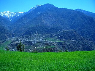
Galkot is a municipality in Baglung district of Gandaki province of Nepal. It consists of several VDCs. Nearby cities include Gulmi and Pokhara. Its geographic coordinates are 28°13'24"N 83°25'29"E.

Paudhur Village in Nepal in Gandaki Province

Paundur (पाउँदुर) is a central village in Kaski district of Gandaki Province of Nepal. It lies about 28 km west of the Pokhara valley and 38 km east of Kushma, Parbat. It is a part of ward no. 3 of Annapurna Gaupalika of Gandaki Province of Nepal, and was the ward no.5 and 8 of the former Dhikurpokhari VDC.It lies west of Nagdanda; nearest sub urban area. There are more than 100 houses in this village.

Jaimini Municipality Municipality in Gandaki Province, Nepal

Jaimini is a municipality in Baglung district of Gandaki province of Nepal. Nearby cities include Kusma and Baglung. Its geographic coordinates are 28.182101" N 83.613602" E. Jaimini Municipality is surrounded by Parbat district on the east, Galkot Municipality and Bareng Rural Municipality on the west, Khathekhola Rural Municipality and Baglung Municipality on the north and Gulmi and Parbat districts on the south.

References

  1. "Nepal Census 2001". Nepal's Village Development Committees. Digital Himalaya . Retrieved 2008-08-23.

Coordinates: 28°13′N83°40′E / 28.217°N 83.667°E / 28.217; 83.667