Jutpani is a village development committee in Chitwan District in Bagmati Province of southern Nepal. At the time of the 1991 Nepal census it had a population of 8,762 people living in 1,714 individual households.
Barakot is a ward in Dasharathchanda municipality, in Baitadi District in Sudurpashchim Province of western Nepal. Earlier it was a village development committee (VDC). At the time of the 1991 Nepal census it had a population of 2,389 and had 462 houses in the village.
Kailashmandau used to be VDC in Bajura District in the Seti Zone of north-western Nepal. At the time of the 2011 Nepal census it had a population of 9,586 and had 1818 houses. There is a small market and it is also the junction to many villages of this region.

Kolti is a village in tehri District in the Seti Zone of Karnali-Nepal. At the time of the 1991 Nepal census it had a population of 4,530 and had 850 houses in the village.

Takukot is a Ward of Barpak sulikot Rural Municipality in Gorkha District in the Gandaki Province of northern-central Nepal. At the time of the 1991 Nepal census it had a population of 4,234 and had 801 houses in the town.
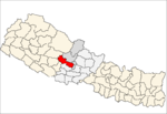
Shikhar Ambote is a village development committee (VDC) in Kavrepalanchok District in the Bagmati Zone of central Nepal. At the center of village is a public school named Shree Devi Secondary School. At least 700 students from different parts of the village receive basic education. At the time of the 1991 Nepal census, the village had a population of 3,995 in 702 individual households.
Danabari is a town and Village Development Committee in Ilam District in the Province No. 1 of eastern Nepal. At the time of the 2011 Nepal census it had a population of 14302 persons living in 1492 individual households.
Sulubung is a Village Development Committee in Ilam District in the Province No. 1 of eastern Nepal. At the time of the 1991 Nepal census it had a population of 3,470. Maipokhari, one of the major tourist and religious place of Nepal lies here. A company named Hesty Kiwi Private Limited has been established in this region which had helped to popularize this village with the plantation of kiwifruit. It is about 15 km from Ilam Bazaar. It is a hilly area having cold climate and mainly tea production is the income of most of the people here.

Hemja is a former Village Development Committee in the north of Pokhara in Kaski District in the Gandaki Province of northern-central Nepal. In 2014, Hemja was annexed to Pokhara City as ward number 27. Hemja is now under Pokhara Municipality ward #25. At the time of the 2011 Nepal census, it had a population of 12,262 living in 3,019 households.
Salyan is a town and Village Development Committee in Kaski District in the Gandaki Zone of northern-central Nepal. At the time of the 1991 Nepal census it had a population of 3,254 persons living in 665 individual households.
Kaskikot, commonly known as Kaski, is a Ward no. 24 of the Pokhara metropolitan city. It was earlier a part of the village development committee in Kaski District, a region in northern-central Nepal.
Tikhatar is a village development committee in Doti District in the Seti Zone of western Nepal. At the time of the 1991 Nepal census it had a population of 5222 people in 958 individual households.

Bhadrapur is a town and municipality in Jhapa District in the Province No. 1 of southeastern Nepal. It lies on the banks of the Mechi River, and shares borders with Bihar state, India on south and West Bengal state on north. There is a border crossing with customs office for goods. Galgalia village in Kishanganj District borders with Bhadrapur
Beldandi is a rural municipality in Kanchanpur District in Sudurpashchim Province of southwestern Nepal named after the former Village Development Committee. At the time of the 1991 Nepal census the VDC had a population of 9301 people living in 1483 individual households. According to the Nepal census 2011 the municipality had 3022 individual households and a population of 21,959. In the north and west, Beldandi is surrounded by Suklaphatha national park. To the east lies Belauri Municipality. On the south, it borders India.
Gardi was a village development committee in Chitwan District in Bagmati Province of mid-southern Nepal before merging into Madi Municipality. At the time of the 2011 Nepal census it had a population of 9,241 people living in 2,168 individual households. Sitalpur (सितलपुर) is the largest village inside Gardi.
Urlabari is a city and municipality in Morang District in the Koshi Zone of south-eastern Nepal. It is considered to be the second largest city in Morang District after Biratnagar. At the time of the 1991 Nepal census it had a population of 18,224. At the time of the 2011 Nepal census it had a population of 35,166 and 8,165 households.
Amarapuri is a town in Gaidakot Municipality in Nawalparasi District in the Lumbini Zone of southern Nepal. It became a municipality in May 2014 by merging the existing Mukundapur, Amarapuri, Gaidakot, Nawalparasi, VDCs. At the time of the 1991 Nepal census it had a population of 5,451 living in 967 households. Amarapuri has three high schools, the Shree Laxmi Higher Secondary School, Amar Jyoti Higher Secondary School and Amar English Higher Secondary Boarding School.
'Ghusel is a village and former Village Development Committee that is now part of Bagmati Rural Municipality in Bagmati Province of central Nepal. It is located southern part of Kathmandu Valley at similar or less heights. At the time of the 2011 Nepal census it had a population of 1510 in 308 individual households, down from the time of the 1991 Nepal census when it had a population of 1715 in 294 individual households.

Gokarneshwar is a municipality in Kathmandu District in the Bagmati Province of Nepal that was established on 2 December 2014 by merging the former Village development committees Sundarijal, Nayapati, Baluwa, Jorpati and Gokarna. The office of the municipality is that of the former Jorpati village development committee. The river Bagmati has its origin as the name Bagh Dwar situated in the middle of the Shivapuri jungle in this municipality. In the village on the banks of the Bagmati River stands the Gokarna Mahadev temple, built in 1582. In late August or early September people go to this temple to bathe and make offerings in honor of their fathers, living or dead, on a day called Gokarna Aunsi.
Agnisaira Krishnasavaran is a rural municipality in Saptari District in the Sagarmatha Zone of south-eastern Nepal. At the time of the 2017 Nepal census it had a population of 27,129 people living in 2265 individual households.