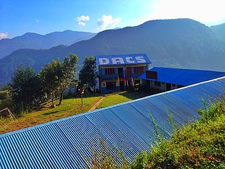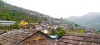
Baglung District, a part of Gandaki Province, is one of the seventy-seven districts of Nepal. The district, with Baglung as its district headquarters, covers an area of 1,784 km2 (689 sq mi) and has a population (2011) of 268,613.
Amalachaur is a village development committee in Baglung District in the Dhaulagiri Zone of central Nepal. At the time of the 1991 Nepal census it had a population of 5,055 and had 943 houses.
Amarbhumi is a village development committee in Baglung District in the Dhaulagiri Zone of central Nepal. At the time of the 1991 Nepal census it had a population of 2,248 and had 409 houses in the village. It has been reported that the villagers of Amarbhumi VDC in Baglung district have changed their village's name to Mulabari.
Argal is a Village Development Committee in Baglung District in the Dhaulagiri Zone of central Nepal. It is located roughly 25 kilometres west of Baglung. At the time of the 1991 Nepal census it had a population of 2,148 and had 387 houses in the village.
Damek is a village development committee in Baglung District in the Dhaulagiri Zone of central Nepal. At the time of the 1991 Nepal census it had a population of 5,824 and had 1072 houses in the town.
Dhamja is a village development committee in Baglung District in the Dhaulagiri Zone of central Nepal. At the time of the 1991 Nepal census it had a population of 2,571 and had 497 houses in the village. Only some basic developmental infrastructure are on its way to Dhamja. Most people are dependent to the traditional agriculture for their living. Millet, barley, rice, wheat, and various kinds of seasonal fruits and vegetables are the major crops. The foreign remittance is also considered one of the major source of income for the people living there.
Baglung municipality 5 (Malika) is in Baglung District in the Dhaulagiri Zone of central Nepal. At the time of the 1991 Nepal census it had a population of 2,242 and had 433 houses in the village.
Sarkuwa is a village development committee of the Baglung District of the Dhaulagiri Zone, situated in western Nepal. At the 1991 Nepal census it had a population of 2,516 and 495 houses.
Machhegaun is a village and former Village Development Committee that is now part of Chandragiri Municipality in Kathmandu District in Province No. 3 of central Nepal. At the time of the 1991 Nepal census it had a population of 2,871.
Mulpani is a village and former Village Development Committee that is now part of Kageshwari-Manohara Municipality in Kathmandu District in Province No. 3 of central Nepal. Mulpani was previously known as Bhaimal, meaning "no fear". At the time of the 1991 Nepal census it had a population of 4,718 living in 843 households. The main occupation of the people in the village is agriculture. Mulpani is surrounded by Bagmati and Manohara river. Mulpani is famous for the Nepal's biggest International Cricket Ground, known as Mulpani Cricket Stadium, which is under construction. In recent years, Mulpani has seen much change in its infrastructure and people as well. The main occupation in Mulpani was agriculture but now employment is more diverse.

Chaukidanda is an administrative Headquarter of Salpasilichho Rural Municipality in Bhojpur District in the Province No. 1 of eastern Nepal. It is ward no.-3 too on newly formed Salpasilichho Rural Municipality in northern part of District.
Lamatar is a village and former Village Development Committee that is now part of Mahalaxmi Municipality in Province No. 3 of central Nepal.
Dhikurpokhari is a suburb and former Village Development Committee in Kaski District in the Gandaki Province of northern-central Nepal. At the 1991 Nepal census, it had a population of 7,392 persons in 1,427 individual households.
Banau is a village development committee in Parbat District in the Dhawalagiri Zone of central Nepal. At the time of the 1991 Nepal census it had a population of 1432 people living in 251 individual households.
Gamhariya was a village development committee in Rautahat District in the Narayani Zone of south-eastern Nepal.
Gunjanagar is a town in Bharatpur, Chitwan in Bagmati Province of southern Nepal. The former Gunjanagar VDC and Saradanagar VDC were merged on 18 May 2014 to form new Chitrawan Municipality, which later was merged with Bharatpur. At the time of the 1991 Nepal census it had a population of 11,076 people living in 2025 individual households.

Letang, "लेटाङ " is a municipality with 9 wards in Morang District in the Koshi Province of Nepal. It was formed by merging the existing Village Development Committees of Letang, Jante, Warrangi and Bhogateni. This municipality is situated in Hilly Region as well as Terai Region. Previously it was called Letang Bhogateni but now it's known as Letang.
Jaidi is a development committees of Baglung District of Gandaki Province, situated in western Nepal. Jaidi is situated in the southern part of Baglung district. It is surrounded by Chisti, Kiwai, Byarthala, Sarkuwa and Arjewa Village Development Committees. According to the census of 2011. this VDC have more than 1000 households. The VDC is again divided into smaller villages called Ward, and it has 9 different Ward within VDC.

Serachaur सेराचौर is a village which is located in Kaski District, Gandaki Province, Nepal. The word Sera refers to a plain land which is used to farm and supply food to a palace and Chaur means a grassy land. First settlers of this village were Adhikari Family. It is a part of the Annapurna Gaunpalika ward number- 2, Kaski, Nepal. Pastly the village was part of Dhikurpokhari V.D.C but later the Ministry of Federal Affairs and Local Development (Nepal) dissolved the existing village development committees and announced the establishment of this new local body. Visitors can take the Baglung Highway, Kaskikot road and other existing trails to reach here. Concrete pavement is recent installation to the road.

Annapurna Rural Municipality, Kaski is a Gaunpalika in Kaski District in Gandaki Province of Nepal named after the Annapurna Mountain. On 12 March 2017, the Government of Nepal implemented a new local administrative structure. With the implementation of the new local administrative structure, VDSs have been replaced with municipal and village councils. Annapurna Gaupalika is one of these 753 local units.


