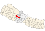
Pokharathok is a small town in Arghakhanchi District in the Lumbini Zone of southern Nepal. At the time of the 1991 Nepal census it had a population of 3,373 and had 622 houses in the town.
Bongadobhan is a village development committee in Baglung District in the Dhaulagiri Zone of central Nepal. At the time of the 1991 Nepal census it had a population of 4,537 and had 904 houses in the town.
Daga Tumdada is a village development committee in Baglung District in the Dhaulagiri Zone of central Nepal. At the time of the 1991 Nepal census it had a population of 4,874 and had 897 houses in the town.
Damek is a village development committee in Baglung District in the Dhaulagiri Zone of central Nepal. At the time of the 1991 Nepal census it had a population of 5,824 and had 1072 houses in the town.
Devisthan is a village development committee in Baglung District in the Dhaulagiri Zone of central Nepal. At the time of the 1991 Nepal census it had a population of 6,151 and had 1247 houses in the town.
Hatiya is a Village Development Committee in Baglung District in the Dhaulagiri Zone of central Nepal. At the time of the 1991 Nepal census it had a population of 6,015 and had 1131 houses in the town.
Hugdishir is a village development committee in Baglung District in the Dhaulagiri Zone of central Nepal. At the time of the 1991 Nepal census it had a population of 4,366 and had 831 houses in the town.
Jaljala is a Village Development Committee in Baglung District in the Dhaulagiri Zone of central Nepal. At the time of the 1991 Nepal census it had a population of 3,637 and had 624 houses in the town.
Khungkhani is a village development committee in Baglung District in the Dhaulagiri Zone of central Nepal. At the time of the 1991 Nepal census it had a population of 1,908 and had 397 houses in the village. Chhantyal, Dalits and Magar are the three ethnic groups living in the VDC.
Khunga is a Village Development Committee in Baglung District in the Dhaulagiri Zone of central Nepal. At the time of the 1991 Nepal census it had a population of 2,926 and had 583 houses in the town.
Lekhani is a Village Development Committee in Baglung District in the Dhaulagiri Zone of central Nepal. At the time of the 1991 Nepal census it had a population of 2,431 and had 507 houses in the village.
Salyan is a village development committee in Baglung District in the Dhaulagiri Zone of central Nepal. At the time of the 1991 Nepal census it had a population of 1,935 and had 396 houses in the village.
Salmechakala is a village development committee in Kabhrepalanchok District in the Bagmati Zone of central Nepal. At the time of the 1991 Nepal census it had a population of 1,369 in 224 individual households.
Samundratar is a village development committee in Nuwakot District in the Bagmati Zone of central Nepal. At the time of the 1991 Nepal census it had a population of 1859 people living in 364 individual households.
Sahare is a Village Development Committee in Surkhet District in the Bheri Zone of mid-western Nepal. At the time of the 1991 Nepal census it had a population of 7297 people residing in 1318 individual households.
Rumaga is a village development committee in Myagdi District in the Dhawalagiri Zone of western-central Nepal. At the time of the 1991 Nepal census it had a population of 4612 people living in 873 individual households.
Sankarpur is a village development committee in Kanchanpur District in Sudurpashchim Province of south-western Nepal. At the time of the 1991 Nepal census it had a population of 6538.
Bhakunde is a village development committee in Baglung District in the Dhawalagiri Zone of central Nepal. At the time of the 1991 Nepal census it had a population of 3,833 and had 697 houses in the village. At the time of the 2011 Nepal census it had a population of 4,952 among which 2,443 were female and 2,509 were male. There were about 831 houses in the village.
Amuwa Paschim is a village development committee in Rupandehi District in Lumbini Province of southern Nepal. It is one of the richest VDC in rupandehi district. A new four lane highway has been under construction between belbas to bethari via amuwa. connecting to Lumbini this highway will be one of the rupandehi's and nepal's standard highway. At the time of the 1991 Nepal census it had a population of 6870 people living in 1127 individual households.
Siddheshwar is a village development committee in Palpa District in the Lumbini Zone of southern Nepal. At the time of the 1991 Nepal census it had a population of 3104 people living in 543 individual households.
