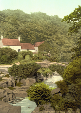
Jesmond Dene, a public park in the east end of Newcastle upon Tyne, England, occupies the narrow steep-sided valley of a small river known as the Ouseburn, flowing south to join the River Tyne. In north-east England, such valleys are commonly known as denes; the name 'Jesmond' meaning 'mouth of the Ouseburn'.

Newcastle upon Tyne North is a constituency represented in the House of Commons of the UK Parliament since 2010 by Catherine McKinnell of the Labour Party.

Elswick is a district and electoral ward of the city and metropolitan borough of Newcastle upon Tyne, in the county of Tyne and Wear, England, 1.9 miles west of the city centre, bordering the River Tyne. Historically in Northumberland, Elswick became part of Newcastle upon Tyne in 1835. Elswick is home to the Newcastle Utilita Arena; and Newcastle College, with approximately 45,000 students.

Stocksfield, formerly Broomley and Stocksfield is a civil parish in Northumberland, England. At the 2001 census, the parish, which includes the village of Stocksfield, along with the hamlets of Apperley Dene, Branch End, Broomley, Hindley, New Ridley and Painshawfield, had a population of 3,039, falling slightly to 3,011 at the 2011 Census.

Newcastle upon Tyne East was a constituency of the House of Commons of the UK Parliament. It was held by Nick Brown, an independent formerly of the Labour Party, from its recreation in 2010 until its abolition for the 2024 general election.
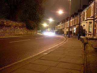
Sandyford is a small district in central Newcastle upon Tyne. It represents the north-eastern border of central Newcastle, with the suburbs of Jesmond to the north and Heaton to the east.

Jesmond Dene is an unincorporated community neighboring Escondido in San Diego County, California. It lies just east of Interstate 15 north of Escondido and has a ZIP Code of 92026. The community is inside area code 760.

Kenton is a suburb and electoral ward in the north west of Newcastle upon Tyne, in the county of Tyne and Wear, England. It borders the Town Moor and Gosforth. Kenton also has close road links to Newcastle Airport. The ward population at the 2011 Census was 11,605.

A dene or dean used to be a common name for a valley, in which sense it is frequently found as a component of British place-names, such as Rottingdean and Ovingdean in England and Deanston and Hassendean in Scotland.
Dene is an electoral ward of Newcastle upon Tyne in North East England. The ward takes its name from the nearby gorge at Jesmond Dene. Contained within the ward are government offices of the Department for Work and Pensions and the Freeman Hospital. The population of the ward is 9,554, increasing to 9,667 at the 2011 Census, 3.7% of the total population of Newcastle upon Tyne. Car ownership in the area is 74.8% much higher than the city average of 54.7%.
Qurios Entertainment was an animation and visual effects production studio.

Apperley Bridge is a village in the metropolitan borough of the City of Bradford, in West Yorkshire, England in the Idle and Thackley Ward. Apperley Bridge is north-east of Bradford on the boundary with the City of Leeds bounded in the east by Carr Beck and to the south by Greengates. The village straddles the Leeds and Liverpool Canal and the River Aire. It takes its name from the old bridge over the river on Apperley Lane.

Jesmond Dene House is a 19th-century mansion house at Jesmond Dene, Newcastle upon Tyne, England which is now a hotel. It is a Grade II listed building.

Jesmond is a suburb of Newcastle upon Tyne, Tyne and Wear, England, situated north of the city centre and to the east of the Town Moor. Jesmond is considered to be one of the most affluent suburbs of Newcastle upon Tyne, with higher average house prices than most other areas of the city.
Below is a complete list of High Sheriffs of Tyne and Wear since the creation of that county in 1974.
Seaburn Dene is a northern suburb of Sunderland, England, located about one mile inland from the North Sea, near the boundary with South Tyneside.

Pandon Dene Power Station was an early coal-fired power station situated on the Pandon Dene, to the east of Newcastle upon Tyne.

Whittle Dene is 12 miles (19 km) west of Newcastle upon Tyne, England, straddling the B6318 Military Road, and is a complex of reservoirs and treatment works forming the last stage in the supply of drinking water to Newcastle upon Tyne and Gateshead.

