Arbacoochee, Alabama

Last updated

Arbacoochee, Alabama
Arbacoochee fire insurance map.jpg
1922 fire insurance map of Arbacoochee
USA Alabama location map.svg
Red pog.svg
Arbacoochee, Alabama
Usa edcp location map.svg
Red pog.svg
Arbacoochee, Alabama
Coordinates: 33°34′34″N85°31′02″W / 33.57611°N 85.51722°W / 33.57611; -85.51722
Country United States
State Alabama
County Cleburne
Elevation
961 ft (293 m)
Time zone UTC-6 (Central (CST))
  Summer (DST) UTC-5 (CDT)
GNIS feature ID159079

Arbacoochee is an unincorporated community in Cleburne County, Alabama, United States.

Contents

History

Arbacoochee was named after the old Creek Indian village of "Abihkuchi", which translates to "a pile at the base." [1] Gold was discovered here in 1832, and the local mines produced over $5,000,000 worth of gold. In 1845, Arbacoochee had a population of over 5,000 people and was home to twenty general stores, five saloons, a school, two churches, two hotels, two mining supply stores, a fire department, race track, and over 100 homes. [2] Most of the residents departed when news of the California Gold Rush reached Alabama, and only a few families remained. [3]

A post office was operated in Arbacoochee from 1842 to 1904. [4]

Demographics

Arbacoochee

Historical population
CensusPop.Note
1880 50
U.S. Decennial Census [5]

Arbacoochee first appeared on the 1880 U.S. Census as an unincorporated village and as the 10th beat/precinct of Cleburne County (see below). The population of the village made it the second largest community in the county behind the then-county seat of Edwardsville. [6] The village did not report again on the census, although the precinct bearing its name continued to report until 1950.

Historic Demographics

Census
Year
PopulationState
Place
Rank
County
Place
Rank
1880 [lower-alpha 1] [6] 50 (-) [lower-alpha 2] [lower-alpha 3] 211th (-)2nd (-)

Arbacoochee Precinct (1880-1950)

Historical population
CensusPop.Note
1880 877
1890 1,04619.3%
1900 896−14.3%
1910 8990.3%
1920 833−7.3%
1930 1,08430.1%
1940 826−23.8%
1950 607−26.5%
U.S. Decennial Census [7]

The Arbacoochee Beat (Precinct) (Cleburne County 10th Beat) first appeared on the 1880 U.S. Census. It was changed from "beat" to "precinct" in 1890. The precinct continued to report until 1950. In 1960, the precinct was merged as part of a larger reorganization of counties into the census division of Heflin. [8]

Notable people

Related Research Articles

<span class="mw-page-title-main">Autauga County, Alabama</span> County in Alabama, United States

Autauga County is a county located in the central portion of the U.S. state of Alabama. As of the 2020 census the population was 58,805. Its county seat is Prattville.

<span class="mw-page-title-main">Cleburne County, Alabama</span> County in Alabama, United States

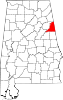
Cleburne County is a county located in the east central portion of the U.S. state of Alabama. As of the 2020 census, the population was 15,056. Its county seat is Heflin. Its name is in honor of Patrick R. Cleburne of Arkansas who rose to the rank of major general in the Confederate States Army. The eastern side of the county borders the state of Georgia.

<span class="mw-page-title-main">Alexandria, Alabama</span> Unincorporated community in Alabama, United States

Alexandria is a census-designated place and unincorporated community in Calhoun County, Alabama, United States. At the 2020 census, the population was 4,032. It is included in the Anniston–Oxford, Alabama Metropolitan Statistical Area.

<span class="mw-page-title-main">Ashland, Alabama</span> City in and county seat of Clay County, Alabama

Ashland is a city in Clay County, Alabama, United States. The population was 2,037 at the 2010 census. The city is the county seat of Clay County.

<span class="mw-page-title-main">Benton, Alabama</span> Town in Alabama, United States

Benton is a town in Lowndes County, Alabama, United States. Its population was 41 at the 2020 census, down from 49 at the 2010 census.

<span class="mw-page-title-main">Alexander City, Alabama</span> City in Alabama, United States

Alexander City, known to locals as "Alex City", is the largest city in Tallapoosa County, Alabama, United States, with a population of 14,843 as of the 2020 census. It has been the largest community in Tallapoosa County since 1910. It is known for Lake Martin with its 750 miles (1,210 km) of wooded shoreline and 44,000 acres (18,000 ha) of water. Lake Martin stands on the Tallapoosa River and offers boating, swimming, fishing, golfing, and camping. Many neighborhoods and luxury homes are located on the lake.

Jefferson is an unincorporated community in Marengo County, Alabama, United States. It is the birthplace of sculptor Geneva Mercer.

<span class="mw-page-title-main">Alpine, Talladega County, Alabama</span> Unincorporated community in Alabama, United States

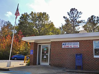
Alpine is an unincorporated community in Talladega County, Alabama, United States, located southwest of Talladega and northwest of Childersburg. It is known to Alabama residents as the site of YMCA Camp Cosby. The community gained its name from Alpine, a plantation owned by the Welch family. Over time, a town grew up around the plantation when a railroad came through. Initially known as Welchs Depot, it eventually came to be known as Alpine, in honor of the plantation.

<span class="mw-page-title-main">Allsboro, Alabama</span> Unincorporated community in Alabama, United States

Allsboro is a populated place in Colbert County, Alabama, United States. This unincorporated community is located in the far western area of the county, about 9 miles (14 km) southwest of the town of Cherokee, near the Mississippi state border.

Arkadelphia is an unincorporated community in Cullman County, Alabama, United States.

<span class="mw-page-title-main">Alabama Port, Alabama</span> Unincorporated community in Alabama, United States

Alabama Port, also sometimes known as Port Alabama, is an unincorporated community on Mon Louis Island, in Mobile County, Alabama, United States.

<span class="mw-page-title-main">Shelby, Alabama</span> Census-designated place in Alabama, United States

Shelby is a census-designated place and unincorporated community in Shelby County, Alabama, United States. Its population was 1,044 as of the 2010 census. The area is near Lay Lake and Waxahatchee Creek. Shelby Iron Park is located at the heart of the area. Two sites in Shelby, The Brick House and the Old Shelby Hotel, are listed on the Alabama Register of Landmarks and Heritage.

Abernant is an unincorporated community in Tuscaloosa County, Alabama, United States. Abernant is located along Alabama State Route 216, 3.6 miles (5.8 km) west of Lake View. Abernant has a post office with ZIP code 35440.

<span class="mw-page-title-main">Uchee, Alabama</span> Unincorporated community in Alabama, United States

Uchee, also known as Spains Stand, is an unincorporated community in Russell County, Alabama, United States.

Almond, also known as Flat Rock, is an unincorporated community in Randolph County, Alabama, United States.

Abel is an unincorporated community in Cleburne County, in the U.S. state of Alabama.

Acton is an unincorporated community in Shelby County, in the U.S. state of Alabama. It is partially located within the city of Hoover. It is not to be confused with the village of Acton, approximately 6+12 miles to the northeast in Jefferson County.

Abernathy is an unincorporated community in Cleburne County, Alabama, United States

<span class="mw-page-title-main">Allenton, Alabama</span> Unincorporated community in Alabama, United States

Allenton is an unincorporated community in Wilcox County, Alabama, United States.

Acton is an unincorporated community in Jefferson County, in the U.S. state of Alabama. It is a suburban area bordering the city of Birmingham, centered around the intersection of Caldwell Mill Road and Old Looney Mill Road just west of the Cahaba River. It is not to be confused with the former mining village of Acton, Alabama in Shelby County (now within the city of Hoover, approximately 6+12 miles to the southwest as the crow flies. Initially, this Acton was also in Shelby County before a border adjustment shifted it into Jefferson County.

References

Notes

  1. 1st year Arbacoochee reported on census
  2. (-)Indicates no immediate prior population figure or rank
  3. Racial demographics not reported for places of less than 2,500 on 1880 census.

References

  1. "Arbacoochee". Geographic Names Information System . United States Geological Survey, United States Department of the Interior.
  2. Plott, Bill (August 10, 1970). "Gold Mining Still Going On in Alabama". The Tuscaloosa News. Tuscaloosa: Tim Thompson. Retrieved June 2, 2014.
  3. "Arbachoochee (Arbacoochee) Alabama". Ghosttownsandmines.com. November 20, 2010. Retrieved June 2, 2014.
  4. "Cleburne County". Jim Forte Postal History. Archived from the original on November 29, 2014. Retrieved November 20, 2014.
  5. "U.S. Decennial Census". Census.gov. Archived from the original on May 7, 2015. Retrieved June 6, 2013.
  6. 1 2 "Table III - Population of Civil Divisions less than counties, in the aggregate at the Censuses of 1880 and 1870" (PDF). United States Census Bureau. 1880.
  7. "U.S. Decennial Census". Census.gov. Retrieved June 6, 2013.
  8. "Number of Inhabitants - Alabama" (PDF). United States Census Bureau. 1960.