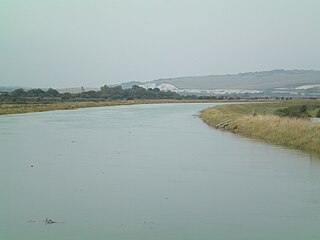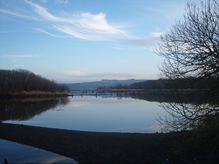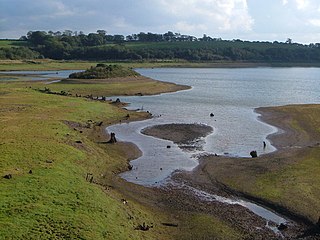
The River Great Ouse is a river in England, the longest of several British rivers called "Ouse". From Syresham in Northamptonshire, the Great Ouse flows through Buckinghamshire, Bedfordshire, Cambridgeshire and Norfolk to drain into the Wash and the North Sea near Kings Lynn. Authorities disagree both on the river's source and its length, with one quoting 160 mi (260 km) and another 143 mi (230 km). Mostly flowing north and east, it is the fifth longest river in the United Kingdom. The Great Ouse has been historically important for commercial navigation, and for draining the low-lying region through which it flows; its best-known tributary is the Cam, which runs through Cambridge. Its lower course passes through drained wetlands and fens and has been extensively modified, or channelised, to relieve flooding and provide a better route for barge traffic. The unmodified river would have changed course regularly after floods.

The Ouse is a 35 miles long river in the English counties of West and East Sussex. It rises near Lower Beeding in West Sussex, and flows eastwards and then southwards to reach the sea at Newhaven. It skirts Haywards Heath and passes through Lewes. It forms the main spine of an extensive network of smaller streams, of which the River Uck is the main tributary. As it nears the coast it passes through the Lewes and Laughton Levels, an area of flat, low-lying land that borders the river and another tributary, the Glynde Reach. It was a large tidal inlet at the time of the Domesday book in 1086, but over the following centuries, some attempts were made to reclaim some of the valley floor for agriculture, by building embankments, but the drainage was hampered by the buildup of a large shingle bar which formed across the mouth of the river by longshore drift.

Carsington Water is a reservoir, operated by Severn Trent Water, between Wirksworth and Kniveton in Derbyshire, England. The reservoir takes water from the River Derwent at Ambergate during winter months, pumping up to the reservoir by 10.5-kilometre (6.5 mi) long tunnels and aqueduct. Water is released back into the river during summer months for water abstraction and treatment further downstream. It is England's ninth-largest reservoir with a capacity of 36,331 megalitres.

Grafham Water is an 806.3-hectare (1,992-acre) biological Site of Special Scientific Interest (SSSI) north of Perry, Huntingdonshire. It was designated an SSSI in 1986. It is a reservoir with a circumference of about 16 km (10 mi), is 21 m (69 ft) deep at maximum, and is the eighth largest reservoir in England by volume and the third largest by area at 6.27 km2. An area of 114 ha at the western end is a nature reserve managed by the Wildlife Trust for Bedfordshire, Cambridgeshire and Northamptonshire.

The River Lee is a river in Ireland. It rises in the Shehy Mountains on the western border of County Cork and flows eastwards through Cork, where it splits in two for a short distance, creating an island on which Cork's city centre is built, then passes through Cork Harbour on the south coast, one of the largest natural harbours in the world, to empty into the Celtic Sea. The catchment area of the River Lee is 1,253 km2. The long-term average flow rate of the River Lee is 40.4 cubic metres per second (m3/s).

Bewl Water is a reservoir in the valley of the River Bewl, straddling the boundary between Kent and East Sussex in England. It is about 2 miles (3.2 km) south of Lamberhurst, Kent. The reservoir was part of a project to increase the supply of water in the area. It supplies Southern Water's customers in the towns of Thanet and Hastings.

Edgbaston Reservoir, originally known as Rotton Park Reservoir and referred to in some early maps as Rock Pool Reservoir, is a canal feeder reservoir in Birmingham, England, maintained by the Canal & River Trust. It is situated close to Birmingham City Centre and is a Site of Importance for Nature Conservation.

Hollingworth Lake is a 130-acre (53 ha) reservoir at Smithy Bridge in Littleborough, Greater Manchester, England. It was originally built as the main water source for the Rochdale Canal, but developed as a tourist resort from the 1860s. Hotels were built around it, helped by the arrival of the railway in 1839, which brought day-trippers and weekend visitors from Manchester, Bradford and Leeds.

Balcombe is a village and civil parish in the Mid Sussex District of West Sussex, England. It lies 31 miles (50 km) south of London, 16 miles (26 km) north of Brighton, and 32 miles (51 km) east-northeast of the county town of Chichester. Nearby towns include Crawley to the northwest and Haywards Heath to the south-southeast.

The Brent Reservoir is a reservoir in North West London. It straddles the boundary between the boroughs of Brent and Barnet and is owned by the Canal & River Trust. The reservoir takes its informal name from a public house called The Welsh Harp, which stood nearby until the early 1970s. It is a 68.6-hectare (170-acre) biological Site of Special Scientific Interest (SSSI), the only SSSI in either borough and among more than 30 SSSIs in Greater London.

Mission Bay is an artificial, saltwater bay located south of the Pacific Beach community of San Diego, California, created from approximately 2,000 acres (810 ha) of historical wetland, marsh, and saltwater bay habitat. The bay is part of the recreational Mission Bay Park, the largest man-made aquatic park in the United States, consisting of 4,235 acres (17.14 km2), approximately 46% land and 54% water. The combined area makes Mission Bay Park the ninth largest municipally-owned park in the United States.

Stanborough Park, also referred to as Stanborough Lakes is a 126-acre (0.51 km2) park in Welwyn Garden City, Hertfordshire, England.

Caversham Lakes is a set of lakes created through gravel extraction between the suburb of Caversham in Reading, Berkshire and the hamlet of Sonning Eye in Oxfordshire, just north of the River Thames and also refers to the sports buildings and facilities alongside those lakes.

Weir Wood Reservoir is a 153.5-hectare (379-acre) biological Site of Special Scientific Interest west of Forest Row in East Sussex. It is in High Weald Area of Outstanding Natural Beauty and an area of 32.6 hectares is a Local Nature Reserve which is owned by Southern Water and managed by East Sussex County Council and Southern Water.

Guelph Lake is a man-made reservoir on the Speed River, in the Township of Guelph/Eramosa. It is located upriver and slightly northeast of the city of Guelph, Ontario. The reservoir was created in 1974, with the construction of the Guelph Lake dam. The site is part of a 1,608 hectares conservation area maintained by the Grand River Conservation Authority.

Wimbleball Lake on Exmoor in Somerset, England, is a water supply reservoir constructed in the 1970s and completed in 1979.

Barcombe Mills is a small settlement and an area of countryside including a local nature reserve near the village of Barcombe Cross in East Sussex, England. It is located in the civil parish of Barcombe in the Lewes District. It is an important area for its wildlife, natural environment and water storage. The River Ouse and Andrew's Stream, one of its tributaries and popular for fishing, flow through the area and Barcombe Reservoir is adjacent. The area includes a small hamlet and some farms, including Barcombe House, and a water treatment works.

Sussex is a historic county and cultural region in the south of England corresponding roughly in area to the ancient Kingdom of Sussex. It is bounded on the north by Surrey, north-east by Kent, south by the English Channel, and west by Hampshire, and is divided for local government into West Sussex and East Sussex and the city of Brighton and Hove. The city of Brighton & Hove was created a unitary authority in 1997, and was granted City status in 2000. Until then Chichester had been Sussex's only city. By convention, Chichester is Sussex's capital city and Lewes is Sussex's county town.

Roadford Lake, also known as Roadford Reservoir is a man-made reservoir fed by the River Wolf. It is located to the north-east of Broadwoodwidger in West Devon, eight miles (13 km) east of Launceston and is the largest area of fresh water in the southwest of England. Operated by South West Water, it directly supplies water for North Devon. It also supplies Plymouth and southwest Devon via releases into the River Tamar for abstraction at Gunnislake. It is a Local Nature Reserve.

Worth Forest is an electoral division of West Sussex in the United Kingdom, and returns one member to sit on West Sussex County Council.


