Armous-et-Cau

Last updated

Armous-et-Cau
Armous et Cau - Mairie.JPG
The town hall in Armous-et-Cau
Location of Armous-et-Cau
Armous-et-Cau
France location map-Regions and departements-2016.svg
Red pog.svg
Armous-et-Cau
Languedoc-Roussillon-Midi-Pyrenees region location map.svg
Red pog.svg
Armous-et-Cau
Coordinates: 43°34′27″N0°11′27″E / 43.5742°N 0.1908°E / 43.5742; 0.1908
Country France
Region Occitania
Department Gers
Arrondissement Mirande
Canton Pardiac-Rivière-Basse
Intercommunality CC Cœur Astarac Gascogne
Government
  Mayor (20202026) Jean-Paul Doubrere [1]
Area
1
9.33 km2 (3.60 sq mi)
Population
 (Jan. 2020) [2]
92
  Density9.9/km2 (26/sq mi)
Time zone UTC+01:00 (CET)
  Summer (DST) UTC+02:00 (CEST)
INSEE/Postal code
32009 /32230
Elevation152–279 m (499–915 ft)
(avg. 175 m or 574 ft)
1 French Land Register data, which excludes lakes, ponds, glaciers > 1 km2 (0.386 sq mi or 247 acres) and river estuaries.

Armous-et-Cau is a commune in the Gers department in southwestern France.

Contents

Geography

Armous-et-Cau and its surrounding communes Map commune FR insee code 32009.png
Armous-et-Cau and its surrounding communes

Population

Historical population
YearPop.±%
1962108    
1968117+8.3%
1975104−11.1%
198281−22.1%
199082+1.2%
199990+9.8%
200895+5.6%
201586−9.5%

See also

Related Research Articles

<span class="mw-page-title-main">Tarn-et-Garonne</span> Department of France

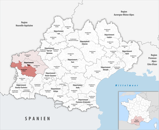
Tarn-et-Garonne is a department in the Occitania region in Southern France. It is traversed by the rivers Tarn and Garonne, from which it takes its name. The area was originally part of the former provinces of Quercy and Languedoc. The department was created in 1808 under Napoleon, with territory taken from the neighbouring Lot, Haute-Garonne, Lot-et-Garonne, Gers and Aveyron departments.

<span class="mw-page-title-main">Gers</span> Department of France

Gers is a department in the region of Occitania, Southwestern France. Named after the Gers River, its inhabitants are called the Gersois and Gersoises in French. In 2019, it had a population of 191,377.

<span class="mw-page-title-main">Lot-et-Garonne</span> Department of France in Nouvelle-Aquitaine

Lot-et-Garonne is a department in the Nouvelle-Aquitaine region of Southwestern France. Named after the rivers Lot and Garonne, it had a population of 331,271 in 2019. Its prefecture and largest city is Agen.

<span class="mw-page-title-main">Roquelaure</span> Commune in Occitania, France

Roquelaure is a commune in the Gers department in southwestern France. A type of knee-length cloak, which was worn by men in the 18th and 19th Centuries of the Common Era, is named for the commune.

<span class="mw-page-title-main">Lombez</span> Commune in Occitania, France

Lombez is a commune in the Gers department in southwestern France.

<span class="mw-page-title-main">Lectoure</span> Commune in Occitania, France

Lectoure is a commune in the Gers department in the Occitanie region in southwestern France.

<span class="mw-page-title-main">Arrondissement of Mirande</span> Arrondissement in Occitania, France

The arrondissement of Mirande is an arrondissement of France in the Gers department in the Occitanie region. It has 165 communes. Its population is 42,285 (2016), and its area is 1,871.2 km2 (722.5 sq mi).

<span class="mw-page-title-main">Montréal, Gers</span> Commune in Occitania, France

Montréal is a commune in the Gers department in southwestern France.

<span class="mw-page-title-main">Caux-et-Sauzens</span> Commune in Occitanie, France

Caux-et-Sauzens is a commune in the Aude department in southern France.

<span class="mw-page-title-main">Gazax-et-Baccarisse</span> Commune in Occitania, France

Gazax-et-Baccarisse is a commune in the Gers department in southwestern France.

<span class="mw-page-title-main">Lagraulet-du-Gers</span> Commune in Occitania, France

Lagraulet-du-Gers is a commune in the Gers department in southwestern France.

<span class="mw-page-title-main">Peyrusse-Massas</span> Commune in Occitania, France

Peyrusse-Massas is a commune in the Gers department in southwestern France.

<span class="mw-page-title-main">Preignan</span> Commune in Occitania, France

Preignan is a commune in the Gers department in southwestern France.

<span class="mw-page-title-main">La Romieu</span> Commune in Occitania, France

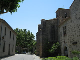
La Romieu is a commune in the Gers department in southwestern France.

<span class="mw-page-title-main">Saint-Clar</span> Commune in Occitania, France

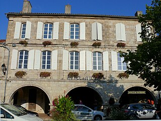
Saint-Clar is a commune in the Gers department in southwestern France.

Scieurac-et-Flourès is a commune in the Gers department in southwestern France.

Tournan is a commune in the Gers department in southwestern France.

<span class="mw-page-title-main">Tilloy-lez-Marchiennes</span> Commune in Hauts-de-France, France

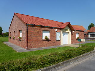
Tilloy-lez-Marchiennes is a commune in the Nord department in the Hauts-de-France region, Northern France. In 2018, it had a population of 516.

<span class="mw-page-title-main">Astaffort</span> Place in Nouvelle-Aquitaine, France

Astaffort is a commune in the Lot-et-Garonne department in southwestern France. It is situated on the river Gers, about 15 km south of Agen. Astaffort has a mill and the church of Sainte-Geneviève.

<span class="mw-page-title-main">Canton of Pardiac-Rivière-Basse</span> Canton in Occitania, France

The canton of Pardiac-Rivière-Basse is an administrative division of the Gers department, southwestern France. It was created at the French canton reorganisation which came into effect in March 2015. Its seat is in Plaisance.

References

  1. "Répertoire national des élus: les maires". data.gouv.fr, Plateforme ouverte des données publiques françaises (in French). 9 August 2021.
  2. "Populations légales 2020". The National Institute of Statistics and Economic Studies. 29 December 2022.