Tasque | |
|---|---|
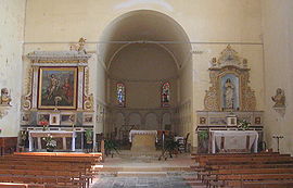 Interior of the church | |
 Coat of arms | |
Location of Tasque  | |
 Tasque  Tasque | |
| Coordinates: 43°38′25″N0°01′12″E / 43.6403°N 0.02°E | |
| Country | France |
| Region | Occitania |
| Department | Gers |
| Arrondissement | Mirande |
| Canton | Pardiac-Rivière-Basse |
| Intercommunality | Bastides et vallons du Gers |
| Government | |
| • Mayor (2020–2026) | Frank Arnoux [1] |
Area 1 | 10.02 km2 (3.87 sq mi) |
| Population (2022) [2] | 245 |
| • Density | 24/km2 (63/sq mi) |
| Time zone | UTC+01:00 (CET) |
| • Summer (DST) | UTC+02:00 (CEST) |
| INSEE/Postal code | 32440 /32160 |
| Elevation | 115–190 m (377–623 ft) (avg. 117 m or 384 ft) |
| 1 French Land Register data, which excludes lakes, ponds, glaciers > 1 km2 (0.386 sq mi or 247 acres) and river estuaries. | |
Tasque (French pronunciation: [task] ; Occitan : Tasca) is a commune in the Gers department of southwestern France. It contains a stone Catholic church.
