As Ac | |
|---|---|
 | |
 As  As | |
| Coordinates: 45°58′57″N33°50′20″E / 45.98250°N 33.83889°E | |
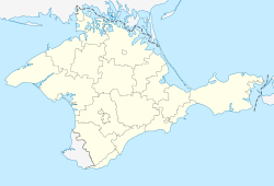
| Country | |
| Republic | |
| Raion | |
| Area | |
• Total | 0.57 km2 (0.22 sq mi) |
| Elevation | 2 m (6.6 ft) |
| Population (2001) | |
• Total | 222 |
| • Density | 390/km2 (1,000/sq mi) |
| Time zone | UTC+2 (EET) |
| • Summer (DST) | UTC+3 (EEST) |
| Postal code | 96002 |
| Area code | +380 6565 |
| Vehicle registration | AK/KK/01 |
As (Ukrainian : Ac; Crimean Tatar : As; Russian : Ac), until 2023 Proletarka, is a village in the Krasnoperekopsk Raion, Autonomous Republic of Crimea, Ukraine. Since 2014 the town has been occupied and unilaterally annexed by the Russian Federation. According to the 2001 Ukrainian Census, the settlement counted a population of 222 inhabitants. [1]