Yevpatoria

Last updated

Yevpatoria
Євпаторія (Ukrainian)
Евпатория (Russian)
Kezlev (Crimean Tatar)
Кезлев (Crimean Tatar)
Yevpatoria panorama.jpeg
Yevpatoria panorama
Flag Eupatoria.svg
COA Yevpatoriia, Crimea, Ukraine.svg
Relief map of Crimea (disputed status).jpg
Red pog.svg
Yevpatoria
Location of Yevpatoria within Crimea
Reliefkarte Ukraine 2022.png
Red pog.svg
Yevpatoria
Yevpatoria (Ukraine)
Coordinates: 45°11′38″N33°22′5″E / 45.19389°N 33.36806°E / 45.19389; 33.36806
Country Territory of Ukraine, occupied by Russia [1]
Region Crimea
Area
  Total120 km2 (50 sq mi)
Elevation
10 m (30 ft)
Population
 (2014)
105,719
  Density1,618.37/km2 (4,191.6/sq mi)
Time zone UTC+3 (MSK)
Postal code
97400 — 97490
Area code +7-36569
Climate Cfa
Website my-evp.ru (russian site)

Yevpatoria (Ukrainian : Євпаторія, romanized: Yevpatoriia; Russian : Евпатория, romanized: Yevpatoriya; Crimean Tatar : Kezlev or Кезлев, Greek : Ευπατορία, romanized: Eupatoría) is a Ukrainian city of regional significance[ citation needed ] in Western Crimea, north of Kalamita Bay. Yevpatoria serves as the administrative center of Yevpatoria Municipality, one of the districts (raions) into which Crimea is divided. It had a population of 105,719 (2014 Census). [2]

Contents

History

Greek settlement

The first recorded settlement in the area, called Kerkinitis (Κερκινίτις), was built by Greek colonists around 500 BCE. Along with the rest of the Crimea, Kerkinitis formed part of the dominions of King Mithridates VI Eupator (r.120–63 BCE). The name of the modern city derives from his nickname, Eupator ('of a noble father').

Khanate period

From roughly the 7th through the 10th centuries, Yevpatoria was a Khazar settlement; its name in Khazar language was probably Güzliev (literally 'beautiful house'). [3] It was later subject to the Cumans (Kipchaks), the Mongols, and the Crimean Khanate. During this period the city was called Kezlev by Crimean Tatars and Gözleve by Ottoman Turks. The Russian medieval name Kozlov is a Russification of the Crimean Tatar name. For a short period between 1478 and 1485, the city was administered by the Ottoman Empire. Afterward, it became an important urban center of the Crimean Khanate.

The 400-year-old Juma-Jami Mosque is one of the many designed by the Ottoman architect Mimar Sinan. It was built in 1552-1564. 35-metre minarets rose on the flanks of the building. The mosque was of great state significance. It was here that a ceremony of the declaration of rights of the Crimean Khans was held at their enthronement. Only after that did they go to their capital, the city of Bakhchysarai.

Entrance to one of the Eupatorian Kenassas Eupatoria 04-14 img16 Karaimskaya Street.jpg
Entrance to one of the Eupatorian Kenassas

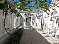
Yevpatoria became a residence of the spiritual ruler of the Crimean Karaites, the Ḥakham. In this connection, a complex of two prayer houses was built under the supervision of the Rabovich brothers, in which the Renaissance and Muslim architectural styles entwined in a most unusual manner. The ensemble organically incorporates three courtyards. The entrance to it is marked by gates, built in 1900, which look like a refined triumphal arch.

Imperial Russian rule

Soviet-era road sign on P25 road in Crimea Evpatoriyskoye shosse.jpg
Soviet-era road sign on P25 road in Crimea

In 1783, along with the rest of Crimea, Kezlev was captured by the Russian Empire. Its name was officially changed to Yevpatoriya in 1784. This spelling of the city name came to the French, German, Spanish, and English languages at the end of the 18th сentury.

Polish poet Adam Mickiewicz visited the town in 1825 and wrote one of his Crimean Sonnets here; it was later translated into Russian by Mikhail Lermontov.

The city was occupied in September 1854 by British, French and Turkish troops during the Crimean War prior to the Allied landing in Kalamita Bay, after which the Battle of the Alma south of the bay followed. It became a garrison of Ottoman troops later during the war and was the site of the Battle of Eupatoria in February 1855, which was the largest military clash in the Crimean theatre outside the Sevastopol area.

Soviet rule

Hydro-massage on Lake Moynaki Jugaduss (sarko) Moinaki limaani korgsoolase veega..jpg
Hydro-massage on Lake Moynaki

Natural factors at Yevpatoria created beneficial conditions for the treatment of osteoarticular tuberculosis and other children's diseases; in 1933, at a scientific conference in Yalta, it was agreed that among Soviet resort towns for the organization of children's resorts, most people approved Yevpatoria. In 1936, the Soviet government placed the All-Union children's resort in Yevpatoria. In 1938, the approved plan of a general reconstruction of the city.

During World War II, sanatoriums were used as military hospitals. By 1 July 1945, Yevpatoria operated 14 sanatoriums, and have taken 2,885 people. By the 1980s, the city operated 78 sanatoriums for 33 thousand people.

Independent Ukraine and Russian annexation

On 24 December 2008, a blast destroyed a five-story building in the town. 27 people were killed. President of Ukraine Viktor Yushchenko declared 26 December to be a day of national mourning. [4] [5] [6] [7] [8]

Two beaches in Yevpatoria have been Blue Flag beaches since May 2010, these were the first beaches (with two beaches in Yalta) to be awarded a Blue Flag in a CIS member state. [9]

In 2014 due to the military operation of the Russian Armed forces, the city of Yevpatoria was occupied by Russia along with the entire Crimean peninsula. The UN General Assembly condemned the Russian operation and considered the annexation the temporary occupation of part of the territory of Ukraine—the Autonomous Republic of Crimea and the City of Sevastopol. [10]

Today, Yevpatoria is a major Black Sea port, a rail hub, and a resort town. The main industries of the city include fishing, food processing, winemaking, limestone quarrying, weaving, manufacturing, machinery, furniture manufacturing, and tourism.

Yevpatoria has spas of mineral water, salt, and mud lakes. These resorts belong to a vast area with curative facilities where the main health-improving factors are the sunshine and sea, air and sand, brine and mud of the salt lakes, as well as the mineral water of the hot springs. The curative qualities of the local mud was witnessed by the manuscripts of Pliny the Elder, a Roman scholar (c.80 BC).

Economy and industry

71-411 tram. 71-411 tram on 1st route in Yevpatoria (another photo distance).jpg
71-411 tram.

Education

Demographics

Ethnic composition of Yevpatoria in 2001 according to the Ukrainian census:

  1. Russians: 64,9%
  2. Ukrainians: 23,3%
  3. Crimean Tatars: 6,9%
  4. Belarusians: 1,5%
  5. Armenians: 0,5%
  6. Jews: 0,4%
  7. Tatars (excluding Crimean Tatars): 0,2%
  8. Poles: 0,2%
  9. Moldovans: 0,2%
  10. Azerbaijanis: 0,2%

Geography

Climate

Yevpatoria has a humid subtropical climate (Cfa) under the Köppen climate classification with cool winters and warm to hot summers.

Climate data for Yevpatoria (1981–2010)
MonthJanFebMarAprMayJunJulAugSepOctNovDecYear
Mean daily maximum °C (°F)4.4
(39.9)
4.9
(40.8)
8.3
(46.9)
14.6
(58.3)
20.7
(69.3)
25.7
(78.3)
28.9
(84.0)
28.8
(83.8)
23.1
(73.6)
16.9
(62.4)
10.5
(50.9)
6.1
(43.0)
16.1
(61.0)
Daily mean °C (°F)1.5
(34.7)
1.6
(34.9)
4.6
(40.3)
10.3
(50.5)
15.9
(60.6)
21.0
(69.8)
23.9
(75.0)
23.6
(74.5)
18.4
(65.1)
12.7
(54.9)
7.0
(44.6)
3.2
(37.8)
12.0
(53.6)
Mean daily minimum °C (°F)−1.1
(30.0)
−1.3
(29.7)
1.7
(35.1)
6.8
(44.2)
12.0
(53.6)
17.0
(62.6)
19.5
(67.1)
19.0
(66.2)
14.2
(57.6)
9.0
(48.2)
4.1
(39.4)
0.6
(33.1)
8.5
(47.3)
Average precipitation mm (inches)30.5
(1.20)
31.1
(1.22)
28.9
(1.14)
29.3
(1.15)
25.1
(0.99)
39.7
(1.56)
31.1
(1.22)
41.4
(1.63)
46.4
(1.83)
33.6
(1.32)
38.8
(1.53)
37.5
(1.48)
413.4
(16.28)
Average precipitation days (≥ 1.0 mm)6.56.36.44.75.05.23.54.15.24.86.76.665.0
Average relative humidity (%)83.480.878.274.171.870.264.863.970.276.881.983.375.0
Source: World Meteorological Organization [11]

Area attractions

Famous attractions within or near Yevpatoria are:

The garden at the Karaite Kenasa in Yevpatoria Dvorik v Evpatoriiskikh Kenassakh.jpg
The garden at the Karaite Kenasa in Yevpatoria

Notable people

Names of asteroid number 6489 and number 24648

Asteroid number 6489 has the name Golevka, which has a complicated origin. In 1995, Golevka was studied simultaneously by three radar observatories across the world: Goldstone in California, Eupatoria RT-70 radio telescope (Yevpatoriya is sometimes romanized as Evpatoria or Eupatoria (Russian origin), and Kashima in Japan. 'Gol-Ev-Ka' comes from the first few letters of each observatory's name; it was proposed by the discoverer following a suggestion by Alexander L. Zaitsev.

Asteroid 24648 Evpatoria was discovered 1985 Sept. 19 by Nikolai Chernykh and Lyudmila Chernykh at the Crimean Astrophysical Observatory, and named in honor of Evpatoria (transliteration from Russian to English, thus Yevpatoriya). The minor planet marked the occasion of the 2500th anniversary of the town in 2003. [12]

Twin towns – sister cities

ArmsCityNationSince
Ioannina Flag of Greece.svg  Greece 1989
FIG.png Figueira da Foz Flag of Portugal.svg  Portugal 1989
DEU Ludwigsburg COA.svg Ludwigsburg Flag of Germany.svg  Germany 1992
Zakynthos Flag of Greece.svg  Greece 2002
POL Ostrowiec Swietokrzyski COA.svg Ostrowiec Świętokrzyski Flag of Poland.svg  Poland 2004
Coat of arms of Krasnogorsky rayon (Moscow oblast).png Krasnogorsky District Flag of Russia.svg  Russia 2006
Lambie Flag of Greece.svg  Greece 2009
Coat of Arms of Belgorod.svg Belgorod Flag of Russia.svg  Russia 2010

See also

Related Research Articles

<span class="mw-page-title-main">Crimea</span> Peninsula in Europe

Crimea is a peninsula in Eastern Europe, on the northern coast of the Black Sea, almost entirely surrounded by the Black Sea and the smaller Sea of Azov. The Isthmus of Perekop connects the peninsula to Kherson Oblast in mainland Ukraine. To the east, the Crimean Bridge, constructed in 2018, spans the Strait of Kerch, linking the peninsula with Krasnodar Krai in Russia. The Arabat Spit, located to the northeast, is a narrow strip of land that separates the Syvash lagoons from the Sea of Azov. Across the Black Sea to the west lies Romania and to the south is Turkey. The largest city is Sevastopol. The region has a population of 2.4 million, and has been under Russian occupation since 2014.

<span class="mw-page-title-main">Simferopol</span> Second-largest city on the Crimean Peninsula

Simferopol, also known as Aqmescit, is the second-largest city on the Crimean Peninsula. The city, along with the rest of Crimea, is internationally recognised as part of Ukraine, and is considered the capital of the Autonomous Republic of Crimea, but currently is under the de facto control of Russia, which annexed Crimea in 2014 and regards Simferopol as the capital of the Republic of Crimea. Simferopol is an important political, economic and transport hub of the peninsula, and serves as the administrative centre of both Simferopol Municipality and the surrounding Simferopol District. Its population was 332,317 .

<span class="mw-page-title-main">Bakhchysarai</span> City in Crimea

Bakhchysarai is a town in the Autonomous Republic of Crimea, Ukraine. It is the administrative center of the Bakhchysarai Raion (district), as well as the former capital of the Crimean Khanate. Its main landmark is Hansaray, the only extant palace of the Crimean Khans, currently open to tourists as a museum. Population: 27,448 .

<span class="mw-page-title-main">Inkerman</span> City in Sevastopol

Inkerman is a city in the Crimean peninsula. It is de facto within the federal city of Sevastopol within the Russian Federation, but de jure within Ukraine. It lies 5 kilometres east of Sevastopol, at the mouth of the Chernaya River which flows into Sevastopol Inlet. Administratively, Inkerman is subordinate to the municipality of Sevastopol which does not constitute part of the Autonomous Republic of Crimea. Population: 10,348 .

<span class="mw-page-title-main">Islam in Ukraine</span> Aspect of religious life in Ukraine

Islam in Ukraine is a minority religious affiliation with Muslims representing around 5% of the total population as of 2016. The religion has a long history in Ukraine dating back to Berke Khan of the Ulug Ulus in the 13th century and the establishment of the Crimean Khanate in the 15th century.

The Yevpatoria City Municipality is one of the 25 regions of the Autonomous Republic of Crimea, a territory recognized by almost all countries as part of Ukraine but occupied by Russia as the Republic of Crimea. The region is located on the western coast of Crimea on the Black Sea's shore. Its administrative center is the city of Yevpatoria. Population: 119,258 .

Saky is a town in Crimea. Although it is the administrative centre of the Saky Raion, it does not belong to the raion (district), serving instead as the center and the only locality of Saky Municipality. Population: 25,146 .

<span class="mw-page-title-main">History of Crimea</span>

The recorded history of the Crimean Peninsula, historically known as Tauris, Taurica, and the Tauric Chersonese, begins around the 5th century BCE when several Greek colonies were established along its coast, the most important of which was Chersonesos near modern day Sevastopol, with Scythians and Tauri in the hinterland to the north. The southern coast gradually consolidated into the Bosporan Kingdom which was annexed by Pontus and then became a client kingdom of Rome. The south coast remained Greek in culture for almost two thousand years including under Roman successor states, the Byzantine Empire (341–1204), the Empire of Trebizond (1204–1461), and the independent Principality of Theodoro. In the 13th century, some Crimean port cities were controlled by the Venetians and by the Genovese, but the interior was much less stable, enduring a long series of conquests and invasions. In the medieval period, it was partially conquered by Kievan Rus' whose prince Vladimir the Great was baptised at Sevastopol, which marked the beginning of the Christianization of Kievan Rus'. During the Mongol invasion of Europe, the north and centre of Crimea fell to the Mongol Golden Horde, and in the 1440s the Crimean Khanate formed out of the collapse of the horde but quite rapidly itself became subject to the Ottoman Empire, which also conquered the coastal areas which had kept independent of the Khanate. A major source of prosperity in these times was frequent raids into Russia for slaves.

<span class="mw-page-title-main">Yevpatoria RT-70 radio telescope</span> Radio telescope in Crimea

The Yevpatoria RT-70 radio telescope is an RT-70 radio telescope and planetary radar at the Center for Deep Space Communications, Yevpatoria, Crimea. In scientific literature, it is often called the Evpatoria Planetary Radar (EPR).

<span class="mw-page-title-main">Juma-Jami Mosque</span> Sunni mosque in Yevpatoria, Crimea

The Juma-Jami Mosque, also known as the Friday Mosque, is located in Yevpatoria, Crimea. Built between 1552 and 1564, and designed by the Ottoman architect Mimar Sinan.

<span class="mw-page-title-main">Mufti-Jami Mosque</span> Sunni mosque in Feodosia, Crimea

The Mufti-Jami Mosque, is located in Feodosiya, in Crimea.

<span class="mw-page-title-main">Kebir-Jami Mosque, Simferopol</span> Sunni mosque in Simferopol, Crimea

The Kebir-Jami Mosque is located in Simferopol, Crimea. Kebir-Jami mosque is a prominent architectural monument in Simferopol and the oldest building in the city.

<span class="mw-page-title-main">Tahtali-Jami Mosque</span> Sunni mosque in Bakhchisaray, Crimea

The Tahtali-Jami Mosque is located in Bakhchisaray, Crimea. In Crimean Tatar: Tahtalı Cami means "wooden mosque".

<span class="mw-page-title-main">Orta Cami Mosque</span> Sunni mosque in Bakhchisaray, Crimea

Orta Cami Mosque is one of the oldest mosques in Crimea. It is situated on the modern day Lenina Street in the old town of Bakhchisaray.

<span class="mw-page-title-main">Autonomous Republic of Crimea</span> De jure autonomous republic of Ukraine

The Autonomous Republic of Crimea is an administrative division of Ukraine encompassing most of Crimea that was annexed by Russia in 2014. The Autonomous Republic of Crimea occupies most of the peninsula, while the City of Sevastopol occupies the rest.

<span class="mw-page-title-main">Yevpatoria Bay</span>

Yevpatoria Bay is a bay in the Black Sea near Yevpatoria, Crimea. It forms an arm of the Gulf of Kalamita.

<span class="mw-page-title-main">Kalamita Bay</span>

Kalamita Bay, also known as Gulf of Kalamita, is a bay and a gulf in the Black Sea south of Yevpatoria, Crimea. Kalamita was likewise a name used for Inkerman.

<span class="mw-page-title-main">Shcholkine</span> City in Crimea

Shcholkine, also commonly known as Shchelkino or Shchyolkino by its Russian name, is a small city in the Lenine Raion of Crimea. Geographically, Shcholkine is located near the headland of Kazantyp, on a peninsula jutting northward out into the Sea of Azov from the Crimean mainland. Population: 11,677 (2001); 10,620 .

<span class="mw-page-title-main">Aqmescit Friday Mosque</span> Mosque in Simferopol, Crimea

Aqmescit Friday Mosque, also known as the Great Friday Mosque and the Simferopol Cathedral Mosque named after Noman Çelebicihan is the largest mosque in Aqmescit (Simferopol), Crimea, which has been under construction since 2015 after Russian annexation of the Crimean peninsula. According to the plan, it was to be completed on 21 April 2020, but has been since postponed to 2021.

<span class="mw-page-title-main">Port of Yevpatoriya</span> Port in Ukraine

Yevpatoriya Commercial Sea Port is a large Black Sea port, the largest enterprise in the city of Yevpatoria.

References

  1. This place is located on the Crimean peninsula, which is internationally recognized as part of Ukraine, but since 2014 under Russian occupation. According to the administrative-territorial division of Ukraine, there are the Ukrainian divisions (the Autonomous Republic of Crimea and the city with special status of Sevastopol) located on the peninsula. Russia claims these as federal subjects of the Russian Federation (the Republic of Crimea and the federal city of Sevastopol).
  2. Russian Federal State Statistics Service (2014). "Таблица 1.3. Численность населения Крымского федерального округа, городских округов, муниципальных районов, городских и сельских поселений" [Table 1.3. Population of Crimean Federal District, Its Urban Okrugs, Municipal Districts, Urban and Rural Settlements]. Федеральное статистическое наблюдение «Перепись населения в Крымском федеральном округе». ("Population Census in Crimean Federal District" Federal Statistical Examination) (in Russian). Federal State Statistics Service . Retrieved 4 January 2016.
  3. Brutzkus, Julius (1944). "The Khazar Origin of Ancient Kiev", Slavonic and East European Review, p. 118
  4. UPDATE: 26 Killed, 5 Hospitalized After Crimea House Blast [ permanent dead link ], Ukrainian News Agency (26 December 2008)
  5. Death toll of Crimean blast reaches 27, says Emergencies Ministry Archived 2008-12-29 at the Wayback Machine , Interfax-Ukraine (26 December 2008)
  6. Friday Declared Mourning Day In Ukraine For Victims Of Yevpatoriya Gas Explosion Archived 2012-09-13 at archive.today , Ukrainian News Agency (26 December 2008)
  7. Ukraine mourns Crimea blast dead, BBC News (26 December 2008)
  8. 27 dead after Ukrainian apartment blast, CNN (26 December 2008)
  9. Four beaches in Crimea receive international certificates of cleanliness, Kyiv Post (12 May 2010)
  10. "A/RES/71/205 – E – A/RES/71/205". undocs.org.
  11. "World Meteorological Organization Climate Normals for 1981–2010". World Meteorological Organization. Archived from the original on 17 July 2021. Retrieved 17 July 2021.
  12. JPL Small-Body Database, NASA