Krasnohvardiiske

Last updated
Krasnohvardiiske
Красногвардійське
Krasnogvardeiskoe s vozdukha.jpg
Krasnohvardiiske from the air from the south, Maryanivka is at the foreground
Flag of Krasnohvardiiske.jpg
Crimea location map.svg
Red pog.svg
Krasnohvardiiske
Location of Krasnohvardiiske in Crimea
Coordinates: 45°29′41″N34°17′41″E / 45.49472°N 34.29472°E / 45.49472; 34.29472
CountryDisputed
Flag of Russia.svg  Russia, Flag of Ukraine.svg  Ukraine
Republic Crimea
Raion Krasnohvardiiske Raion
Town status1957
Government
  Town HeadViktor Kozytskyi
Elevation
[1]
46 m (151 ft)
Population
 (2014)
  Total11,134
Time zone UTC+4 (MSK)
Postal code
97000
Area code +380 6556

Krasnohvardiiske, [lower-alpha 1] also known as Krasnogvardeyskoye [lower-alpha 2] [2] or Kurman, [lower-alpha 3] is an urban-type settlement in the Crimea, a territory recognized by a majority of countries as part of Ukraine and annexed by Russia. The town also serves as the administrative center of Krasnohvardiiske Raion (district) - also known as Kurman Raion - and houses the district's local administration buildings. [3] Its population is 11,134 (2014 Census). [4]

Contents

The former Veseloye air base is located nearby.

History

Early history

The exact date of foundation of the settlement is unknown. It is first mentioned in written sources in 1865 under its original name, Kurman-Kemelchi (Ukrainian : Курман-Кемельчі; Russian : Курман-Кемельчи). [5] This name, which comes from a Crimean Tatar-language phrase literally meaning "not-drying", is a reference to the swampy, wet conditions of the area around the village. [6] At this time, it was part of Perekopsky Uyezd of Taurida Governorate of the Russian Empire. [5]

In the 1870s, a railway station was built nearby, spurring the growth of the village and making it a hub for wheat sales. In 1905, Kurman-Kemelchi had a population of 48 people, all of whom were Crimean Tatars, the indigenous people of Crimea. In 1908, a church was built in the village. By 1913, the population had grown to 72. [5]

Soviet period

During the Russian Civil War that began in 1918, Kurman-Kemelchi changed hands between the warring sides multiple times. In 1921, the village was designated a selyshche (rural-type settlement), and became the center of Kurman Raion  [ ru ] within the Crimean ASSR. In 1926, Kurman-Kemelchi had a population of 811 people, of whom 617 were Russians, 74 Jews, 61 Germans, 24 Ukrainians, eight Armenians, five Crimean Tatars, and five Greeks. In 1935, Kurman-Kemelchi became the center of a national raion for the ethnic German minority, named after Ernst Thalmann. By 1939, the village had a population of 1,754 people. [5]

During World War II, Kurman-Kemelchi was occupied by Nazi Germany. In either 1941 or 1942, around 60 Jews from Kurman-Kemelchi and surrounding villages were imprisoned in a building in the village by the Nazis for days, before being murdered at a brickworks by a yet-unidentified Nazi SS unit. [7] On 21 August 1945, after the end of fighting in Crimea, the village was renamed Krasnohvardiiske by the Soviet government. [6] That same year, the German national raion it was in was renamed to Krasnohvardiiske Raion. By 1946, the population had fallen to 1,612 people. [5]

Krasnohvardiiske received urban-type settlement status in September 1957. [6] The population had grown rapidly, reaching around 4,200 by 1959. It continued to grow throughout the remainder of the 20th century, reaching 7,600 by 1970 and 9,100 people by 1979. [5]

21st century

In 2014, Russia invaded and annexed the entire Crimean peninsula from Ukraine, including Krasnohvardiiske, beginning an ongoing occupation. Krasnohvardiiske has been the site of repressions against Jehovah's Witnesses, a religious minority group that is persecuted in Russia. [8]

During the full-scale Russian invasion of Ukraine that began in 2022, Ukraine has retaliated by repeatedly attacking Russian assets in Crimea. On 22 July 2023, Russia-installed governor of Crimea Sergey Aksyonov reported there had been an explosion at an ammunition depot in Krasnohvardiiske, attributing it to a Ukrainian drone strike. The authorities evacuated all civilians in a 3 kilometres (1.9 mi) radius and briefly paused traffic on the Crimean Bridge. [9]

In September 2023 a law enacted by the Verkhovna Rada of Ukraine came into effect restoring the historic name Kurman in Ukrainian law as part of decommunization in Ukraine. [10] Russia, which has occupied the peninsula since 2014, continues to refer to the town as Krasnogvardeyskoye.

Demographics

Population history
YearPop.±%
1905 48 [5]     
1913 72 [5] +50.0%
1926 811 [5] +1026.4%
1939 1,754 [5] +116.3%
1946 1,612 [5] −8.1%
1959 4,200 [5] +160.5%
YearPop.±%
1970 7,600 [5] +81.0%
1979 9,100 [5] +19.7%
1989 11,448 [11] +25.8%
2001 11,112 [5] −2.9%
2014 11,134 [4] +0.2%

As of the 2001 Ukrainian census, its population was 11,112. In terms of self-reported ethnic background, 58% of residents were Russians, 24.9% were Ukrainians, and 16.6 were Crimean Tatars. [5] By 2014, the population had stayed mostly the same, at 11,134. [4]

The town has multiple religious communities: There are followers of the Ukrainian Orthodox Church (Moscow Patriarchate), Islam, Jehovah's Witnesses, the Seventh-day Adventist Church, and the Evangelical Baptist Union of Ukraine. [5]

See also

Notes

  1. Ukrainian: Красногвардійське
  2. Variously also spelled Krasnogvardeyskoe and Krasnogvardeiskoe, all from Russian: Красногвардейское
  3. Ukrainian and Russian: Курман; Crimean Tatar: Qurman

Related Research Articles

<span class="mw-page-title-main">Krasnoperekopsk</span> City in Crimea

Krasnoperekopsk or Yany Kapu is a town in Crimea. Following the 2014 annexation of Crimea, it was incorporated into Russia's Republic of Crimea. However, a majority of countries recognises the territory as part of Ukraine within the Autonomous Republic of Crimea. It is the administrative center of Krasnoperekopsk Raion. Administratively is not a part of the raion (district) and is incorporated separately as a town of regional significance. Population: 26,268 .

<span class="mw-page-title-main">Dzhankoi</span> City in Crimea

Dzhankoi or Jankoy is a town of regional significance in the northern part of Crimea, internationally recognized as part of Ukraine, but since 2014 occupied by Russia. It also serves as administrative centre of Dzhankoi Raion although it is not a part of the raion (district). Population: 38,622 .

<span class="mw-page-title-main">Dzhankoi Raion</span> Raion in Crimea, Ukraine

Dzhankoi Raion is one of the 25 regions of Crimea, currently subject to a territorial dispute between the Russian Federation and Ukraine. Population: 68,429 .

<span class="mw-page-title-main">Kirovske Raion</span> Raion in Crimea, Ukraine

Kirovske Raion was one of the 25 regions of the Autonomous Republic of Crimea until 2020. The raion's administrative centre is the urban-type settlement of Kirovske. Population: 50,834 .
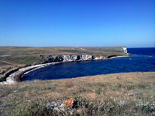
<span class="mw-page-title-main">Yalta Municipality</span> Municipality in Crimea, Ukraine

Yalta City Municipality, officially "the territory governed by the Yalta city council", also known as Greater Yalta is one of the 25 regions of the Autonomous Republic of Crimea, a territory recognized by a majority of countries as part of Ukraine but forcibly incorporated into Russia after Russia invaded Ukraine in 2014.

<span class="mw-page-title-main">Alushta Municipality</span> Municipality in Crimea

Alushta City Municipality, officially "the territory governed by the Alushta city council", also known as Greater Alushta is one of the 25 regions of the Autonomous Republic of Crimea, a territory recognized by a majority of countries as part of Ukraine but incorporated by Russia as the Republic of Crimea. Population: 52,318 .

The Yevpatoria City Municipality is one of the 25 regions of the Autonomous Republic of Crimea, a territory recognized by almost all countries as part of Ukraine but occupied by Russia as the Republic of Crimea. The region is located on the western coast of Crimea on the Black Sea's shore. Its administrative center is the city of Yevpatoria. Population: 119,258 .

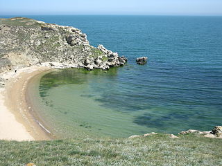
The Saky City Municipality is one of the 25 regions of the Crimean Peninsula, internationally recognized as part of Ukraine, but currently occupied by Russia. The region is located on the western coast of Crimea on the Black Sea's shore. Its administrative centre is the city of Saky. In 2014, the population stood at 25,146.

<span class="mw-page-title-main">Krasnohvardiiske Raion</span> Raion in Crimea

Krasnohvardiiske Raion, known by Ukrainian authorities as Kurman Raion is one of the 25 regions of the Autonomous Republic of Crimea, a territory recognised by a majority of countries as part of Ukraine and annexed by Russia. The administrative centre of the raion is the urban-type settlement of Krasnohvardiiske. Krasnohvardiiske Raion is located in the central part of Crimea. Population: 83,135 .

<span class="mw-page-title-main">Krasnoperekopsk Raion</span> Raion in Crimea, Ukraine

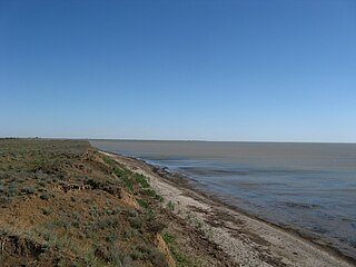
Krasnoperekopsk Raion is one of the 25 districts of the Autonomous Republic of Crimea, a territory recognized by a majority of countries as part of Ukraine and incorporated by Russia as the Republic of Crimea. It is situated in the northern part of the republic. The administrative center of the raion is the town of Krasnoperekopsk. The latter is not a part of the raion (district) and incorporated separately as a town of regional significance. Population : 24,738 .

<span class="mw-page-title-main">Lenine Raion</span> Raion in Crimea, Ukraine

Lenine Raion or Yedy-Kuiu Raion was one of the twenty-five districts of the Autonomous Republic of Crimea in Ukraine until its abolition in 2020. It continues to be used by the Russian administration known as the Republic of Crimea, as Russia has occupied Crimea since 2014.

<span class="mw-page-title-main">Rozdolne Raion</span> Raion in Crimea, Disputed:

Rozdolne Raion is, de facto, one of the 25 regions of the Republic of Crimea within the Russian Federation, though the territory is recognized by a majority of countries as part of Ukraine as the Autonomous Republic of Crimea. Its administrative center is the urban-type settlement of Rozdolne. Population: 30,633 .

Chornomorske or Chernomorskoye is an urban-type settlement and the administrative center of Chornomorske Raion in Crimea, a territory recognized by a majority of countries as part of Ukraine and occupied by Russia as the Republic of Crimea. It is located on the northern edge of the Tarkhankut Peninsula. Population: 11,267 ; 11,643.

<span class="mw-page-title-main">Rozdolne</span> Urban-type settlement in Crimea, Ukraine

Rozdolne is an urban-type settlement in the Autonomous Republic of Crimea, a territory recognized by a majority of countries as part of Ukraine and incorporated by Russia as the Republic of Crimea. The town also serves as the administrative center of the Rozdolne Raion (district), housing the district's local administration buildings.

Oktiabrske, known by Ukrainian authorities as Biiuk-Onlar is an urban-type settlement in the Krasnohvardiiske Raion (district) of the Autonomous Republic of Crimea, a territory illegally occupied by Russia as the Republic of Crimea since 2014. As of the 2001 Ukrainian Census, its population is 10,910. Current population: 10,218 .

Nyzhniohirskyi is an urban-type settlement in the Autonomous Republic of Crimea, a territory recognized by a majority of countries as part of Ukraine and occupied by Russia as the Republic of Crimea. The town also serves as the administrative center of the Nyzhnohirskyi Raion (district), housing the district's local administration buildings.

<span class="mw-page-title-main">Novoselivske</span> Urban-type settlement in Crimea

Novoselivske is an urban-type settlement in Rozdolne Raion (district) of the Autonomous Republic of Crimea of Ukraine, currently occupied by Russia as the Republic of Crimea. As of the 2001 Ukrainian Census, its population was 3,186. Current population: 3,179 .

Molodizhne is an urban-type settlement in Simferopol Raion of the Autonomous Republic of Crimea, a territory recognized by a majority of countries as part of Ukraine and incorporated by Russia as the Republic of Crimea. Population: 7,597 .

<span class="mw-page-title-main">Autonomous Republic of Crimea</span> De jure autonomous republic of Ukraine

The Autonomous Republic of Crimea is an administrative division of Ukraine encompassing most of Crimea that was annexed by Russia in 2014. The Autonomous Republic of Crimea occupies most of the peninsula, while the City of Sevastopol occupies the rest.
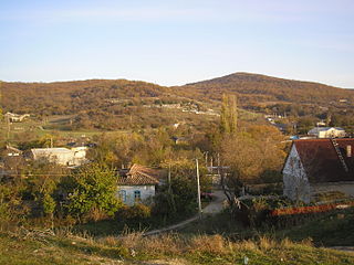
<span class="mw-page-title-main">Mizhrichchia</span> Village in Crimea

Mizhrichchia or Mezhdurechye is a village in the Feodosia Raion of Crimea, a territory recognized by a majority of countries as part of Ukraine and annexed by Russia as the Republic of Crimea.
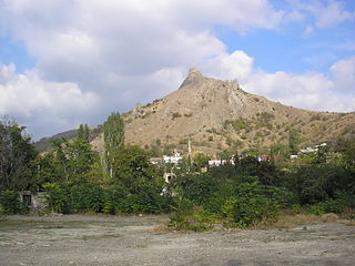
References

  1. "Krasnohvardiiske (Crimea, Krasnohvardiiske Raion)". weather.in.ua (in Ukrainian). Retrieved 14 February 2012.
  2. "Crimea: Persecution of Crimean Tatars Intensifies". Human Rights Watch. 2017-11-14. Retrieved 2024-01-03.
  3. "Krasnohvardiiske, Autonomous Republic of Crimea, Krasnohvardiiske Raion". Regions of Ukraine and their Structure (in Ukrainian). Verkhovna Rada of Ukraine . Retrieved 14 February 2012.[ permanent dead link ]
  4. 1 2 3 Russian Federal State Statistics Service (2014). "Таблица 1.3. Численность населения Крымского федерального округа, городских округов, муниципальных районов, городских и сельских поселений" [Table 1.3. Population of Crimean Federal District, Its Urban Okrugs, Municipal Districts, Urban and Rural Settlements]. Федеральное статистическое наблюдение «Перепись населения в Крымском федеральном округе». ("Population Census in Crimean Federal District" Federal Statistical Examination) (in Russian). Federal State Statistics Service . Retrieved January 4, 2016.
  5. 1 2 3 4 5 6 7 8 9 10 11 12 13 14 15 16 17 Соболь, Л. А. (2014-02-01). "Красногвардійське". Encyclopedia of Modern Ukraine (in Ukrainian). Vol. 15. Інститут енциклопедичних досліджень НАН України. ISBN   978-966-02-2074-4.
  6. 1 2 3 "Красногвардійське, Красногвардійський район, Кримська область". Історія міст і сіл Української РСР (in Ukrainian).
  7. "Murder Story of Kurman Kemelchi Jews at the Brickworks near Kurman-Kemelchi" . Retrieved 2024-01-03.
  8. "CRIMEA: Two "extremism" criminal trials, more raids, criminal investigations" . Retrieved 2024-01-03.
  9. "Ukrainian drone strike in Crimea 'closed road and prompted evacuation'". The Guardian. 2023-07-22. ISSN   0261-3077 . Retrieved 2024-01-03.
  10. "Про перейменування окремих населених пунктів та районів Автономної Республіки Крим та міста Севастополя". Офіційний вебпортал парламенту України (in Ukrainian). Retrieved 2024-01-03.
  11. "Україна / Ukrajina". Archived from the original on 21 June 2013. Retrieved 20 July 2019.