
Aleppo Governorate is one of the fourteen governorates of Syria. It is the most populous governorate in Syria with a population of more than 4,867,000, almost 23% of the total population of Syria. The governorate is the fifth in area with an area of 18,482 km2 (7,136 sq mi), or 18,498 km2, about 10% of the total area of Syria. The capital is the city of Aleppo.

An-Nabek or Al-Nabek is a Syrian city administratively belonging to Rif Dimashq and the capital of the Qalamoun. Located 81 kilometers (50 mi) north of Damascus and south of Homs. It has an altitude of 1255 meters. According to the Syria Central Bureau of Statistics (CBS), An-Nabek had a population of 32,548 in the 2004 census. The Monastery of Saint Moses the Abyssinian is located along the Anti-Lebanon Mountains near Nabek and dates back to at least the 6th century.
Ariha, also called Riha, is a town in northern Syria, administratively part of the Idlib Governorate, located south of Idlib. Nearby localities include Urum al-Jawz to the southwest, Sarjah to the south, Kafr Latah to the southeast, Maar Bilit to the east, al-Nayrab to the northeast, Nahlaya and al-Mastumah to the north, Kurin to the northwest and Maataram to the west. According to the Syria Central Bureau of Statistics, Ariha had a population of 39,501 in the 2004 census. The town is also the administrative centre of the Ariha District and the Ariha nahiyah (subdistrict), which consists of 24 localities, with a combined population of 83,487 in 2004.
Qatana is a city in southern Syria, administratively part of the Qatana District of Rif Dimashq Governorate. Qatana has an altitude of 879 meters. According to the Syria Central Bureau of Statistics, the city had a population of 33,996 in the 2004 census. It is the administrative center of the Qatana Subdistrict, which contained 20 localities with a collective population of 147,451 in 2004.
Ma'arrat Misrin is a small city in northwestern Syria, administratively part of Idlib Governorate. Ma'arrat Misrin lies an elevation of 338 metres (1,109 ft). It is located 50 kilometers southwest of Aleppo and 40 kilometers north of Ma'arrat al-Numan and 12 kilometers from Sarmin. Nearby localities include Kafr Yahmul to the north, Zardana and Maarrat al-Ikhwan to the northeast, Taftanaz to the east, Ta'um, Binnish, al-Fu'ah and Kafriya to the southeast, Idlib to the south, and Hafasraja to the southwest.

as-Safira District is a district of Aleppo Governorate in northern Syria. Administrative centre is the city of as-Safira. At the 2004 census, the district had a population of 178,293.

Armanaz is a town in northwestern Syria, administratively part of the Harem District, in the Idlib Governorate. It is located 20 kilometers northwest of Idlib near the Syrian-Turkish borders. Nearby localities include Salqin, Harem and Kafr Takharim to the north and Idlib, Ma'arrat Misrin and Saraqib to the southeast.
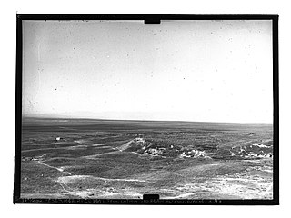
Dhahab River or Dhahab Valley, also in medieval times known as Wadi Butnan or Butnan Habib, is an intermittent river and valley in northern Syria. The principal towns in the valley are al-Bab, Bizaah and Tadef.
Arak is a village in eastern Syria, administratively part of the Homs Governorate. It is situated on an oasis in the Syrian Desert along the road between Palmyra which is 28 kilometers to the southwest and al-Sukhnah to the northeast. According to the Central Bureau of Statistics of Syria (CBS), Arak had a population of 111 in the 2004 census.

Zamalka is a town of Damascus in Syria, located 3.5 kilometers (2.2 mi) east-northeast of Old Damascus. It is administratively a part of the Markaz Rif Dimashq District of the Rif Dimashq Governorate. Nearby localities include Jobar and Qaboun to west and northwest, Harasta and Arbin to north and northeast, Hamouriyah and Saqba to east, Kafr Batna to southeast, Ein Tarma to the south and Al-Maamouniye to southwest. The Aleppo-Damascus Highway is the districts boundary in the west, separating Zamalka from the Jobar municipality of Damascus.
Maryamin is a village in northwestern Aleppo Governorate northwestern Syria. Administratively, the village belongs to Nahiya Afrin in Afrin District. Nearby localities include Jalbul to the south, Afrin to the west, Qatma to the north and A'zaz to the east. In the 2004 census, Maryamin had a population of 810. The village is inhabited by Turkmen.
Kafr Halab or Kafr Aleppo is a town in northern Syria, administratively part of the Atarib District of the Aleppo Governorate, located southwest of Aleppo. Nearby localities include Zardana to the west, Kafr Nuran, al-Jinah and Ibbin Samaan to the northwest, Urum al-Sughra to the north, al-Bawabiya to the south and Maarrat al-Ikhwan and Taftanaz to the southwest. According to the Syria Central Bureau of Statistics (CBS), Kafr Halab had a population of 4,136 in the 2004 census.
Tell Aran is a Kurdish-majority town in northern Syria, administratively part of the al-Safira District of the Aleppo Governorate, located southeast of Aleppo close to Sabkhat al-Jabbul. Nearby localities include Tell Hasil, al-Nayrab and Tell Shughayb to the northwest and al-Safira to the southeast. According to the Syria Central Bureau of Statistics (CBS), Tell Aran had a population of 17,767 in the 2004 census. The town is famous for its grapes, vineyards and gardens. The number of residents of Talaar has exceeded 60,000, especially after the large numbers of people displaced from the city of Aleppo to it due to the bloody war in Syria. The affairs of the town of Talaran are managed through its municipality, which is elected by members of the Baath Party. Muhammad Shadi Murad is currently heading the municipality of Talaran, succeeding Mr. Haitham Hamam.
Al-Qastal is a village in southern Syria, administratively part of the Rif Dimashq Governorate, located on the northeast of Damascus, on the ancient caravan route to Homs and Aleppo, in the Qalamoun Mountains. Nearby localities include Yabroud, an-Nabek, al-Sahel and Deir Atiyah to the north, ar-Ruhaybah, Jayroud, al-Dumayr and al-Qutayfah to the south, and Ma'loula, Assal al-Ward and Hosh Arab to the southwest. According to the Syria Central Bureau of Statistics, al-Qastal had a population of 3,486 in the 2004 census. Its inhabitants are predominantly Sunni Muslims.
Tell Sultan is a town in northwestern Syria, administratively part of the Idlib Governorate, located southeast of Idlib and 37 kilometers southwest of Aleppo. Nearby localities include Abu al-Thuhur to the southeast, Tell Mardikh to the southwest, Saraqib to the west and Tell Touqan to the northwest. According to the Syria Central Bureau of Statistics, Tell Sultan had a population of 2,389 in the 2004 census.
Al-Dana is a town in northern Syria, administratively part of the Idlib Governorate, located north of Idlib, 38 kilometers west of Aleppo, and just east of the border with Turkey. Nearby localities include Sarmada to the southwest, Tell Elkarame to the south, Atarib to the southeast, Turmanin to the northeast, Salwah to the north and Qah to the northwest. According to the Syria Central Bureau of Statistics, al-Dana had a population of 14,208 in the 2004 census. The town is also the administrative center of the al-Dana nahiyah consisting of thirteen villages with a combined population of 60,058. Al-Dana was notable for its indigo dye industry which has since disappeared.
Qastun, also spelled Kastun or Kustun, is a village in northern Syria, administratively part of the Hama Governorate, located northwest of Hama and 35 kilometers southwest of Idlib. It is situated in the Ghab plain, on the eastern bank of the Orontes River. Nearby localities include al-Ziyarah to the west, Qarqur to the northwest, Farikah to the north, Maaratah to the northeast, al-Muzarah to the southeast and al-Ankawi to the south. According to the Syria Central Bureau of Statistics, Qastun had a population of 6,187 in the 2004 census, making it the largest locality in the al-Ziyarah sub-district (nahiyah).
Latmin is a Syrian village located in the Kafr Zita Subdistrict of the Mahardah District in Hama Governorate. According to the Syria Central Bureau of Statistics (CBS), Latmin had a population of 1,113 in the 2004 census.
Banan is a town in the Aleppo Governorate. It is the administrative center of a nahiya with the same name, and part of the As-Safira District.
The following is a timeline of the history of the city of Homs, Syria.


