Attatba الحطاطبة | |
|---|---|
Commune and town | |
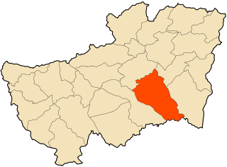
 Location of Attatba within Tipaza Province | |
| Country | |
| Province | Tipaza Province |
| Time zone | UTC+1 (CET) |
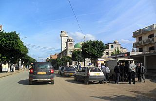
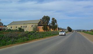
Attatba is a town and commune in Tipaza Province in northern Algeria. [1]
Attatba الحطاطبة | |
|---|---|
Commune and town | |
| Location of Attatba within Tipaza Province | |
| Country | |
| Province | Tipaza Province |
| Time zone | UTC+1 (CET) |
Attatba is a town and commune in Tipaza Province in northern Algeria. [1]

The Habib Bouakeul Stadium is a multi-use stadium in Oran, Algeria. It is currently used mostly for football matches and is the home ground of ASM Oran. Another club, SCM Oran also play there. The stadium holds 20,000 people.
Taoura, known in antiquity as Thagora, is a town and commune in Souk Ahras Province in north-eastern Algeria.
Aïn Sebt is a town and commune in Sétif Province in north-eastern Algeria.

Amoucha is a town and commune in Sétif Province in north-eastern Algeria.

Ahmar El Ain is a town and commune in Tipaza Province in northern Algeria.

Ain Tagourait is a town and commune in Tipaza Province in northern Algeria.
Bourkika is a town and commune in Tipaza Province in northern Algeria. The territory of the municipality is located to the southeast of the wilaya, at 36.4931118n, 2.475915e about 18 km southeast of Tipaza. In 1984, Bourkika became part of the commune of Douaouda.

Chaiba is a town and commune in Tipaza Province in northern Algeria.

Douaouda is a town and commune in Tipaza Province in northern Algeria.

Fouka is a town and commune in Tipaza Province in northern Algeria.
Hadjeret Ennous is a town and commune in Tipaza Province in northern Algeria.
Messelmoun is a town and commune in Tipaza Province in northern Algeria.

Sidi Amar is a town and commune in Tipaza Province in northern Algeria.
Sidi Rached is a town and commune in Tipaza Province in northern Algeria.

Sidi Semiane is a town and commune in Tipaza Province in northern Algeria.
Abi Youcef is a commune in northern Algeria in the Tizi Ouzou Province in the Kabylia region.

Aïn El Hammam is a town and commune in Tizi Ouzou Province in northern Algeria.
Aït Oumalou is a town and commune in Tizi Ouzou Province in northern Algeria.

Akbil is a town and commune in Tizi Ouzou Province in northern Algeria.

At vu gherdan is a town and commune in Tizi Ouzou Province in northern Algeria.
Capital: Tipaza | ||
| Districts |  | |
| Communes | ||
36°34′24″N2°40′31″E / 36.57333°N 2.67528°E
| | This article about a location in Tipaza Province is a stub. You can help Wikipedia by expanding it. |