Beni Milleuk بني ميلك | |
|---|---|
Commune and town | |
 | |
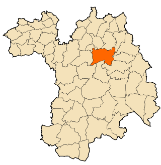
 Location of Beni Milleuk within Tipaza Province | |
| Country | |
| Province | Tipaza Province |
| Time zone | UTC+1 (CET) |
Beni Milleuk or Beni Mileuk is a town and commune in Tipaza Province in northern Algeria. [1]
Beni Milleuk بني ميلك | |
|---|---|
Commune and town | |
| | |
| Location of Beni Milleuk within Tipaza Province | |
| Country | |
| Province | Tipaza Province |
| Time zone | UTC+1 (CET) |
Beni Milleuk or Beni Mileuk is a town and commune in Tipaza Province in northern Algeria. [1]
Beni Messous is a commune in Algiers Province and suburb of the city of Algiers in northern Algeria. As of the 2008 census, the commune had a population of 36,191.

Beni Mellikeche is a commune in northern Algeria in the Béjaïa Province.

Boudjellil is a commune in northern Algeria in the Béjaïa Province.

Béni Maouche District is a district of Béjaïa Province, Algeria.

Béni Mered or Beni Marad is a town and commune in Blida Province, Algeria. As of the 1998 census it had a population of 21,457.
Béni Haoua District is a district of Chlef Province, Algeria.

Beni Amrane is a town and commune in Boumerdès Province, Algeria. According to the 1998 census it has a population of 21,452.
Béni Khiar is a town and commune in the Nabeul Governorate, Tunisia. As of 2004 it had a population of 16,992. It is one of the beautiful towns in Nabeul with beautiful beach, great weather, especially in the summer, and people come from all over the country and from Algeria to spend their summer holidays in Béni Khiar.

Beni Haoua is a town and commune in Chlef Province, Algeria. According to the 1998 census it has a population of 17,602.

Beni Rached, Chlef is a town and commune in Chlef Province, Algeria. According to the 1998 census it has a population of 21,069.

Beni Slimane is a town and commune in Médéa Province, Algeria. According to the 1998 census, it has a population of 31,588.

Beni Zentis is a town and commune in Relizane Province, Algeria.
Beni Oulbane is a town and commune in Skikda Province in north-eastern Algeria.
Beni Zid is a town and commune in Skikda Province in north-eastern Algeria.

Ramdane Djamel is a town and commune in Skikda Province in north-eastern Algeria.
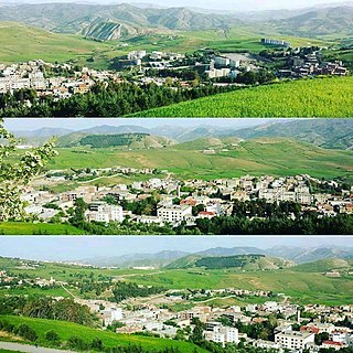
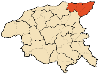
Beni Aziz is a town and commune in Sétif Province in north-eastern Algeria.
Beni Chebana is a town and commune in Sétif Province in north-eastern Algeria.
Beni Fouda is a town and commune in Sétif Province in north-eastern Algeria.
Beni Hocine is a town and commune in Sétif Province in north-eastern Algeria.

Damous is a town and commune in Tipaza Province in northern Algeria.
Capital: Tipaza | ||
| Districts |  | |
| Communes | ||
36°25′01″N1°44′59″E / 36.41694°N 1.74972°E
| | This article about a location in Tipaza Province is a stub. You can help Wikipedia by expanding it. |