Sidi Rached | |
|---|---|
Commune and town | |
 | |
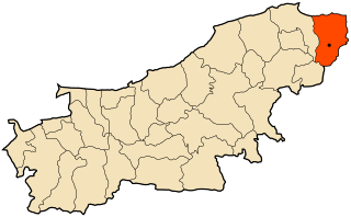
 Location of Sidi Rached within Tipaza Province | |
| Country | |
| Province | Tipaza Province |
| Time zone | UTC+1 (CET) |
Sidi Rached is a town and commune in Tipaza Province in northern Algeria. [1]
Sidi Rached | |
|---|---|
Commune and town | |
| | |
| Location of Sidi Rached within Tipaza Province | |
| Country | |
| Province | Tipaza Province |
| Time zone | UTC+1 (CET) |
Sidi Rached is a town and commune in Tipaza Province in northern Algeria. [1]

Tipaza or Tipasa is a province (wilaya) on the coast of Algeria, Its capital is Tipaza, 50 km west of the capital of Algeria.

Tizi Ouzou is a province (wilayah) of Algeria in the Kabylia region. Its capital is Tizi Ouzou.

El-Flaye is a commune in northern Algeria in the Béjaïa Province. It is located in the Wilaya of Béjaïa and is administratively attached to the daïra of Sidi-Aich.

Ténès District is a district of Chlef Province, Algeria.

Oued Fodda District is a district of Chlef Province, Algeria.
Ouled Rached is a town and commune in Bouïra Province, Algeria. According to the 1998 census it has a population of 8,553.
Aafir or Afir is a town and commune located on the Mediterranean Sea within Dellys District, Boumerdès Province, northern Algeria. According to the 1998 census it has a population of approximately 12,613. Aafir is one of three communes in the Dellys district, the others being Ben Choud and Dellys itself.

Beni Rached, Chlef is a town and commune in Chlef Province, Algeria. According to the 1998 census it has a population of 21,069.

Ahmer El Aïn District is a district of Tipaza Province, Algeria.
Sidi Merouane is a town and commune in Mila Province, Algeria. At the 1998 census it had a population of 20,018.
Sidi Mahdjoub is a town and commune in Médéa Province, Algeria.

Sidi Naamane is a town and commune in Médéa Province, Algeria. According to the 1998 census, it has a population of 21,478.

Sidi Bellater or Sidi Belattar is a town and commune in Mostaganem Province, Algeria. It is located in Aïn Tédelès District. According to the 1998 census it has a population of 6,670.

Sidi Lakhdar is a town and commune in Mostaganem Province, Algeria, about 300 km west of the capital, Algiers. It is the capital of Sidi Lakhdar District. According to the 1998 census, it has a population of 30,950. Under French colonial rule, the town was known as Lapasset. It changed its name in 1962.
Merdja Sidi Abed is a town and commune in Relizane Province, Algeria.

Sidi Amar is a town and commune in Tipaza Province in northern Algeria.

Sidi Semiane is a town and commune in Tipaza Province in northern Algeria.

Aïn El Hammam is a town and commune in Tizi Ouzou Province in northern Algeria.
Rached is a surname and a given name. It may refer to:
Capital: Tipaza | ||
| Districts |  | |
| Communes | ||
36°33′45″N2°32′00″E / 36.56250°N 2.53333°E
| | This article about a location in Tipaza Province is a stub. You can help Wikipedia by expanding it. |