Meurad

Last updated
Merad
مراد
Meurad
Commune and town
Meurad - Bourkika - Boumedfaa - panoramio.jpg
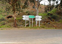
Border of Meurad and Hamame Righa districts
CountryFlag of Algeria.svg  Algeria
Province Tipaza Province
Population
 (1998) [1]
  Total19,916
Time zone UTC+1 (CET)

Meurad is a town and commune in Tipaza Province in northern Algeria. [2]

The village of Meurad was erected as a commune by decree of 19 April 1888, with the douars Sahel and Beni Merit. The territory of the municipality of Merad is located to the south of the wilaya of Tipaza, about 15 km south of Tipaza.

The municipality remained in the department of Algiers in 1956 and took the name of Merad in 1962. [3]

Related Research Articles

Provinces of Algeria Administrative divisions of the country in North Africa

Algeria, since December 18, 2019, is divided into 58 wilayas (provinces). The 58 provinces are divided into 1541 baladiyahs (municipalities). The name of a province is always that of its capital city.

Tipaza Province Province of Algeria

Tipaza or Tipasa is a province (wilaya) on the coast of Algeria, Its capital is Tipaza, 50 km west of the capital of Algeria.

El Hassi, Batna Place in Batna, Algeria

El Hassi is a town in north-eastern Algeria.

NGaous District District in Batna Province, Algeria

N'Gaous District is a daïra in the Batna wilaya of Algeria, whose administrative center is the commune of the same name.

Ighil Ali District District in Béjaïa Province, Algeria

Ighil Ali District is a district of Béjaïa Province, Algeria.

Aïn Merane District District in Chlef Province, Algeria

Aïn Merane District is a district of Chlef Province, Algeria.

Zeboudja District District in Chlef Province, Algeria

Zeboudja District is a district of Chlef Province, Algeria.

Chlef District District in Chlef Province, Algeria

Chlef District is a district of Chlef Province, Algeria.

Ouled Ben Abdelkader District District in Chlef Province, Algeria

Ouled Ben Abdelkader District is a district of Chlef Province, Algeria.

Taougrit District District in Chlef Province, Algeria

Taougrit District is a district of Chlef Province, Algeria.

Benairia Commune and town in Chlef Province, Algeria

Benairia is a town and commune in Chlef Province, Algeria. According to the 1998 census it has a population of 13,509.

Bouzghaia Algerian town and commune

Bouzghaia is a town and commune in Chlef Province, Algeria. According to the 1998 census it has a population of 20,268.

Dahra, Algeria Commune and town in Chlef Province, Algeria

Dahra, Algeria is a town and commune in Chlef Province, Algeria. According to the 1998 census it has a population of 21,284.

Taougrit Commune and town in Chlef Province, Algeria

Taougrit is a town and commune in Chlef Province, Algeria. According to the 1998 census it has a population of 24,267.

Zeboudja Commune and town in Chlef Province, Algeria

Zeboudja is a town and commune in Chlef Province, Algeria. According to the 1998 census it has a population of 23,079.

Aïn Diss Commune and town in Oum El Bouaghi Province, Algeria

Aïn Diss is a town and commune in Oum El Bouaghi Province, Algeria. According to the 1998 census it has a population of 2741.

Bourkika Commune and town in Tipaza Province, Algeria

Bourkika is a town and commune in Tipaza Province in northern Algeria. The territory of the municipality is located to the southeast of the wilaya, at 36.4931118n, 2.475915e about 18 km southeast of Tipaza. In 1984, Bourkika became part of the commune of Douaouda.

Damous Commune and town in Tipaza Province, Algeria

Damous is a town and commune in Tipaza Province in northern Algeria.

Fouka, Algeria Commune and town in Tipaza Province, Algeria

Fouka is a town and commune in Tipaza Province in northern Algeria.

Hadjout Commune and town in Tipaza Province, Algeria

Hadjout formerly Marengo during French colonization is a town and commune in Tipaza Province in northern Algeria, approximately 78km to the west of the capital Algiers..

References

  1. http://www.ons.dz/collections/w42_p1.pdf [ bare URL PDF ]
  2. "Communes of Algeria". Statoids. Retrieved December 12, 2010.
  3. Journal officiel de la République Algérienne, 19 décembre 1984. Décret n° 84-365, fixant la composition, la consistance et les limites territoriale des communes. Wilaya de Tipaza, page 1570.

Coordinates: 36°28′N2°26′E / 36.467°N 2.433°E / 36.467; 2.433