Ahmar El Ain

Last updated
Ahmer El Ain
أحمر العين
Commune and town
Ahmeur El Ain Hmr l`yn - panoramio.jpg
Dz - 42-27 - Ahmar El Ain - Wilaya de Tipaza map.svg
Location of Ahmer Al Ain within Tipaza Province
CountryFlag of Algeria.svg  Algeria
Province Tipaza Province
District Ahmer El Ain
Area
  Total36 sq mi (92 km2)
Elevation
515 ft (157 m)
Population
 (2011)
  Total29,000
Time zone UTC+1 (CET)
Area code ±213 (0) 24

Ahmar El Ain is a town and commune in Tipaza Province in northern Algeria. [1]

Related Research Articles

Yaouri is a village and rural commune in Matameye Department in Niger.

<span class="mw-page-title-main">Ben Srour</span> Commune and town in MSila Province, Algeria

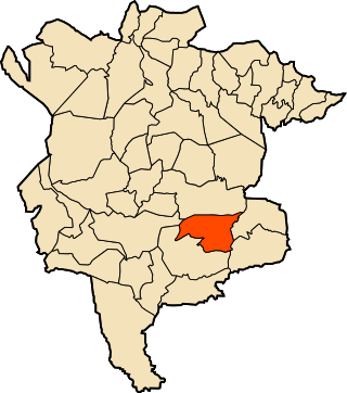
Ben Srour is a town and commune in M'Sila Province, Algeria.

<span class="mw-page-title-main">Taoura</span> Commune and town in Souk Ahras Province, Algeria

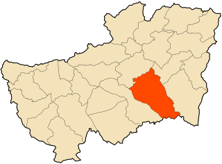
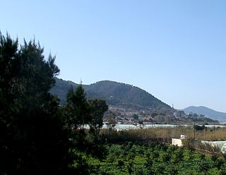
Taoura, known in antiquity as Thagora, is a town and commune in Souk Ahras Province in north-eastern Algeria.

Aïn Sebt is a town and commune in Sétif Province in north-eastern Algeria.

<span class="mw-page-title-main">Aïn Tagourait</span> Commune and town in Tipaza Province, Algeria

Ain Tagourait is a town and commune in Tipaza Province in northern Algeria.

<span class="mw-page-title-main">Attatba</span> Commune and town in Tipaza Province, Algeria

Attatba is a town and commune in Tipaza Province in northern Algeria.

<span class="mw-page-title-main">Bouharoun</span> Commune and town in Tipaza Province, Algeria

Bouharoun is a town and commune in Tipaza Province in northern Algeria.

<span class="mw-page-title-main">Bourkika</span> Commune and town in Tipaza Province, Algeria

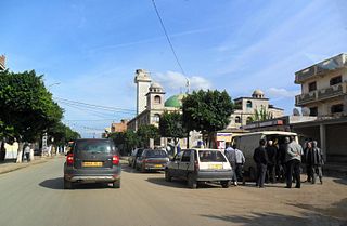
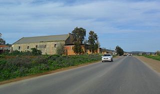
Bourkika is a town and commune in Tipaza Province in northern Algeria. The territory of the municipality is located to the southeast of the wilaya, at 36.4931118n, 2.475915e about 18 km southeast of Tipaza. In 1984, Bourkika became part of the commune of Douaouda.

<span class="mw-page-title-main">Chaiba</span> Commune and town in Tipaza Province, Algeria

Chaiba is a town and commune in Tipaza Province in northern Algeria.

<span class="mw-page-title-main">Douaouda</span> Commune and town in Tipaza Province, Algeria

Douaouda is a town and commune in Tipaza Province in northern Algeria.

<span class="mw-page-title-main">Fouka, Algeria</span> Commune and town in Tipaza Province, Algeria

Fouka is a town and commune in Tipaza Province in northern Algeria.

<span class="mw-page-title-main">Hadjeret Ennous</span> Commune and town in Tipaza Province, Algeria

Hadjeret Ennous is a town and commune in Tipaza Province in northern Algeria.

<span class="mw-page-title-main">Messelmoun</span> Commune and town in Tipaza Province, Algeria

Messelmoun is a town and commune in Tipaza Province in northern Algeria.

<span class="mw-page-title-main">Sidi Amar, Tipaza</span> Commune and town in Tipaza Province, Algeria

Sidi Amar is a town and commune in Tipaza Province in northern Algeria.

<span class="mw-page-title-main">Sidi Rached</span> Commune and town in Tipaza Province, Algeria

Sidi Rached is a town and commune in Tipaza Province in northern Algeria.

<span class="mw-page-title-main">Sidi Semiane</span> Commune and town in Tipaza Province, Algeria

Sidi Semiane is a town and commune in Tipaza Province in northern Algeria.

<span class="mw-page-title-main">Abi Youcef</span> Commune and town in Tizi Ouzou Province, Algeria

Abi Youcef is a commune in northern Algeria in the Tizi Ouzou Province in the Kabylia region.

<span class="mw-page-title-main">Aïn El Hammam</span> Commune and town in Tizi Ouzou Province, Algeria

Aïn El Hammam is a town and commune in Tizi Ouzou Province in northern Algeria.

Aït Oumalou is a town and commune in Tizi Ouzou Province in northern Algeria.

<span class="mw-page-title-main">Assi Youcef</span> Commune and town in Tizi Ouzou Province, Algeria

At vu gherdan is a town and commune in Tizi Ouzou Province in northern Algeria.

References

  1. "Communes of Algeria". Statoids. Archived from the original on 29 November 2010. Retrieved December 12, 2010.

36°28′41″N2°33′50″E / 36.47806°N 2.56389°E / 36.47806; 2.56389