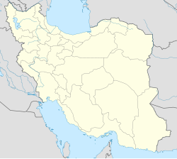
Ravand-e Sofla is a village in Beradust Rural District, Sumay-ye Beradust District, Urmia County, West Azerbaijan Province, Iran. At the 2006 census, its population was 111, in 21 families.
Ravand-e Olya is a village in Beradust Rural District, Sumay-ye Beradust District, Urmia County, West Azerbaijan Province, Iran. At the 2006 census, its population was 109, in 22 families.
Akhyan-e Bozorg is a village in Beradust Rural District, Sumay-ye Beradust District, Urmia County, West Azerbaijan Province, Iran. At the 2006 census, its population was 65, in 12 families.
Akhyan-e Kuchek is a village in Beradust Rural District, Sumay-ye Beradust District, Urmia County, West Azerbaijan Province, Iran. At the 2006 census, its population was 24, in 5 families.
Ishgeh Su is a village in Beradust Rural District, Sumay-ye Beradust District, Urmia County, West Azerbaijan Province, Iran. At the 2006 census, its population was 126, in 18 families.
Asengaran is a village in Beradust Rural District, Sumay-ye Beradust District, Urmia County, West Azerbaijan Province, Iran. At the 2006 census, its population was 80, in 17 families.
Avdelan-e Olya is a village in Beradust Rural District, Sumay-ye Beradust District, Urmia County, West Azerbaijan Province, Iran. At the 2006 census, its population was 13, in 4 families.
Gol-e Sheykhan is a village in Beradust Rural District, Sumay-ye Beradust District, Urmia County, West Azerbaijan Province, Iran. At the 2006 census, its population was 410, in 80 families.
Gangachin is a village in Beradust Rural District, Sumay-ye Beradust District, Urmia County, West Azerbaijan Province, Iran. At the 2006 census, its population was 2,682, in 472 families.
Gundak-e Molla is a village in Beradust Rural District, Sumay-ye Beradust District, Urmia County, West Azerbaijan Province, Iran. At the 2006 census, its population was 198, in 38 families.
Chareh is a village in Beradust Rural District, Sumay-ye Beradust District, Urmia County, West Azerbaijan Province, Iran. At the 2006 census, its population was 137, in 17 families.
Kanespi is a village in Beradust Rural District, Sumay-ye Beradust District, Urmia County, West Azerbaijan Province, Iran. At the 2006 census, its population was 102, in 15 families.
Kanisi is a village in Beradust Rural District, Sumay-ye Beradust District, Urmia County, West Azerbaijan Province, Iran. At the 2006 census, its population was 473, in 73 families.
Mastakan is a village in Beradust Rural District, Sumay-ye Beradust District, Urmia County, West Azerbaijan Province, Iran. At the 2006 census, its population was 234, in 37 families.
Qasrik is a village in Beradust Rural District, Sumay-ye Beradust District, Urmia County, West Azerbaijan Province, Iran. At the 2006 census, its population was 122, in 20 families.
Shegaftik-e Olya is a village in Beradust Rural District, Sumay-ye Beradust District, Urmia County, West Azerbaijan Province, Iran. At the 2006 census, its population was 230, in 46 families.
Shegaftik-e Sofla is a village in Beradust Rural District, Sumay-ye Beradust District, Urmia County, West Azerbaijan Province, Iran. At the 2006 census, its population was 231, in 40 families.
Sufi Kani is a village in Beradust Rural District, Sumay-ye Beradust District, Urmia County, West Azerbaijan Province, Iran. At the 2006 census, its population was 132, in 22 families.
Tazeh Kand-e Sheshmal is a village in Beradust Rural District, Sumay-ye Beradust District, Urmia County, West Azerbaijan Province, Iran. At the 2006 census, its population was 50, in 10 families.
Zangakan is a village in northwestern Iran, in Beradust Rural District, Sumay-ye Beradust District, Urmia County, West Azerbaijan Province. At the 2006 census, its population was 138, in 21 families.