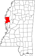
Avon, Mississippi | |
---|---|
Coordinates: 33°13′48″N91°02′50″W / 33.23000°N 91.04722°W | |
Country | United States |
State | Mississippi |
County | Washington |
Elevation | 115 ft (35 m) |
GNIS feature ID | 666436 [1] |
Avon is an unincorporated community located along Highway 1 in southwestern Washington County, Mississippi, US.
Curtis Township is a civil township of Alcona County in the U.S. state of Michigan. The population was 1,087 at the 2020 census.
Raber Township is a civil township of Chippewa County in the U.S. state of Michigan. The population was 632 at the 2020 census.
Allouez Township is a civil township of Keweenaw County in the U.S. state of Michigan. The population was 1,428 at the 2020 census.
Manitou Beach–Devils Lake is a census-designated place (CDP) in Lenawee County in the U.S. state of Michigan. The population of the CDP was 2,032 at the 2020 census. It is located within Rollin Township to the south and Woodstock Township to the north.
Lake Township is a civil township of Roscommon County in the U.S. state of Michigan. The population was 1,119 at the 2020 census.
Clay Township is a civil township of St. Clair County in the U.S. state of Michigan. The population was 8,446 at the 2020 census.
Geneva Township is a civil township of Van Buren County in the U.S. state of Michigan. The population was 3,416 at the 2020 United States Census.
Vichy is an unincorporated community in southern Maries County, Missouri, United States. It is located on U.S. Route 63, approximately 10 miles north of Rolla. The community was founded in 1880 and is named after Vichy, France. A post office called Vichy has been in operation since 1880. The Rolla National Airport, a former U.S. Army airfield owned and operated by the City of Rolla, with two 5,500 ft (1,700 m) asphalt runways, is located nearby. The ZIP Code for Vichy is 65580.
Loose Creek is an unincorporated community in Osage County, Missouri, United States. It is located north of U.S. Route 50, approximately eight miles east of Missouri's capital of Jefferson City. The ZIP Code for Loose Creek is 65054.
Sargent is an unincorporated community in Coweta County, in the U.S. state of Georgia. The ZIP Code for Sargent is 30275.
Chatham is an unincorporated community located in Washington County, Mississippi, near the north shore of Lake Washington. Chatham is approximately 11 miles (18 km) south of Avon and approximately 9 miles (14 km) north of Glen Allan.
Glen Allan is a census-designated place and unincorporated community located in far southern Washington County, Mississippi. It is situated immediately east of Lake Washington's southern shore.
Brashear is an unincorporated community located on Interstate Highway 30 and Farm to Market Road 2653 in west central Hopkins County, Texas, United States. Brashear has a post office, church, farm buildings, a radio building, and other buildings.
Pickton is an unincorporated community in Hopkins County, Texas, United States. Pickton has a post office, with the ZIP code 75471.
Dike is an unincorporated community in Hopkins County, Texas, United States. Dike has a post office, with the ZIP code 75437. On May 6, 2023, Dike voted on whether to incorporate into the city of Dike; the measure failed, with 32 votes in favor against 108 opposed.
Randolph is an unincorporated community in Fannin County, Texas, United States. Randolph has a post office with the ZIP code 75475. This is not to be confused with Randolph in Trinity County.
Bagwell is an unincorporated community in Red River County, Texas, United States. Bagwell has a post office, with the ZIP code 75412. The population in Bagwell is 528.
Columbus Township is a civil township of Luce County in the U.S. state of Michigan. As of the 2020 census, the township population was 169.
Paint Creek is a stream mostly located within Washtenaw County in the U.S. state of Michigan. The stream flows south before entering as a tributary to Stony Creek along the county line with Monroe County.
Archibald is an unincorporated community in Richland Parish, Louisiana, United States. The ZIP Code for Archibald is 71218.
33°13′48″N91°02′50″W / 33.23000°N 91.04722°W