Foote, Mississippi | |
|---|---|
 | |
 Foote  Foote | |
| Coordinates: 33°05′29″N91°01′57″W / 33.09139°N 91.03250°W | |
| Country | United States |
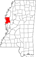
| State | Mississippi |
| County | Washington |
| Elevation | 112 ft (34 m) |
| Time zone | UTC-6 (Central (CST)) |
| • Summer (DST) | UTC-5 (CDT) |
| ZIP code | 38748 |
| GNIS feature ID | 691864 [1] |
Foote is an unincorporated community in Washington County, Mississippi, United States. Variant names include Colmere and Dudley. [1]