The Republic of Texas was a sovereign state in North America that existed from March 2, 1836, to February 19, 1846, that bordered Mexico, the Republic of the Rio Grande in 1840, and the United States of America, although Mexico considered it a rebellious province during its entire existence despite the Treaties of Velasco of May 1836. It was bordered by Mexico to the west and southwest, the Gulf of Mexico to the southeast, the two U.S. states of Louisiana and Arkansas to the east and northeast, and United States territories encompassing parts of the current U.S. states of Oklahoma, Kansas, Colorado, Wyoming, and New Mexico to the north and west. The Anglo residents of the area and of the republic became known as Texians.

Washington County is a county located in the U.S. state of Mississippi. As of the 2020 census, the population was 44,922. Its county seat is Greenville. The county is named in honor of the first President of the United States, George Washington. It is located to the Arkansas border.

Sharkey County is a county located in the U.S. state of Mississippi. Part of the western border is formed by the Yazoo River. According to the 2020 census, the population was 3,800, making it the second-least populous county in Mississippi. Its county seat is Rolling Fork. The county is named after William L. Sharkey, the provisional Governor of Mississippi in 1865.

Issaquena County is a county located in the U.S. state of Mississippi. As of the 2020 Census, its population was 1,338, making it the least populous county in the United States east of the Mississippi River. Its county seat is Mayersville. With a per-capita income of $18,598, Issaquena County is, by that measure, one of the poorest counties in the United States.

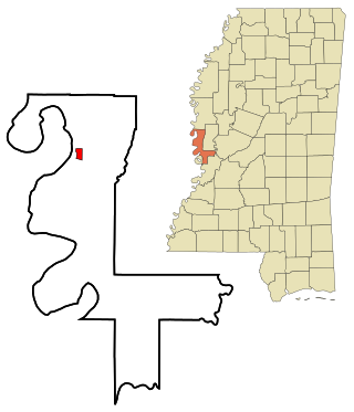
Mayersville is a town on the east bank of the Mississippi River, and the county seat for Issaquena County, Mississippi, United States. It is located in the Mississippi Delta region, known for cotton cultivation in the antebellum era. Once the trading center for the county, the town was superseded when railroads were built into the area. The population of the majority-black town was 547 at the 2010 census, down from 795 at the 2000 census.

Marietta is a city in, and the county seat of, Washington County, Ohio, United States. It is located in southeastern Ohio at the confluence of the Muskingum and Ohio Rivers, 11 miles (18 km) northeast of Parkersburg, West Virginia. As of the 2020 census, Marietta has a population of 13,385 people. It is the principal city of the Marietta micropolitan area, which includes all of Washington County, and is the second-largest city in the Parkersburg–Marietta–Vienna combined statistical area.

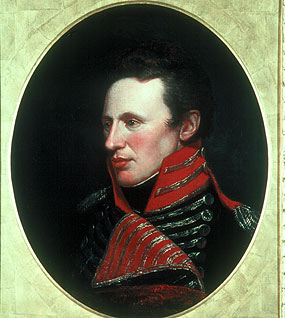
Zebulon Montgomery Pike was an American brigadier general and explorer for whom Pikes Peak in Colorado was named. As a U.S. Army officer he led two expeditions under authority of President Thomas Jefferson through the Louisiana Purchase territory, first in 1805–1806 to reconnoiter the upper northern reaches of the Mississippi River, and then in 1806–1807 to explore the southwest to the fringes of the northern Spanish-colonial settlements of New Mexico and Texas. Pike's expeditions coincided with other Jeffersonian expeditions, including the Lewis and Clark Expedition and the Red River Expedition in 1806.

The Northwest Territory, also known as the Old Northwest and formally known as the Territory Northwest of the River Ohio, was formed from unorganized western territory of the United States after the American Revolutionary War. Established in 1787 by the Congress of the Confederation through the Northwest Ordinance, it was the nation's first post-colonial organized incorporated territory.

Albert Rust was an American politician and slaveholder, who served as a delegate from Arkansas to the Provisional Congress of the Confederate States from 1861 to 1862. A member of the Democratic Party, he was the U.S. representative from Arkansas's 2nd congressional district (1859–1861). He also served as a senior officer of the Confederate States Army who commanded infantry in the Eastern, Western, and Trans-Mississippi theaters of the American Civil War.

Hiram Rhodes Revels was an American Republican politician, minister in the African Methodist Episcopal Church, and a college administrator. Born free in North Carolina, he later lived and worked in Ohio, where he voted before the Civil War. Elected by the Mississippi legislature to the United States Senate as a Republican to represent Mississippi in 1870 and 1871 during the Reconstruction era, he was the first African American to serve in either house of the U.S. Congress.

The Territory of New Mexico was an organized incorporated territory of the United States from September 9, 1850, until January 6, 1912. It was created from the U.S. provisional government of New Mexico, as a result of Nuevo México becoming part of the American frontier after the Treaty of Guadalupe Hidalgo. It existed with varying boundaries until the territory was admitted to the Union as the U.S. state of New Mexico. This jurisdiction was an organized, incorporated territory of the US for nearly 62 years, the longest period of any territory in the contiguous United States.

The Indiana Territory, officially the Territory of Indiana, was created by a congressional act that President John Adams signed into law on May 7, 1800, to form an organized incorporated territory of the United States that existed from July 4, 1800, to December 11, 1816, when the remaining southeastern portion of the territory was admitted to the Union as the state of Indiana. The territory originally contained approximately 259,824 square miles (672,940 km2) of land, but its size was decreased when it was subdivided to create the Michigan Territory (1805) and the Illinois Territory (1809). The Indiana Territory was the first new territory created from lands of the Northwest Territory, which had been organized under the terms of the Northwest Ordinance of 1787. The territorial capital was the settlement around the old French fort of Vincennes on the Wabash River, until transferred to Corydon near the Ohio River in 1813.

The Territory of Mississippi was an organized incorporated territory of the United States that existed from April 7, 1798, until December 10, 1817, when the western half of the territory was admitted to the Union as the State of Mississippi. The eastern half was redesignated as the Alabama Territory until it was admitted to the Union as the State of Alabama on December 14, 1819. The Chattahoochee River played a significant role in the definition of the territory's borders. The population rose in the early 1800s from settlement, with cotton being an important cash crop.
The 1826–27 United States House of Representatives elections were held on various dates in various states between July 3, 1826 and August 30, 1827. Each state set its own date for its elections to the House of Representatives before the first session of the 20th United States Congress convened on December 3, 1827. They occurred during John Quincy Adams's presidency. Elections were held for all 213 seats, representing 24 states.
Francis White was a distinguished early American lawyer and politician in what was then the U.S. state of Virginia.

Unita Zelma Blackwell was an American civil rights activist who was the first African-American woman to be elected mayor in the U.S. state of Mississippi. Blackwell was a project director for the Student Nonviolent Coordinating Committee (SNCC) and helped organize voter drives for African Americans across Mississippi. She was also a founder of the US–China Peoples Friendship Association, a group dedicated to promoting cultural exchange between the United States and China. She also served as an advisor to 6 US Presidents: Lyndon Johnson, Richard Nixon, Jimmy Carter, Ronald Reagan, and Bill Clinton.

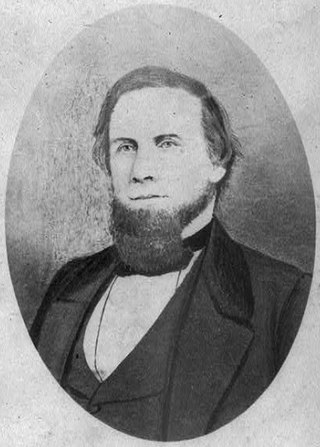
Samuel Jameson Gholson was a United States representative from Mississippi, a United States district judge of the United States District Court for the Northern District of Mississippi and the United States District Court for the Southern District of Mississippi and a General in the Confederate States Army.
Princeton is a ghost town located in Washington County, Mississippi, United States.

David Hunt was an American planter based in the Natchez District of Mississippi who controlled 25 plantations, thousands of acres, and more than 1,000 slaves in the antebellum era. From New Jersey, he joined his uncle in Mississippi business. He became a major philanthropist in the South, contributing to educational institutions in Mississippi, as well as the American Colonization Society and Mississippi Colonization Society, the latter of which he was a founding member.


