Metcalfe, Mississippi

Last updated

Metcalfe, Mississippi
Washington County Mississippi Incorporated and Unincorporated areas Metcalfe Highlighted.svg
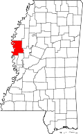
Location of Metcalfe, Mississippi
Usa edcp location map.svg
Red pog.svg
Metcalfe, Mississippi
Location in the United States
Coordinates: 33°27′14″N91°00′26″W / 33.45389°N 91.00722°W / 33.45389; -91.00722
Country United States
State Mississippi
County Washington
Government
  MayorWalter McDavid Jr. [1]
Area
[2]
  Total1.00 sq mi (2.60 km2)
  Land1.00 sq mi (2.60 km2)
  Water0.00 sq mi (0.00 km2)
Elevation
125 ft (38 m)
Population
 (2020)
  Total816
  Density813.56/sq mi (314.25/km2)
Time zone UTC-6 (Central (CST))
  Summer (DST) UTC-5 (CDT)
ZIP code
38760
Area code 662
FIPS code 28-46880
GNIS feature ID673505 [3]

Metcalfe is a town in Washington County, Mississippi, United States. The population was 1,067 at the 2010 census. The county is located on the western border of the state, with the Mississippi River on the west. It is within the Mississippi Delta.

Contents

Geography

According to the United States Census Bureau, the town has a total area of 1.0 square mile (2.6 km2), all land.

Climate

The climate in this area is characterized by hot, humid summers and generally mild to cool winters. According to the Köppen Climate Classification system, Metcalfe has a humid subtropical climate, abbreviated "Cfa" on climate maps. [4]

Demographics

Historical population
CensusPop.Note
1980 952
1990 1,09214.7%
2000 1,1091.6%
2010 1,067−3.8%
2020 816−23.5%
U.S. Decennial Census [5]

2020 census

Metcalfe Racial Composition [6]
RaceNum.Perc.
White 151.84%
Black or African American 77394.73%
Other/Mixed 222.7%
Hispanic or Latino 60.74%

As of the 2020 United States Census, there were 816 people, 351 households, and 201 families residing in the town.

2000 census

At the 2000 census there were 1,109 people, 386 households, and 272 families in the town. The population density was 1,110.5 inhabitants per square mile (428.8/km2). There were 417 housing units at an average density of 417.5 per square mile (161.2/km2). The racial makeup of the town was 1.17% White, 97.57% African American, 0.27% Native American, 0.36% from other races, and 0.63% from two or more races. Hispanic or Latino of any race were 0.63%. [7]

Of the 386 households 44.0% had children under the age of 18 living with them, 23.3% were married couples living together, 43.8% had a female householder with no husband present, and 29.5% were non-families. 27.5% of households were one person and 9.8% were one person aged 65 or older. The average household size was 2.87 and the average family size was 3.54.

The age distribution was 40.8% under the age of 18, 11.6% from 18 to 24, 24.0% from 25 to 44, 16.3% from 45 to 64, and 7.3% 65 or older. The median age was 23 years. For every 100 females, there were 75.8 males. For every 100 females age 18 and over, there were 56.4 males.

The median household income was $15,000 and the median family income was $18,295. Males had a median income of $21,307 versus $16,793 for females. The per capita income for the town was $8,050. About 43.0% of families and 47.4% of the population were below the poverty line, including 58.9% of those under age 18 and 53.3% of those age 65 or over.

Education

The Town of Metcalfe is served by the Western Line School District.

Related Research Articles

<span class="mw-page-title-main">Winter Beach, Florida</span> Census-designated place in Florida, United States

Winter Beach is a census-designated place (CDP) in Indian River County, Florida, United States. The population was 2,067 at the 2010 census, up from 965 at the 2000 census. It is part of the Sebastian–Vero Beach Metropolitan Statistical Area.

<span class="mw-page-title-main">Redington Beach, Florida</span> Town in the state of Florida, United States

Redington Beach is a town in Pinellas County, Florida, United States. It is part of the Tampa–St. Petersburg–Clearwater Metropolitan Statistical Area, more commonly called the Tampa Bay Area. The population was 1,376 at the 2020 census.

<span class="mw-page-title-main">Edmonton, Kentucky</span> City in Kentucky, United States

Edmonton is a home rule-class city in and the county seat of Metcalfe County, Kentucky, United States. It is part of the Glasgow Micropolitan Statistical Area. The population was 1,671 at the 2020 census.

<span class="mw-page-title-main">Masardis, Maine</span> Town in Maine, United States

Masardis is a town in Aroostook County, Maine, United States. The population was 204 at the 2020 census.

Springfield is a town in Penobscot County, Maine, United States. The population was 293 at the 2020 census.

Topsfield is a town in Washington County, Maine, United States. The population was 179 at the 2020 census.

<span class="mw-page-title-main">Ashland, Mississippi</span> Town in Mississippi, United States

Ashland is a town in Benton County, Mississippi, United States and the county seat. The population was 551 at the 2020 census, down from 569 at the 2010 census. Ashland was incorporated on March 8, 1871, and has a Mayor-Aldermen form of government. Mitch Carroll is the 28th mayor of Ashland.

<span class="mw-page-title-main">Hickory Flat, Mississippi</span> Town in Mississippi, United States

Hickory Flat is a town in Benton County, Mississippi, United States. The population was 601 at the 2010 census.

<span class="mw-page-title-main">Montrose, Mississippi</span> Town in Mississippi, United States

Montrose is a town in Jasper County, Mississippi, United States. The population was 140 at the 2010 census.

<span class="mw-page-title-main">Beaumont, Mississippi</span> Town in Mississippi, United States

Beaumont is a town in Perry County, Mississippi. It is part of the Hattiesburg, Mississippi Metropolitan Statistical Area, and located on the edge of the De Soto National Forest. The population was 951 at the 2010 census.

<span class="mw-page-title-main">Algoma, Mississippi</span> Town in Mississippi, United States

Algoma is a town in Pontotoc County, Mississippi. The population was 705 at the 2020 census, up from 590 at the 2010 census.

<span class="mw-page-title-main">Lambert, Mississippi</span> Town in Mississippi, United States

Lambert is a town in Quitman County, Mississippi. The population was 1,638 at the 2010 census.

<span class="mw-page-title-main">Lidgerwood, North Dakota</span> City in North Dakota, United States

Lidgerwood is a city in Richland County, North Dakota, United States. The population was 600 at the 2020 census. Lidgerwood was founded in 1886. It is part of the Wahpeton, ND–MN Micropolitan Statistical Area.

<span class="mw-page-title-main">Adamsville, Ohio</span> Village in Ohio, United States

Adamsville is a village in Muskingum County, Ohio, United States. The population was 140 at the 2020 census. It is part of the Zanesville micropolitan area.

<span class="mw-page-title-main">China Grove, Texas</span> Town in Texas, United States

China Grove is a town in Bexar County, Texas, United States, located on the far east side of San Antonio. The population was 1,141 at the 2020 census. It is part of the San Antonio Metropolitan Statistical Area.

<span class="mw-page-title-main">Harper, Texas</span> Census-designated place in Texas, United States

Harper is an unincorporated community and census-designated place (CDP), located 23 miles (37 km) west of Fredericksburg on U.S. Highway 290, in Gillespie County, in the U.S. state of Texas. The population was 1,192 at the 2010 census.

<span class="mw-page-title-main">Burnsville, West Virginia</span> Town in West Virginia, United States

Burnsville is a town in Braxton County, West Virginia, United States, at the confluence of the Little Kanawha River and Saltlick Creek. The population was 401 at the 2020 census. Burnsville was incorporated in 1902 by the Circuit Court and named for Captain John Burns who operated the first sawmill in that section of the state and who established the town shortly after the close of the American Civil War. It was named "All West Virginia City" in 1976.

<span class="mw-page-title-main">Man, West Virginia</span> Town in West Virginia, United States

Man is a town in Logan County, West Virginia, United States. The population was 772 at the 2020 census. The town is located along the Guyandotte River at the mouth of Buffalo Creek, which was the site of the 1972 Buffalo Creek Flood following a dam collapse. The name of the town reportedly derives from the last syllable of the surname of Ulysses Hinchman, who was a member of the House of Delegates from Logan County between 1866 and 1869.

<span class="mw-page-title-main">Cairo, West Virginia</span> Town in West Virginia, United States

Cairo is a town in Ritchie County, West Virginia, United States, along West Virginia Route 31, the North Fork of the Hughes River, and the North Bend Rail Trail. The population was 174 at the 2020 census.

<span class="mw-page-title-main">Mathiston, Mississippi</span> Town in Mississippi, United States

Mathiston is a town in Choctaw and Webster counties, Mississippi. The population was 698 at the 2010 census.

References

  1. Kirk, Catherine (June 7, 2017). "McDavid Unseats Holmes as Mayor of Metcalfe". Delta Democrat-Times. Archived from the original on October 30, 2017. Retrieved August 23, 2017.
  2. "2020 U.S. Gazetteer Files". United States Census Bureau. Retrieved July 24, 2022.
  3. U.S. Geological Survey Geographic Names Information System: Metcalfe
  4. Climate Summary for Metcalfe, Mississippi
  5. "Census of Population and Housing". Census.gov. Retrieved June 4, 2015.
  6. "Explore Census Data". data.census.gov. Retrieved December 7, 2021.
  7. "U.S. Census website". United States Census Bureau . Retrieved January 31, 2008.