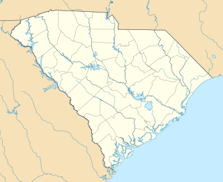
Issaquena County is a county located in the U.S. state of Mississippi. As of the 2010 census, the population was 1,406, making it the least populous county in the United States east of the Mississippi River. Its county seat is Mayersville. With a per-capita income of $18,598, Issaquena County is the poorest county in the United States.

Friars Point is a town in Coahoma County, Mississippi, United States. The population was 1,200 at the 2010 census, down from 1,480 in 2000.

Columbus is a city in and the county seat of Lowndes County, on the eastern border of Mississippi, United States, located primarily east, but also north and northeast of the Tombigbee River, which is also referred to as the Tennessee-Tombigbee Waterway. It is approximately 146 miles (235 km) northeast of Jackson, 92 miles (148 km) north of Meridian, 63 miles (101 km) south of Tupelo, 60 miles (97 km) northwest of Tuscaloosa, Alabama, and 120 miles (193 km) west of Birmingham, Alabama.

Brooksville is a town in Noxubee County, Mississippi, United States. The population was 1,223 at the 2010 census.

Jonestown is a town in Coahoma County, Mississippi, United States. The population was 1,298 as of the 2010 census, down from 1,701 in 2000.

Benton is an unincorporated community in Yazoo County, Mississippi.

Warrenton is an unincorporated community in Warren County, Mississippi. It is located approximately 5 miles south of Vicksburg on U.S. Route 61.

Middleton is a former town in Montgomery County, Mississippi, United States. Once a thriving commercial and educational center, Middleton was bypassed in 1859 when the Mississippi Central Railway built its line through nearby Winona. Businesses and residents followed the railroad, and Middleton was abandoned. Little remains of the town today but its cemetery, which was restored in 1992 by the Lions Club of Winona.

Red Lick is an unincorporated community located in Jefferson County, Mississippi. Red Lick is approximately 5 miles (8.0 km) southeast of Lorman on Mississippi Highway 552.

Commerce is a ghost town in Tunica County, Mississippi, United States. Commerce Landing was the town's port.

Princeton is a ghost town located in Washington County, Mississippi, United States.

Beatties Bluff is a ghost town located in Madison County, Mississippi, United States.

Trotter Landing is a ghost town in Tunica County, Mississippi, United States.
Snowden Grove Park is a mixed-use park located in Southaven, Mississippi, a suburb of Memphis, Tennessee.

Artonish is a ghost town located in Wilkinson County, Mississippi, United States. South of the town was Artonish Landing, located on a stretch of the Mississippi River known as the "Homochitto Cutoff".

Nashville is a ghost town in Lowndes County, Mississippi, United States.

Woodside Cotton Mill Village Historic District is a national historic district located in Greenville County, South Carolina. The district encompasses 278 contributing buildings and 2 contributing sites in an early 20th century urban South Carolina textile mill village. Centered on a mill founded by John T. Woodside in 1902, the district is located just west of the city limits of Greenville and is largely intact despite modernizations made by a succession of mill and home owners. The mill itself is a rectangular, brick, four-story building designed by J.E. Sirrine and built between 1902 and 1912. Eventually the mill became the largest cotton mill under one roof in the United States and one of the largest in the world.

Boykin Mill Complex, also known as Mill Tract Plantation, is a national historic district located near Camden, Kershaw County, South Carolina. The district encompasses nine contributing buildings, two contributing sites, and four contributing structures. “Boykin Mill” denotes a community which consists of an old post office, an old general store, a c. 1905 grist mill, mill pond, mill dam, gates, and canals. The community also includes an early 19th-century Greek Revival style Baptist church, one mid-19th-century residence, three 20th-century residences built for mill workers, and a smoke house. An American Civil War battle site is also a part of the Boykin Mill community. The Battle of Boykin's Mill took place on April 17, 1865.

Gay Hill is an unincorporated area and a ghost town in Washington County, Texas.

St. Julien Plantation is a historic plantation complex located near Eutawville, Orangeburg County, South Carolina. The plantation house was built about 1854, and is a two-story, L-shaped, vernacular farmhouse with Italianate influences. It features a low-pitched hipped roof with projecting eaves and a bracketed cornice. Also on the property are the contributing log cotton warehouse, board and batten kitchen, Carpenter Gothic mule barn, smokehouse, garage, storage building, and several wood frame farm buildings.


