Related Research Articles
Cheshire is an unincorporated community in Lane County, Oregon, United States. It is located near the Long Tom River and is southwest of Junction City on Oregon Route 36.
Mikkalo is an unincorporated community in Gilliam County, Oregon, United States, at an elevation of 1,470 feet (450 m). Mikkalo is about 4 miles (6.4 km) northwest of Clem. Mikkalo has a post office, serving ZIP code of 97861, and is in the 541 area code region. In 1905, the place was named for settler John Mikkalo, and a post office opened at Mikkalo in 1907. It was along the Condon Branch of the Union Pacific Railroad. The Mikkalo Farmers Elevator had a fire on March 28, 1921.
Fox is an unincorporated community in Grant County, Oregon, United States, on U.S. Route 395 south of Long Creek.
Thurston is a neighborhood in the eastern part of Springfield, Oregon, United States on Oregon Route 126. Before being annexed by Springfield, it was formerly an unincorporated community with its own post office. The earliest land claims in the Thurston area by white settlers were in 1851. A small crossroads community, including a general store and a blacksmith shop, formed at the corner of Thurston Road and 66th Street. The settlement was named for pioneer George H. Thurston, son of Samuel Thurston. Thurston post office was established in 1877. The ZIP code for Thurston post office boxes is 97482. The ZIP code for delivered mail is 97478.
Camas Valley is an unincorporated community in Douglas County, Oregon, United States, in the valley of the same name. It is on Oregon Route 42, near the Middle Fork Coquille River.

Curtin is an unincorporated community in Douglas County, Oregon, United States. It is on Interstate 5 and the former Southern Pacific railroad line about 7 miles (11 km) northeast of Drain along Pass Creek. It stands at an elevation of 404 feet.
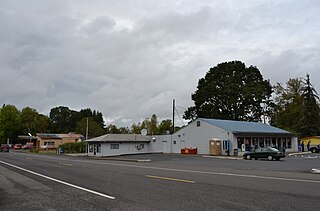
Tenmile is an unincorporated community in Douglas County, Oregon, United States. It is located on Oregon Route 42 southwest of Roseburg.

Blooming is an unincorporated community in Washington County, Oregon, United States near the Tualatin River, about two miles south of Cornelius. Its elevation is 190 feet. There are several plant nurseries in the area.

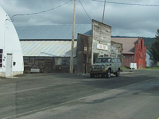
Milo is an unincorporated community in Douglas County, Oregon, United States, about 17 miles (27 km) east of Canyonville on the South Umpqua River.

Olney is an unincorporated community and former company town in Clatsop County, Oregon, United States, on Oregon Route 202 approximately eight miles south of Astoria. Its post office is assigned ZIP code 97325.
Wonder is an unincorporated community in Josephine County, Oregon, United States, on U.S. Route 199 about 13 miles west of Grants Pass and 8 miles east of Selma. It is within the Rogue River – Siskiyou National Forest.
Harlan is an unincorporated community in Lincoln County, Oregon, United States, about 30 miles west of Corvallis. It is located in a valley of the Central Oregon Coast Range in the Siuslaw National Forest. The community's economy was once based on logging and sawmills. Cattle ranching is another mainstay of the local economy.
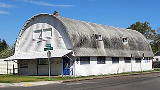
Nonpareil is an unincorporated historic community in Douglas County, Oregon, United States. It is about 8 miles (13 km) east of Sutherlin, near Calapooya Creek. The population of the area was about 202 in 2000. Nonpareil was the birthplace of novelist H. L. Davis.
Drew is an unincorporated community in Douglas County, Oregon, United States. It is located about six miles south of Tiller and 21 miles north of Trail on Oregon Route 227, surrounded by the Umpqua National Forest.
Hamlet is an unincorporated community in Clatsop County, Oregon, United States. It is located approximately six miles southeast of Necanicum, in the Northern Oregon Coast Range near the confluence of the North Fork Nehalem River and the Little North Fork Nehalem River. It is surrounded by units of the Clatsop State Forest.
Holland is an unincorporated community in Josephine County, Oregon, United States. It is about eight miles southeast of Cave Junction, in the Illinois Valley south of Oregon Route 46.

Dale is an unincorporated community in Grant County, Oregon, United States. It is located on U.S. Route 395 within the Umatilla National Forest about 17 miles south of Ukiah. It is near the Umatilla-Grant County border just south of the 45th parallel north.
Dryden is an unincorporated community in Josephine County, Oregon, United States. It is located in the Deer Creek Valley about five miles east of Selma. As of 1990 only one house remained; the 1920 structure formerly served as the Dryden Store and post office.
Rosedale is an unincorporated community in Marion County, Oregon. It is located just south of Salem in the Salem Hills. It is a part of the Salem Metropolitan Statistical Area. Rosedale post office ran from 1892 to 1901. The Rosedale area was a major prune growing region in the early 20th century but is now primarily made up of rural residential properties Vineyards and Christmas tree fields. Rosedale Elementary School located at 6974 Bates Road, Salem, Oregon was in service from 1893 until its closing in 2012. The town was located around the area of Sunnyside Road SE and Delany Road SE. It had a gas station, post office, grocery store, and a feed, seed and livery stable. The community still has a church and cemetery founded in 1896 located at 452 Hylo Rd SE.
Galesville Reservoir is a water storage reservoir in Klamath Mountains of Douglas County, Oregon. The dam was completed in October 1986.
References
- ↑ McArthur, Lewis A.; Lewis L. McArthur (2003) [1928]. Oregon Geographic Names (Seventh ed.). Portland, Oregon: Oregon Historical Society Press. ISBN 0-87595-277-1.
- ↑ "Zip Code". United States Postal Service. Archived from the original on November 24, 2009. Retrieved November 22, 2009.
- ↑ "Tom Pappas". USA Track and Field . Retrieved February 24, 2007.
42°47′44″N123°15′33″W / 42.79556°N 123.25917°W
Municipalities and communities of Douglas County, Oregon, United States | ||
|---|---|---|
| Cities |  | |
| CDPs | ||
| Unincorporated communities | ||
| Indian reservations | ||
| Footnotes | ‡This populated place also has portions in an adjacent county or counties | |
| | This Douglas County, Oregon state location article is a stub. You can help Wikipedia by expanding it. |