Melrose, Oregon | |
|---|---|
Census-designated place (CDP) | |
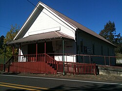 The grange hall at Melrose | |
 Melrose, Oregon  Melrose, Oregon | |
| Coordinates: 43°14′44″N123°27′22″W / 43.24556°N 123.45611°W | |
| Country | United States |
| State | Oregon |
| County | Douglas |
| Area | |
• Total | 4.35 sq mi (11.26 km2) |
| • Land | 4.35 sq mi (11.26 km2) |
| • Water | 0.00 sq mi (0.00 km2) |
| Elevation | 446 ft (136 m) |
| Population | |
• Total | 834 |
| • Density | 191.77/sq mi (74.05/km2) |
| Time zone | UTC-8 (Pacific (PST)) |
| • Summer (DST) | UTC-7 (PDT) |
| ZIP code | 97471 |
| Area codes | 458 and 541 |
| FIPS code | 41-47350 |
| GNIS feature ID | 2611755 [2] |
Melrose is an unincorporated community and census-designated place in Douglas County, Oregon, United States. [2] As of the 2010 census, it had a population of 735. [4] It was named by Henry Scott for Melrose Abbey in Scotland. Its post office, at first named Hogan, was established on May 18, 1887, and James McKinney was the first postmaster. [5] Named earlier on as French Settlement, Oregon.
