Related Research Articles

Douglas County is one of the 36 counties in the U.S. state of Oregon. As of the 2020 census, the population was 111,201. The county seat is Roseburg. The county is named after Stephen A. Douglas, an American politician who supported Oregon statehood. Douglas County comprises the Roseburg, OR Micropolitan Statistical Area.

Roseburg is a city in the U.S. state of Oregon. It is in the Umpqua River Valley in southern Oregon and is the county seat and most populous city of Douglas County. Founded in 1851, the population was 23,683 at the 2020 census, making it the principal city of the Roseburg, Oregon Micropolitan Statistical Area. The community developed along both sides of the South Umpqua River and is traversed by Interstate 5. Traditionally a lumber industry town, Roseburg was the original home of Roseburg Forest Products, which is now based in nearby Springfield.

Roseburg North is a census-designated place (CDP) in Douglas County, Oregon, United States. The population was 5,912 at the 2010 census. Winchester, Oregon is included as part of Roseburg North.

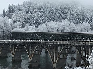
The Umpqua River on the Pacific coast of Oregon in the United States is approximately 111 miles (179 km) long. One of the principal rivers of the Oregon Coast and known for bass and shad, the river drains an expansive network of valleys in the mountains west of the Cascade Range and south of the Willamette Valley, from which it is separated by the Calapooya Mountains. From its source northeast of Roseburg, the Umpqua flows northwest through the Oregon Coast Range and empties into the Pacific at Winchester Bay. The river and its tributaries flow almost entirely within Douglas County, which encompasses most of the watershed of the river from the Cascades to the coast. The "Hundred Valleys of the Umpqua" form the heart of the timber industry of southern Oregon, generally centered on Roseburg.

The Alsea River flows 48.5 miles (78.1 km) from Alsea, an unincorporated community in the coastal mountains of the U.S. state of Oregon, to the Pacific Ocean near the city of Waldport. It begins at the confluence of the North Fork Alsea River and the South Fork Alsea River and ends in Alsea Bay, a wide estuary at Waldport. The river flows generally west-northwest in a winding course through the mountains of southern Benton and Lincoln counties, passing near the unincorporated community of Tidewater and through the Siuslaw National Forest. Its drainage basin extends into Lane County, along the headwaters of the South Fork Alsea River.
The Little River is a tributary of the North Umpqua River, about 30 miles (48 km) long, in southwestern Oregon in the United States. It drains part of the western side of the Cascade Range east of Roseburg, between the North and South Umpqua.

The Calapooya Mountains are a mountain range in Lane and Douglas counties of southwestern Oregon in the United States. The range runs for approximately 60 miles (97 km) west from the Cascade Range between Eugene on the north and Roseburg on the south.
Ash is an unincorporated community in Douglas County, Oregon, United States, south of Loon Lake in the Southern Oregon Coast Range. The community is also referred to as Ash Valley.
Winchester is an unincorporated community in Douglas County, Oregon, United States. It is on the south bank of the North Umpqua River 4 miles (6.4 km) north of Roseburg on Interstate 5 and is included in the Roseburg North CDP for statistical purposes.
Alder is an unincorporated community in Benton County, Oregon, United States. Alder lies near U.S. Route 20 southeast of Blodgett on the Marys River in the Central Oregon Coast Range. The post office serving Alder was named Hipp.

Curtin is an unincorporated community in Douglas County, Oregon, United States. It is on Interstate 5 and the former Southern Pacific railroad line about 7 miles (11 km) northeast of Drain along Pass Creek. It stands at an elevation of 404 feet.
Tenmile is an unincorporated community in Douglas County, Oregon, United States. It is located on Oregon Route 42 southwest of Roseburg.

Lookingglass is an unincorporated community and census-designated place in the Lookingglass Valley of Douglas County, Oregon, United States, about 9 miles (14 km) southwest of Roseburg. As of the 2010 census it had a population of 855. Lookingglass is considered a suburb of Roseburg.
Nonpareil is an unincorporated historic community in Douglas County, Oregon, United States. It is about 8 miles (13 km) east of Sutherlin, near Calapooya Creek. The population of the area was about 202 in 2000. Nonpareil was the birthplace of novelist H. L. Davis.
Tiernan is an unincorporated community in Lane County, Oregon, United States. It is about five miles west of Mapleton on Oregon Route 126 near the Siuslaw River and within the Siuslaw National Forest.
Walker is an unincorporated community in Lane County, Oregon, United States. It is located about 4 miles (6 km) north of Cottage Grove on Oregon Route 99, near the Coast Fork Willamette River.
Steamboat is an unincorporated community in Douglas County, Oregon, United States. It is located about 39 miles east of Roseburg on Oregon Route 138, near the confluence of the North Umpqua River with Steamboat Creek within the Umpqua National Forest.
Peel is an unincorporated community in Douglas County, Oregon, United States. It is located about six miles southeast of Glide near the Little River.
Hampton is an unincorporated locale in Lane County, Oregon, United States. It is located about 13 miles (21 km) southeast of Lowell. Hampton was established in 1952 as a station on the Southern Pacific Railroad Cascade Line on the shore of Lookout Point Lake, when the railroad was relocated because of the creation of the lake. It was named for Harry A. Hampton, the railroad division engineer from 1922 to 1943.
Derry is an unincorporated locale in Polk County, Oregon, United States. It is located about 10 miles west of Salem and one mile east of Rickreall.
References
- ↑ "Shady". Geographic Names Information System . United States Geological Survey. November 28, 1980. Retrieved 2010-12-16.
- 1 2 Oregon Atlas & Gazetteer (7th ed.). Yarmouth, Maine: DeLorme. 2008. p. 53. ISBN 0-89933-347-8.
- 1 2 "Douglas County Transportation System Plan" (PDF). November 1998. p. 218. Retrieved 2010-12-16.
- ↑ "Agenda". Douglas County Board of Commissioners. November 23, 2005. Retrieved 2010-12-16.
- ↑ Harrison, Ken (October 1, 1994). "Southern Pacific Station Names" . Retrieved 2010-12-16.
- ↑ "Shady Point". Geographic Names Information System . United States Geological Survey. May 1, 1994. Retrieved 2010-12-16.
