This article relies largely or entirely on a single source .(May 2022) |
Ballard was a small village located between Chenoa and Lexington, Illinois, on the Union Pacific railroad.
This article relies largely or entirely on a single source .(May 2022) |
Ballard was a small village located between Chenoa and Lexington, Illinois, on the Union Pacific railroad.
At one point in time, Ballard had a decent population with a few businesses and homes. The last remaining marker of the settlement was the Graham and Bennion Elevator, better known to locals simply as "the Ballard elevator". The roughly 80-foot structure was demolished in 2006. [1]
Municipalities and communities of McLean County, Illinois, United States | ||
|---|---|---|
| Cities | 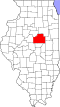 | |
| Town | ||
| Villages | ||
| Townships | ||
| CDPs | ||
| Other communities | ||
| Ghost towns | ||
| Footnotes | ‡This populated place also has portions in an adjacent county or counties | |