Dale Township, McLean County, Illinois

Last updated

Dale Township
Township
Map highlighting Dale Township, McLean County, Illinois.svg
Location in McLean County
Map of Illinois highlighting McLean County.svg
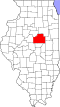
McLean County's location in Illinois
Country United States
State Illinois
County McLean
EstablishedNovember 3, 1857
Area
  Total
34.56 sq mi (89.5 km2)
  Land34.56 sq mi (89.5 km2)
  Water0.01 sq mi (0.03 km2)  0.03%
Population
 (2010)
  Estimate 
(2016) [1]
1,223
  Density35.7/sq mi (13.8/km2)
Time zone UTC-6 (CST)
  Summer (DST) UTC-5 (CDT)
FIPS code 17-113-18381

Dale Township is located in McLean County, Illinois. As of the 2010 census, its population was 1,233 and it contained 521 housing units. [2] It contains part of the census-designated place of Twin Grove and the entirety of Shirley.

Contents

Geography

According to the 2010 census, the township has a total area of 34.56 square miles (89.5 km2), of which 34.56 square miles (89.5 km2) (or 100%) is land and 0.01 square miles (0.026 km2) (or 0.03%) is water. [2]

Demographics

Historical population
CensusPop.Note
2016 (est.)1,223 [1]
U.S. Decennial Census [3]

References

  1. 1 2 "Population and Housing Unit Estimates" . Retrieved June 9, 2017.
  2. 1 2 "Population, Housing Units, Area, and Density: 2010 - County -- County Subdivision and Place -- 2010 Census Summary File 1". United States Census. Archived from the original on February 12, 2020. Retrieved May 28, 2013.
  3. "Census of Population and Housing". Census.gov. Retrieved June 4, 2016.

40°26′33″N89°06′04″W / 40.44250°N 89.10111°W / 40.44250; -89.10111