Holder, Illinois

Last updated
Holder, Illinois
Illinois grain elevators. Evening on the Illinois Prairie after the harvest is in. Holder, IL (cropped).jpg
USA Illinois location map.svg
Red pog.svg
Holder
Location of Holder within Illinois
Usa edcp location map.svg
Red pog.svg
Holder
Holder (the United States)
Coordinates: 40°27′04″N88°48′15″W / 40.45111°N 88.80417°W / 40.45111; -88.80417 Coordinates: 40°27′04″N88°48′15″W / 40.45111°N 88.80417°W / 40.45111; -88.80417
CountryUnited States
StateIllinois
County McLean County
Township Old Town Township
Elevation
840 ft (260 m)
Time zone UTC-6 (CST)
  Summer (DST) UTC-5 (CDT)
Area code 309

Holder is an unincorporated community in Old Town Township, McLean County, Illinois.

Contents

Geography

Holder is located at 40°27′4″N88°48′15″W / 40.45111°N 88.80417°W / 40.45111; -88.80417 (40.4511462, -88.8042368), and is located east of Bloomington.

History

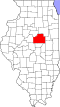
Holder was laid out 7 December 1871 by Charles W. Holder. Holder was a Bloomington land developer who was associated with the development of many towns including Towanda, Illinois, Normal, Illinois. and Lyons, Iowa. The Lafayette, Bloomington and Mississippi Railroad, for which Padua Township had supplied $30,000 worth of bonds. The location of the station came as a surprise to local people who had expected that it would be closer to the center of the Township. [1] A store was moved to the new Town. By 1872 freight service had begun of the railroad. [2] The original town consisted of four blocks on the north side of the depot grounds. The depot was on the south side of the tracks and early grain elevators were on both sides of the tracks. [3]

Demographics

Holder consists of approximately 25 residential dwellings.

Notes

  1. History of McLean County Illinois (Chicago: LeBaron 1879, p. 567.
  2. William D. Walters, Jr. "Town-Making in Eastern McLean County, Illinois: A Geographic Microstudy," Bulletin of the Illinois Geographical Society, (June 1998) XL:2 pp. 32.32.
  3. Combined Indexed Atlas 1856 - 1914, McLean County, Illinois (Bloomington: McLean County Historical Society and McLean County Genealogical Society, 2006) p. 181

Related Research Articles

<span class="mw-page-title-main">Dwight, Illinois</span> Village in Illinois, United States

Dwight is a village located mainly in Livingston County, Illinois, with a small portion in Grundy County. The population was 4,032 at the 2020 census. Dwight contains an original stretch of U.S. Route 66, and from 1892 until 2016 continuously used a railroad station designed in 1891 by Henry Ives Cobb. Interstate 55 bypasses the village to the north and west.

<span class="mw-page-title-main">Anchor, Illinois</span> Village in Illinois, United States

Anchor is a village in McLean County, Illinois, United States. The population was 163 at the 2020 census. It is part of the Bloomington–Normal Metropolitan Statistical Area.

<span class="mw-page-title-main">Arrowsmith, Illinois</span> Village in Illinois, United States

Arrowsmith is a village in McLean County, Illinois, United States. The population was 276 at the 2020 census. It is part of the Bloomington–Normal Metropolitan Statistical Area.

<span class="mw-page-title-main">Bellflower, Illinois</span> Village in Illinois, United States

Bellflower is a village in McLean County, Illinois, United States. The population was 346 at the 2020 census. It is part of the Bloomington–Normal Metropolitan Statistical Area.

<span class="mw-page-title-main">Carlock, Illinois</span> Village in Illinois, United States

Carlock is a village in McLean County, Illinois, United States. The population was 548 at the 2020 census. It is part of the Bloomington–Normal Metropolitan Statistical Area.

<span class="mw-page-title-main">Colfax, Illinois</span> Village in Illinois, United States

Colfax is a village in McLean County, Illinois, United States. The population was 996 at the 2020 census. It is part of the Bloomington–Normal Metropolitan Statistical Area.

<span class="mw-page-title-main">Cooksville, Illinois</span> Village in Illinois, United States

Cooksville is a village in McLean County, Illinois, United States. The population was 157 at the 2020 census. It is part of the Bloomington–Normal Metropolitan Statistical Area.

<span class="mw-page-title-main">Danvers, Illinois</span> Village in Illinois, United States

Danvers is a village in McLean County, Illinois, United States. The population was 1,089 as of the 2020 census. It is part of the Bloomington–Normal Metropolitan Statistical Area.

<span class="mw-page-title-main">Ellsworth, Illinois</span> Village in Illinois, United States

Ellsworth is a village in Dawson Township, McLean County, Illinois, United States. The population was 184 at the 2020 census. It is part of the Bloomington–Normal Metropolitan Statistical Area.

<span class="mw-page-title-main">Gridley, Illinois</span> Village in Illinois, United States

Gridley is a village in McLean County, Illinois, United States. The population was 1,456 at the 2020 census. It is part of the Bloomington–Normal Metropolitan Statistical Area.

<span class="mw-page-title-main">Le Roy, Illinois</span> City in Illinois, United States

Le Roy is a city in McLean County, Illinois, United States. The population was 3,512 at the 2020 census.

<span class="mw-page-title-main">McLean, Illinois</span> Village in Illinois, United States

McLean is a village in McLean County, Illinois, United States. The population was 743 at the 2020 census, down from 830 in 2010. It is part of the Bloomington–Normal Metropolitan Statistical Area. McLean is the home of the Dixie Travel Plaza.

<span class="mw-page-title-main">Saybrook, Illinois</span> Village in Illinois, United States

Saybrook is a village in McLean County, Illinois, United States. The population was 654 at the 2020 census. It is part of the Bloomington–Normal Metropolitan Statistical Area.

<span class="mw-page-title-main">Stanford, Illinois</span> Village in Illinois, United States

Stanford is a village in McLean County, Illinois, United States. The population was 600 at the 2020 census. It is part of the Bloomington–Normal Metropolitan Statistical Area.

<span class="mw-page-title-main">Towanda, Illinois</span> Village in Illinois, United States

Towanda is a village in McLean County, Illinois, United States. The population was 431 at the 2020 census. It is part of the Bloomington–Normal Metropolitan Statistical Area.

<span class="mw-page-title-main">Constitution Trail</span>

The Constitution Trail is a multi-use rail trail located in Illinois. It occupies an abandoned Illinois Central Gulf Railroad corridor that runs through the 'Twin Cities' of Bloomington and Normal in McLean County, Illinois.

Cropsey is a small unincorporated community in McLean County, Illinois, United States. It was named for a Civil War colonel in the Union Army.

The village of Benjaminville, Illinois, was founded in McLean County, Illinois, United States during the 1850s by Quaker farmers, who, like many others who came to Illinois, were looking to take advantage of the rich prairie soil. The town's settlement centered on the Society of Friends and the meeting house that was first constructed there in 1859. The town was rendered a ghost town after 1870 when the expected Lake Erie Railroad did not come into town. Today the unincorporated community of Bentown, Illinois, exists near the site of the former town of Benjaminville.

Shirley is an unincorporated community located in southwestern McLean County, Illinois, United States, just off Interstate 55. It was founded in 1854 and currently has a population of 378. Shirley is home to the Funk Prairie Home & Rock Museum.

Weston is an unincorporated community located in McLean County, Illinois. It currently is still in existence, as opposed to its now-defunct namesake in DuPage County.