Weston, McLean County, Illinois

Last updated

Weston, Illinois
USA Illinois location map.svg
Red pog.svg
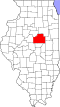
Weston
Location of Weston within Illinois
Usa edcp location map.svg
Red pog.svg
Weston
Weston (the United States)
Coordinates: 40°44′50″N88°37′19″W / 40.74722°N 88.62194°W / 40.74722; -88.62194 [1]
CountryUnited States
StateIllinois
County McLean
Elevation
[1]
702 ft (214 m)
Time zone UTC-6 (CST)
  Summer (DST) UTC-5 (CDT)
ZIP code
61726
Area codes 815, 779
GNIS ID420966 [1]

Weston is an unincorporated community located in McLean County, Illinois. It currently is still in existence, as opposed to its now-defunct namesake in DuPage County.

History

Weston was laid out 26 August 1867 by W. F. Bryan. [2] The Original Town included 288 small lots, five blocks that were not subdivided and a Public Park. The depot and town hall were on the south side of the tracks. It was a station along the Toledo Peoria and Western Railroad. In 1895 there were four churches. [3] Just east of town an area of natural tall grass prairie survives at Weston Cemetery Prairie.

References

  1. 1 2 3 U.S. Geological Survey Geographic Names Information System: Weston, McLean County, Illinois
  2. Historical Encyclopedia of Illinois and History of McLean County (Chicago: Munsell, 1908) p. 902.
  3. Combined Indexed Atlas 1856-1914, McLean County, Illinois (Bloomington: McLean County Historical Society and McLean County Genealogical Society, 2006) p. 212.
  1. Osman Topo Map in McLean County IL
  2. "Osman, Illinois". Geographic Names Information System . United States Geological Survey, United States Department of the Interior.