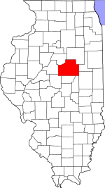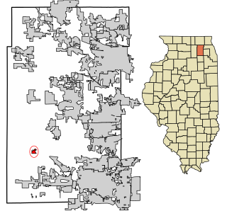
Kaneville is a village in southwestern Kane County, Illinois, United States. It was incorporated in November 2006, and the first elected officials were chosen in elections held on April 17, 2007. The village had a population of 484 at the 2010 census. Kaneville is part of the Chicago metropolitan area. The village was originally called "Royalton", but this was found to be taken by another settlement. The name was then changed to "Kaneville", referring to Elias Kane.

Bellflower Township is located in McLean County, Illinois. As of the 2010 census, its population was 585 and it contained 267 housing units. Bellflower Township changed its name from Prairie Township on May 17, 1858.

Blue Mound Township is located in McLean County, Illinois. As of the 2010 census, its population was 441 and it contained 202 housing units.

Cropsey Township is located in McLean County, Illinois. As of the 2010 census, its population was 222 and it contained 90 housing units. It was named after Col. A. J. Cropsey, the owner of a large farm in the area. In 1860 there were 25 families living in the township; by the 2000 census the total population was reported at 256.
Dawson Township is located in McLean County, Illinois. As of the 2010 census, its population was 590 and it contained 253 housing units.

Empire Township is located in McLean County, Illinois. As of the 2010 census, its population was 4,093 and it contained 1,719 housing units. Empire Township changed its name from Le Roy Township on May 17, 1858.

Gridley Township is located in McLean County, Illinois. As of the 2010 census, its population was 1,913 and it contained 790 housing units.

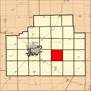
Martin Township is located in McLean County, Illinois. As of the 2010 census, its population was 1,289 and it contained 538 housing units.
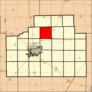
Money Creek Township is located in McLean County, Illinois. As of the 2010 census, its population was 1,085 and it contained 511 housing units.

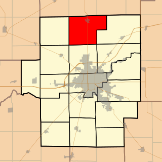
Normal Township is located in McLean County, Illinois. As of the 2010 census, its population was 52,560 and it contained 18,861 housing units. The majority of the township is occupied by the town of Normal.

Yates Township is located in McLean County, Illinois. As of the 2010 census, its population was 287 and it contained 121 housing units. Yates Township formed as Union Township from Chenoa Township on June 5, 1862. Union was changed to Yates sometime prior to 1920.
Belle Prairie Township is located in Livingston County, Illinois in the United States. As of the 2010 census, its population was 135 and it contained 55 housing units.

Broughton Township is located in Livingston County, Illinois. As of the 2010 census, its population was 313 and it contained 139 housing units. Broughton Township changed its name from Broughtonville Township on October 3, 1860.

Chatsworth Township is located in Livingston County, Illinois. As of the 2010 census, its population was 1,366 and it contained 639 housing units.

Forrest Township is located in Livingston County, Illinois. As of the 2010 census, its population was 1,605 and it contained 627 housing units. Forrest Township formed from a portion of Chatsworth Township as Forrestville Township in 1861, but then changed its name to just Forrest in 1865.

Indian Grove Township is located in Livingston County, Illinois. As of the 2010 census, its population was 4,297 and it contained 1,814 housing units. Indian Grove Township changed its name from Worth Township on May 11, 1858.

Rooks Creek Township is located in Livingston County, Illinois. As of the 2010 census, its population was 567 and it contained 233 housing units.

Saunemin Township is located in Livingston County, Illinois, United States. As of the 2010 census, its population was 666 and it contained 281 housing units. It is named after, and contains, Saunemin, Illinois.

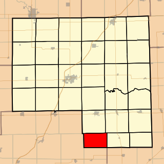
Ridgeland Township is one of twenty-six townships in Iroquois County, Illinois, USA. As of the 2010 census, its population was 369 and it contained 173 housing units. Ridgeland Township was formed from Onarga Township on January 29, 1879; the original name was Ridge Township, but the name was changed to Ridgeland Township on an unknown date.
Maroa Township is located in Macon County, Illinois. As of the 2010 census, its population was 2,100 and it contained 883 housing units.