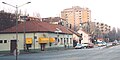
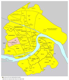
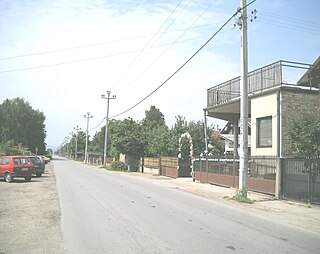
Banatić

Last updated
Banatić
Банатић
Urban neighborhood

Banatic02.jpg

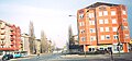
Banatić, Jaša Tomić Boulevard
Country Flag of Serbia.svg  Serbia
Province Vojvodina
District South Bačka
Municipality Novi Sad
Time zone CET (UTC+1)
  Summer (DST) CEST (UTC+2)
Area code +381(0)21
Car plates NS

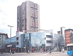
Banatić (Serbian : Банатић) is an urban neighborhood of the city of Novi Sad, Serbia. Its name means "a little Banat".

Serbian language South Slavic language

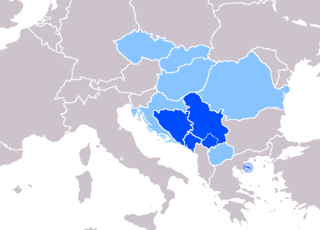
Serbian is the standardized variety of the Serbo-Croatian language mainly used by Serbs. It is the official language of Serbia, the territory of Kosovo, and one of the three official languages of Bosnia and Herzegovina. In addition, it is a recognized minority language in Montenegro where it is spoken by the relative majority of the population, as well as in Croatia, North Macedonia, Romania, Hungary, Slovakia, and the Czech Republic.

Novi Sad City in Vojvodina, Serbia

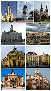
Novi Sad is the second largest city of Serbia, the capital of the autonomous province of Vojvodina and the administrative center of the South Bačka District. It is located in the southern part of the Pannonian Plain, on the border of the Bačka and Srem geographical regions. Bordering the banks of the Danube river, the city faces the northern slopes of Fruška Gora mountain.

Banat Historical region

The Banat is a geographical and historical region in Central Europe that is currently divided among three countries: the eastern part lies in western Romania ; the western part in northeastern Serbia ; and a small northern part lies within southeastern Hungary.

Contents

Borders

The southern border of Banatić is Bulevar kralja Petra I (King Petar I Boulevard), the eastern border is Bulevar oslobođenja (Liberation Boulevard), the north-eastern borders are Bulevar Jaše Tomića (Jaša Tomić Boulevard) and Kisačka ulica (Kisač street), the northern border is railway Belgrade-Subotica, the north-western border is ulica Kornelija Stankovića (Kornelije Stanković Street), and the western border is Rumenačka ulica (Rumenka Street).

Neighbouring city quarters

Map of the urban area of Novi Sad with city quarters, showing the location of Banatic Novi sad quarters.png
Map of the urban area of Novi Sad with city quarters, showing the location of Banatić
Banatic, Liberation Boulevard Bulevar NoviSad2.jpg
Banatić, Liberation Boulevard

The neighbouring city quarters are: Detelinara in the west, Sajmište in the south, Rotkvarija and Salajka in the east, and Pervazovo Naselje and Industrijska Zona Jug in the north.

Detelinara Urban neighborhood in South Bačka, Vojvodina, Serbia

Detelinara is an urban neighborhood of the city of Novi Sad, Serbia.

Salajka Urban neighborhood in South Bačka, Vojvodina, Serbia

Salajka, also known as Slavija, is an urban neighborhood of the city of Novi Sad, Serbia.

Features

The city main train and bus stations are located in Banatić.

See also

Related Research Articles

Liman, Novi Sad Urban neighborhood in South Bačka, Vojvodina, Serbia

Liman is an urban neighborhood of the city of Novi Sad, Serbia. It is located to the south of the city centre, along the Danube river, covering an area of 3.98 km². It is a relatively new part of the city, built between 1960s and 1990s on what previously were marshes. It is divided into four parts, numbered by Roman numerals: Liman I, II, III and IV, which match the chronology of its development.

Adamovićevo Naselje Urban neighborhood in South Bačka, Vojvodina, Serbia

Adamovićevo Naselje is an urban neighborhood of the city of Novi Sad, Serbia.

Bistrica (Novo Naselje) Urban neighborhood in South Bačka, Vojvodina, Serbia

Bistrica, also known as Novo Naselje, is an urban neighborhood of the city of Novi Sad, Serbia.

Telep Urban neighborhood in South Bačka, Vojvodina, Serbia

Telep is an urban neighborhood of the city of Novi Sad, Serbia.

Grbavica (Novi Sad) Urban neighborhood in South Bačka, Vojvodina, Serbia

Grbavica is an urban neighborhood of the city of Novi Sad, Serbia.

Satelit

Satelit is an urban neighborhood of the city of Novi Sad, Serbia.

Stari Grad, Novi Sad Urban neighborhood in South Bačka, Vojvodina, Serbia

Stari Grad is an urban neighborhood of the city of Novi Sad, Serbia. It is the main part of Novi Sad, and it is also known as City Centre. In the Serbian language, the name "Stari Grad" means "Old Town".

Sajmište, Novi Sad Urban neighborhood in South Bačka, Vojvodina, Serbia

Sajmište is an urban neighborhood of the city of Novi Sad, Serbia.

Rotkvarija (Žitni Trg)

Rotkvarija, also known as Žitni Trg, is an urban neighborhood of the city of Novi Sad, Serbia.

Veternička Rampa

Veternička Rampa is an urban neighborhood of the city of Novi Sad, Serbia.

Jugovićevo

Jugovićevo is an urban neighborhood of the city of Novi Sad, Serbia.

Podbara Urban neighborhood in South Bačka, Vojvodina, Serbia

Podbara is an urban neighborhood of the city of Novi Sad, Serbia.

Adice Urban neighborhood in South Bačka, Vojvodina, Serbia

Adice is an urban neighborhood belonging to the city of Novi Sad, Serbia.

Avijatičarsko Naselje Urban neighborhood in South Bačka, Vojvodina, Serbia

Avijatičarsko Naselje, also known as Avijacija, is an urban neighborhood of the city of Novi Sad, Serbia.

Slana Bara Urban neighborhood in South Bačka, Vojvodina, Serbia

Slana Bara is an urban neighborhood of the city of Novi Sad, Serbia.

Sajlovo Urban neighborhood in South Bačka, Vojvodina, Serbia

Sajlovo or Donje Sajlovo is a neighborhood of the city of Novi Sad, Serbia.

Gornje Livade, Novi Sad

Klisanski breg, also known as Gornje Sajlovo and Šumice, is an urban neighborhood of the city of Novi Sad, Serbia.

Bulevar Urban neighborhood in South Bačka, Vojvodina, Serbia

Bulevar is an urban neighborhood of the city of Novi Sad, Serbia. Its name simply means "boulevard" in Serbian. Bulevar is not a traditional city neighborhood; it is rather an informal neighborhood that includes parts of several traditional city quarters that are situated around 3 km long Liberation Boulevard, the main street in Novi Sad.

References