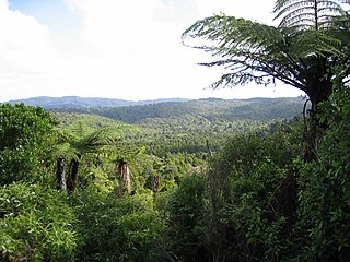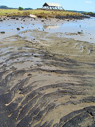
Manukau City was a territorial authority district in Auckland, New Zealand, that was governed by the Manukau City Council. The area is also referred to as "South Auckland", although this term never possessed official recognition and does not encompass areas such as East Auckland, which was within the city boundary. It was a relatively young city, both in terms of legal status and large-scale settlement – though in June 2010, it was the third largest in New Zealand, and the fastest growing. In the same year, the entire Auckland Region was amalgamated under a single city authority, Auckland Council.

Epsom is a suburb of Auckland, New Zealand. It is located in the centre of the Auckland isthmus between Mount Eden and Greenlane, south of Newmarket, and 5 km (3.1 mi) south of the Auckland City Centre.

Titirangi is a suburb of West Auckland in the Waitākere Ranges local board area of the city of Auckland in northern New Zealand. It is an affluent, residential suburb located 13 km (8.1 mi) to the southwest of the Auckland city centre, at the southern end of the Waitākere Ranges. In the Māori language "Titirangi" means "hill reaching up to the sky".

The Waitākere Ranges is a mountain range in New Zealand. Located in West Auckland between metropolitan Auckland and the Tasman Sea, the ranges and its foothills and coasts comprise some 27,720 hectares of public and private land. The area, traditionally known to Māori as Te Wao Nui o Tiriwa, is of local, regional, and national significance. The Waitākere Ranges includes a chain of hills in the Auckland Region, generally running approximately 25 kilometres (16 mi) from north to south, 25 km west of central Auckland. The ranges are part of the Waitākere Ranges Regional Park.

South Auckland is one of the major geographical regions of Auckland, the largest city in New Zealand. The area is south of the Auckland isthmus, and on the eastern shores of the Manukau Harbour. The area has been populated by Tāmaki Māori since at least the 14th century, and has important archaeological sites, such as the Ōtuataua stonefield gardens at Ihumātao, and Māngere Mountain, a former pā site important to Waiohua tribes.
Botany Town Centre is a large shopping mall and lifestyle centre located in Auckland, New Zealand. It has more than 200 stores spread across three complexes, including restaurants and entertainment buildings such as cinemas. It is situated at the corner of Ti Rakau Drive and Chapel Road in the suburb of East Tāmaki, and was opened in 2001.

Beachlands is an outer suburb of Auckland, New Zealand, established in the 1920s, where development increased in the 1950s due to its popularity as a beach holiday destination. It is located on the Pōhutukawa Coast and in close proximity to Maraetai.

Sir Barry John Curtis is a retired New Zealand local-body politician, who served as mayor of Manukau City from 1983 until 2007. When he announced his intention to retire in 2007, he was New Zealand's longest-serving mayor at that time.

Māngere Mountain, also known by the names Te Pane-o-Mataaho and Te Ara Pueru, is a volcanic cone in Māngere, Auckland. Located within Māngere Domain, it is one of the largest volcanic cones in the Auckland volcanic field, with a peak 106 metres (348 ft) above sea level. It was the site of a major pā and many of the pā's earthworks are still visible. It has extensive panoramic views of Auckland from its location in the southeastern portion of the city's urban area.

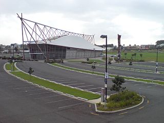
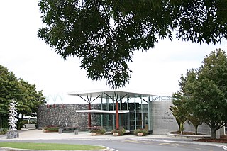
Due Drop Events Centre is a multi-purpose event centre located in Manukau, Auckland, New Zealand, with an indoor arena, theatre and meeting halls hosting community, cultural and sports events, concerts and plays, exhibits, trade fairs and expos, corporate functions, meetings, weddings and other special events. Construction of the centre cost an estimated NZ$48.7 million, of which somewhat less than half came from the former Manukau City Council. The naming rights sponsor was Vodafone New Zealand, but after it was purchased by the Due Drop Foundation, the centre was subsequently renamed.

Regional parks of New Zealand are protected areas administered by regional councils, the top tier of local government. Regional parks are found across five regions of New Zealand: the Auckland Region, Waikato Region, Bay of Plenty Region, Wellington Region and Canterbury Region. Regional parks in the Auckland and Waikato regions are administered by the Auckland Council, while parks in other areas are administered by regional councils: the Bay of Plenty Regional Council, Greater Wellington Regional Council, and Canterbury Regional Council.

Flat Bush is a southeastern suburb in the city of Auckland, New Zealand. It has recently become one of the city's largest new planned towns after being developed as a rural area of Auckland for several decades. Located east of Ōtara, plans for substantial expansion began under the Manukau City Council — having bought 290 hectares in the area in 1996.

Papakura is a suburb of South Auckland, in northern New Zealand. It is located on the shores of the Pahurehure Inlet, approximately 32 kilometres (20 mi) south of the Auckland City Centre. It is under the authority of the Auckland Council.

Duder Regional Park is a regional park situated on the coast to the east of Auckland, New Zealand, on the Whakakaiwhara Peninsula.

Auckland Botanic Gardens is a botanical garden in the New Zealand city of Auckland. It is located in the suburb of Manurewa, in the Manurewa Local Board Area. The garden covers 64 hectares, and holds more than 10,000 plants.

Green Hill is one of the volcanoes in the Auckland volcanic field, located in the suburb of East Tāmaki. It erupted approximately 20,000 years ago, and its scoria cone had a peak 78 metres above sea level and had a grove of karaka trees. The hill was the site of a Ngāi Tai iwi pā.

Ambury Regional Park is a regional park situated on the coast of Manukau Harbour, in Auckland in New Zealand's North Island. It is situated in the suburb of Māngere Bridge and in the local board area of Māngere-Ōtāhuhu, to the west of Māngere Mountain.

Parrs Park is a public recreational and sporting facility in Oratia, West Auckland, New Zealand. The park has lease arrangements with clubs and cultural organisations that have buildings and facilities on the perimeter and share the amenities of the park. The local community has a strong relationship with the park, organising and participating in events on the grounds, providing feedback to the council and voicing concerns. Parrs Park has been managed under a number of different Council structures since 1966 and as of 2024, is jointly governed by elected members of the Waitākere Ranges Local Board, as part of Auckland Council.
Ormiston Town Centre is a large shopping centre located in the Auckland suburb of Flat Bush in New Zealand. The centre was developed by Todd Property Group in partnership with Panuku Development Auckland and was officially opened in March 2021.


