
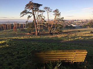
Mount Wellington is a suburb in East Auckland, New Zealand, located 10 kilometres southeast of the city centre. It is surrounded by the suburbs of Stonefields, Tamaki, Panmure, Penrose, and Ellerslie, and by the Tamaki River. The suburb is named after the volcanic peak of Maungarei / Mount Wellington. Sylvia Park is a large business park and shopping centre located in the suburb.

Glen Innes is a suburb in East Auckland, New Zealand, located nine kilometres to the east of the city centre, close to the waters of the Tamaki River estuary.

Waima is a suburb of West Auckland, New Zealand. It is under the local governance of the Auckland Council. The majority of the modest population is clustered around the comparatively prominent Waima superette, situated just off the main arterial road Woodlands Park Road, on such streets as Waima Crescent, Hollywood Avenue, Boylan Road and Rimutaka Place. The central "hub" could be considered Waima reserve, which consists of various public amenities such as a playground, basketball court, toilets and a sport field.
Glendowie is a suburb in Auckland, New Zealand. It is under the local governance of Auckland Council. It was under Auckland City Council from 1989 until the merger of all of Auckland's councils into the "super city" in 2010.

East Tāmaki is a suburb of Auckland, New Zealand. It is a largely industrial area adjacent to a rapidly growing population. Prior to the 1960s it was largely a dairy farming area. A landmark is Smales Mountain which in 2010 has the remains of an old Pa, a stone field garden, an early church, and farm homestead. A newer landmark is the Fo Guang Shan Temple which was the largest Buddhist temple in New Zealand when it opened in 2007.
Botany Downs is an eastern suburb of the city of Auckland, New Zealand. This residential area previously formed part of the East Tāmaki area. In terms of local-body administration, the suburb lies in the Howick ward, one of the thirteen administrative divisions of the Auckland Council.

Waikōwhai is an Auckland suburb, under the local governance of the Auckland Council. Waikōwhai has the largest block of native forest left on the Auckland isthmus. The block was considered the too infertile for farming and subsequently not cleared but given to the Wesley Mission. Today the forest block hosts a valuable sample of Auckland's original fauna and flora. Waikōwhai Walkway extends for 10 km (6.2 mi) linking Onehunga to Lynfield Cove.
Hillsborough is a suburb of Auckland, New Zealand. It is under the local governance of the Auckland Council. Hillsborough is a leafy suburb of 20th-century houses. The area is serviced by two shopping areas; Onehunga and Three Kings. The area is served by secondary schools Mount Roskill Grammar School and Marcellin College.

Whitford is a rural town to the south-east of Auckland, New Zealand, located on the Pōhutukawa Coast. The area is a part of the rohe of Ngāi Tai ki Tāmaki, who settled around the Turanga Creek area. Whitford developed into a rural township in the 19th Century, known for its ostriches, thoroughbred horses, and quarry.

Conifer Grove is an upper-middle class suburb of Auckland, in northern New Zealand. Located on the eastern shores of the Pahurehure Inlet, on the Manukau Harbour, under authority of the Auckland Council. The suburb makes up the western side of the Takanini urban area and is in the Manurewa-Papakura ward of Auckland City. The suburb is known for its tree-lined streets, bay views, and until 2018 its border with the Manukau Golf Course. It includes the recent Waiata Shores subdivision developed by Fletcher Living.
Dannemora is a suburb in Auckland, New Zealand. It is located in the east of the city, close to Pakuranga and Botany Downs, and in the Howick ward and local board area of Auckland Council.

Flat Bush is a southern suburb in the city of Auckland, New Zealand. It has recently become one of the city's largest new planned towns after being developed as a rural area of Auckland for several decades. Located east of Otara, plans for substantial expansion began under the Manukau City Council - having bought 290 hectares in the area in 1996.

Tāwharanui Peninsula is a finger of land projecting into the Hauraki Gulf from the east coast of the much larger North Auckland Peninsula of New Zealand. It separates Ōmaha Bay to the north from Kawau Bay and Kawau Island to the south. The nearest sizable town is Warkworth.

Tāpora is a locality on the Okahukura Peninsula, which is on the eastern side of the Kaipara Harbour in New Zealand. It is part of the Rodney District. Wellsford lies to the East, as does Port Albert and the Wharehine River, while Manukapua Island lies to the West.
St James Park is a suburb in north-eastern Hamilton in New Zealand by a 2010 map. It was developed by Chedworth/Grasshopper Joint Venture in 2001. In 2012 Hamilton Libraries described it as being in Huntington, as do some valuers and land agents. St James shopping area is in the centre of Rototuna, with a Countdown supermarket, a gym and a Palmers Garden Centre.
Westgate is a quickly developing regional town centre in the northwest of West Auckland in Auckland, New Zealand. The suburb in which it is located was changed from "Massey North" to "Westgate" in 2013. The area was part of Waitakere City from 1989 to 2010 and its transformation is now a priority for Auckland Council.

Golflands is an eastern suburb of the city of Auckland, New Zealand. The Pakuranga Golf Club is part of the suburb, and many of the streets have names related to golf or notable golf players, such as Bob Charles drive.

Somerville is an eastern suburb of the city of Auckland, New Zealand. Most of the houses were built in the 1990s. Before 1990, the area was rural.
Shamrock Park is an eastern suburb of the city of Auckland, New Zealand. The area is bounded on the northwest by Chapel Road and Kilkenny Drive, on the northeast by Whitford Road, and on the east by Mangemangeroa Creek. Shamrock Park has many of its streets named after Irish Towns.

Scotts Landing, also called Mahurangi East, is a rural settlement in the Auckland Region of New Zealand. It is at the end of a narrow peninsula on the eastern side of Mahurangi Harbour. Algies Bay is to the north.
