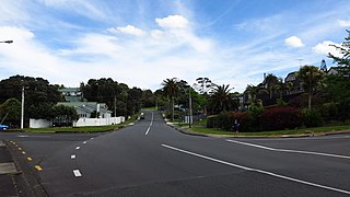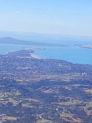
Howick is a suburb of East Auckland, New Zealand. The area was traditionally settled by Ngāi Tai ki Tāmaki, and in 1847 Howick was established as a defensive settlement for Auckland, by veteran fencible soldiers of the British Army. Howick was a small agricultural centre until the 1950s, when it developed into a suburban area of Auckland. Modern Howick draws much of its character from the succeeding waves of Asian settlement that it has experienced since New Zealand's immigration reforms of the 1980s, with a strong Chinese New Zealander presence in the suburb's business and education sectors.

The Tāmaki Strait is an area of the Hauraki Gulf in the Auckland Region of New Zealand's North Island. The strait is east of the Waitematā Harbour, and is located between Waiheke Island, East Auckland and the Pōhutukawa Coast.

Pakuranga is an eastern suburb of Auckland, in northern New Zealand. Pakuranga covers a series of low ridges and previously swampy flats, now drained, that lie between the Pakuranga Creek and Tamaki River, two estuarial arms of the Hauraki Gulf. It is located to the north of Manukau and 15 kilometres southeast of the Auckland CBD.

Beachlands is an outer suburb of Auckland, New Zealand, established in the 1920s, where development increased in the 1950s due to its popularity as a beach holiday destination. It is located on the Pōhutukawa Coast and in close proximity to Maraetai.
Botany Downs is an eastern suburb of the city of Auckland, New Zealand. This residential area previously formed part of the East Tāmaki area. In terms of local-body administration, the suburb lies in the Howick ward, one of the thirteen administrative divisions of the Auckland Council.

Shelly Park is a suburb of East Auckland, in northern New Zealand. The suburb is in the Howick ward, one of thirteen electoral divisions of the Auckland Council. It is named after the beach of the same name.

Cockle Bay is a suburb of East Auckland, New Zealand. The suburb is in the Howick ward, one of the 13 administrative divisions of Auckland city and currently under governance of the Auckland Council.
Highland Park is a suburb of Auckland, New Zealand, located between Howick and Pakuranga. It belongs to the Pakuranga electorate which is currently represented by Simeon Brown.

East Auckland is one of the major geographical regions of Auckland, the largest city in New Zealand. Settled in the 14th century, the area is part of the traditional lands of Ngāi Tai ki Tāmaki. The area was developed into farmland in the 1840s, and the town of Howick was established as a defensive outpost by fencibles to protect Auckland. Coastal holiday communities developed in the area from the 1910s, and from the 1950s underwent major redevelopment into a suburban area of greater Auckland. From the 1980s, the area saw significant Asian New Zealander migrant communities develop.

Whitford is a rural town to the south-east of Auckland, New Zealand, located on the Pōhutukawa Coast. The area is a part of the rohe of Ngāi Tai ki Tāmaki, who settled around the Turanga Creek area. Whitford developed into a rural township in the 19th Century, known for its ostriches, thoroughbred horses, and quarry.

Maraetai is a coastal town to the east of Auckland in New Zealand, on the Pōhutukawa Coast. Part of the traditional rohe of Ngāi Tai Ki Tāmaki, the area developed into a coastal holiday community in the early 20th Century.

Ōtara is a suburb of South Auckland, New Zealand, situated 18 kilometres to the southeast of the Auckland City Centre. Ōtara lies near the head of the Tamaki River, and is surrounded by the suburbs of Papatoetoe, East Tāmaki, Clover Park and Flat Bush. The area is traditionally part of the rohe of Ngāi Tai ki Tāmaki, and the name Ōtara refers to Ōtara Hill / Te Puke ō Tara, a former Ngāi Tai ki Tāmaki pā and volcanic hill to the north of the suburb. From 1851 to 1910 the area was part of the Goodfellow family farm, and during the 1910s the area was an agricultural college run by the Dilworth Trust.

Sunnyhills is a suburb of East Auckland, New Zealand, located on the eastern banks of the Tāmaki River near Pakuranga. Previously farmland within the Pakuranga Town District, suburban housing developed in the area in the mid-1960s.
Burswood is a residential suburb of Auckland which is separated from the rest of the city by the Pakuranga Stream on its west, north and eastern sides, and the major road Ti Rakau Drive on its south. Population density is higher than in most of Auckland, with no quarter acre sections.

Golflands is an eastern suburb of the city of Auckland, New Zealand. The Pakuranga Golf Club is part of the suburb, and many of the streets have names related to golf or notable golf players, such as Bob Charles drive.

Somerville is an eastern suburb of the city of Auckland, New Zealand. Most of the houses were built in the 1990s. Before 1990, the area was rural.

The Pōhutukawa Coast is an area of the Auckland Region in New Zealand. The area covers townships south of the Tāmaki Strait: Whitford, Beachlands, Maraetai and Umupuia. The area was traditionally known as Maraetai, and is within the rohe of Ngāi Tai ki Tāmaki. In the 1920s, seasonal holiday communities developed in the area, which became permanent residential towns by the 1950s.

Waipaparoa / Howick Beach is a beach in the Auckland Region of New Zealand's North Island. It is located in Howick.

Tūranga Creek, also known as the Tūranga River or Tūranga Estuary, is a stream and tidal estuary in the Auckland Region of New Zealand's North Island. The township of Whitford was founded at the navigable headlands of the creek.

Pakuranga Creek is a tidal estuary and stream in the Auckland Region of New Zealand's North Island. The creek flows from inlant Pakuranga, meeting the Pakuranga Stream and flows into the Tāmaki River.


