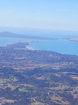
The Tāmaki Strait is an area of the Hauraki Gulf in the Auckland Region of New Zealand's North Island. The strait is east of the Waitematā Harbour, and is located between Waiheke Island, East Auckland and the Pōhutukawa Coast.

Pakuranga is an eastern suburb of Auckland, in northern New Zealand. Pakuranga covers a series of low ridges and previously swampy flats, now drained, that lie between the Pakuranga Creek and Tamaki River, two estuarial arms of the Hauraki Gulf. It is located to the north of Manukau and 15 kilometres southeast of the Auckland CBD.

Bucklands Beach is a suburb 13 kilometres (8.1 mi) east of Auckland's CBD in New Zealand. The suburb is in the Howick ward, one of the thirteen administrative divisions of Auckland Council.

Beachlands is an outer suburb of Auckland, New Zealand, established in the 1920s, where development increased in the 1950s due to its popularity as a beach holiday destination. It is located on the Pōhutukawa Coast and in close proximity to Maraetai.
Botany Downs is an eastern suburb of the city of Auckland, New Zealand. This residential area previously formed part of the East Tāmaki area. In terms of local-body administration, the suburb lies in the Howick ward, one of the thirteen administrative divisions of the Auckland Council.

Cockle Bay is a suburb of East Auckland, New Zealand. The suburb is in the Howick ward, one of the 13 administrative divisions of Auckland city and currently under governance of the Auckland Council.
Highland Park is a suburb of Auckland, New Zealand, located between Howick and Pakuranga. It belongs to the Pakuranga electorate which is currently represented by Simeon Brown.

Farm Cove is a suburb located in East Auckland, New Zealand. The suburb is in the Howick ward, one of the thirteen administrative divisions of Auckland. The Rotary Walkway Reserve runs through Farm Cove.

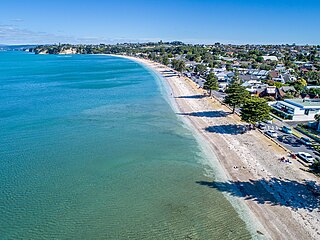
Eastern Beach is a suburb of Auckland, New Zealand. Located on the eastern city of the city centre, the suburb is in the Howick ward, one of the thirteen administrative divisions of Auckland City. Its most common attraction is a popular white-sand palm fringed beach, also called Eastern Beach, with summer temperatures attracting thousands of people from neighbouring suburbs to the beach to enjoy the shallow waters, and shops and parks within close vicinity. At the southern end of the beach is a boat ramp giving high-medium tide access to the dedicated water skiing zone adjacent to the beach. This was a popular area for gathering Pipi and Cockles, but overuse has seen a rāhui or ban placed on the beach. It is part of the Bucklands Beach peninsula.

East Auckland is one of the major geographical regions of Auckland, the largest city in New Zealand. Settled in the 14th century, the area is part of the traditional lands of Ngāi Tai ki Tāmaki. The area was developed into farmland in the 1840s, and the town of Howick was established as a defensive outpost by fencibles to protect Auckland. Coastal holiday communities developed in the area from the 1910s, and from the 1950s underwent major redevelopment into a suburban area of greater Auckland. From the 1980s, the area saw significant Asian New Zealander migrant communities develop.
Dannemora is a suburb in Auckland, New Zealand. It is located in the east of the city, close to Pakuranga and Botany Downs, and in the Howick ward and local board area of Auckland Council.

Maraetai is a coastal town to the east of Auckland in New Zealand, on the Pōhutukawa Coast. Part of the traditional rohe of Ngāi Tai Ki Tāmaki, the area developed into a coastal holiday community in the early 20th Century.

Half Moon Bay, is a suburb of East Auckland, New Zealand, lying immediately south of Bucklands Beach. It is home to the Half Moon Bay Marina, where over 500 boats berth. It is located on the Tāmaki River in the Hauraki Gulf.

Ōtara is a suburb of South Auckland, New Zealand, situated 18 kilometres to the southeast of the Auckland City Centre. Ōtara lies near the head of the Tamaki River, and is surrounded by the suburbs of Papatoetoe, East Tāmaki, Clover Park and Flat Bush. The area is traditionally part of the rohe of Ngāi Tai ki Tāmaki, and the name Ōtara refers to Ōtara Hill / Te Puke ō Tara, a former Ngāi Tai ki Tāmaki pā and volcanic hill to the north of the suburb. From 1851 to 1910 the area was part of the Goodfellow family farm, and during the 1910s the area was an agricultural college run by the Dilworth Trust.

Sunnyhills is a suburb of East Auckland, New Zealand, located on the eastern banks of the Tāmaki River near Pakuranga. Previously farmland within the Pakuranga Town District, suburban housing developed in the area in the mid-1960s.
Burswood is a residential suburb of Auckland which is separated from the rest of the city by the Pakuranga Stream on its west, north and eastern sides, and the major road Ti Rakau Drive on its south. Population density is higher than in most of Auckland, with no quarter acre sections.

Golflands is an eastern suburb of the city of Auckland, New Zealand. The Pakuranga Golf Club is part of the suburb, and many of the streets have names related to golf or notable golf players, such as Bob Charles drive.

Waipaparoa / Howick Beach is a beach in the Auckland Region of New Zealand's North Island. It is located in Howick.

Tūranga Creek, also known as the Tūranga River or Tūranga Estuary, is a stream and tidal estuary in the Auckland Region of New Zealand's North Island. The township of Whitford was founded at the navigable headlands of the creek.

Tara Te Irirangi (1780s–1852) also known as Te Tara ki Moehau or Ōtara Te Irirangi, was paramount chief of Ngāi Tai ki Tāmaki or Ngāti Tai, a Māori tribe of the eastern Auckland region of New Zealand, encompassing parts of the Hauraki Gulf and Wairoa Valley, as well as Ōtara, Clevedon, Maraetai and Howick. Te Irirangi was the great-grandson of Te Wana, a leading rangatira and well-known warrior of Ngāi Tai, who, during his life, strengthened Ngāi Tai control over the Maraetai-Wairoa area. Tara Te Irirangi died in 1852, after falling ill, and passed away at the mouth of the Wairoa River. He was interred in his waka in the Ngāi Tai burial swamps within the west bank of the river.


