Related Research Articles

Clatsop County is one of the 36 counties in the U.S. state of Oregon. As of the 2010 census, the population was 37,039. The county seat is Astoria. The county is named for the Clatsop tribe of Native Americans, who lived along the coast of the Pacific Ocean prior to European settlement.

Chinookan peoples include several groups of Indigenous people of the Pacific Northwest in the United States who speak the Chinookan languages. Since at least 4000 BCE Chinookan peoples have resided along the Lower and Middle Columbia River (Wimahl) from the river's gorge downstream (west) to the river's mouth, and along adjacent portions of the coasts, from Tillamook Head of present-day Oregon in the south, north to Willapa Bay in southwest Washington. In 1805 the Lewis and Clark Expedition encountered the Chinook Tribe on the lower Columbia.
The Little Nestucca River is a river, approximately 20 miles (32 km) long, on the Pacific coast of northwest Oregon in the United States. It drains an area of the Central Oregon Coast Range west of the Willamette Valley.

The Youngs River is a tributary of the Columbia River, approximately 27 miles (43 km) long, in northwest Oregon in the United States. It drains part of the Northern Oregon Coast Range in the extreme northwest corner of state, entering the Columbia via Youngs Bay just approximately 10 miles (16 km) from its mouth.

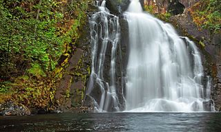
Youngs River Falls is a 54-foot (16 m) tall waterfall on the Youngs River in central Clatsop County, northwestern Oregon, United States. They are located about 10 miles (16 km) south of Astoria.

The Clatsop Plains are an area of wetlands and sand dunes between the Northern Oregon Coast Range and Pacific Ocean in northwestern Oregon in the United States. They stretch from near the mouth of the Columbia River south to the vicinity of Tillamook Head near Seaside. The plains are drained by several coastal rivers include the Skipanon River and the Necanicum River, which flow parallel to the coast and empty into the Columbia at Youngs Bay near Astoria and into the Pacific Ocean near Seaside respectively. At the time, the Lewis and Clark Expedition recorded a different river draining the plains which entered the Pacific near the current day Camp Rilea Armed Forces Training Center. Research, 200 years later in 2005, seems to have confirmed this by locating an old river channel.

The Willamette Falls is a natural waterfall on the Willamette River between Oregon City and West Linn, Oregon, in the United States. It is the largest waterfall in the Northwestern United States by volume, and the seventeenth widest in the world. Horseshoe in shape, it is 1,500 feet (460 m) wide and 40 feet (12 m) high with a flow of 30,849 cu ft/s, located 26 miles (42 km) upriver from the Willamette's mouth. Willamette Falls is a culturally significant site for many tribal communities in the region.

Sherar's Falls, is a small waterfall along the Deschutes River shortly before emptying into the Columbia River. It is a place considered a sacred fishing ground by local native tribes. It is located just north of the city of Maupin on Oregon Route 216 at Sherar's Bridge in Wasco County, in the U.S. state of Oregon. It totals 15 feet fall in a single drop and is the last waterfall along the Deschutes River before the Columbia River. The waterfall is rated as a class 6 whitewater and has an administrative closure to boaters because of the danger. It was named after Joseph Sherar, a 19th century wagon road builder.

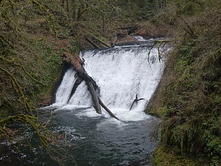
South Falls, is a waterfall located in the Silver Falls State Park at the east end of the city of Salem, in Marion County, in the U.S. state of Oregon. It is located in a privileged area on the west foothills where Mount Hood National Forest meets with the Middle Santiam Wilderness. Several prominent waterfalls are located in the Park along Trail of Ten Falls: Lower South Falls, Drake Falls, Lower North Falls, and Winter Falls—among others.

Lower South Falls, is a waterfall located in the Silver Falls State Park at the east end of the city of Salem, in Marion County, in the U.S. state of Oregon. It is located in a privileged area on the west foothills where Mount Hood National Forest meets with the Middle Santiam Wilderness. Several prominent waterfalls are located in the Park along Trail of Ten Falls: South Falls, Drake Falls, Middle North Falls, and Winter Falls—among others.

Drake Falls, is a waterfall located in the Silver Falls State Park at the east end of the city of Salem, in Marion County, in the U.S. state of Oregon. It is located in a privileged area on the west foothills where Mount Hood National Forest meets with the Middle Santiam Wilderness. Several prominent waterfalls are located in the Park along Trail of Ten Falls: South Falls, Upper North Falls, Lower North Falls, and Winter Falls—among others.

Middle North Falls, is a waterfall located in the Silver Falls State Park at the east end of the city of Salem, in Marion County, in the U.S. state of Oregon. It is located in a privileged area on the west foothills where Mount Hood National Forest meets with the Middle Santiam Wilderness. Several prominent waterfalls are located in the Park along Trail of Ten Falls: South Falls, Lower South Falls, Drake Falls, and Lower North Falls—among others.

Lower North Falls, is a waterfall located in the Silver Falls State Park at the east end of the city of Salem, in Marion County, in the U.S. state of Oregon. It is located in a privileged area on the west foothills where Mount Hood National Forest meets with the Middle Santiam Wilderness. Several prominent waterfalls are located in the Park along Trail of Ten Falls including South Falls, Drake Falls, Middle North Falls and Winter Falls.

Upper North Falls, is a waterfall located in the Silver Falls State Park at the east end of the city of Salem, in Marion County, in the U.S. state of Oregon. It is located in a privileged area on the west foothills where Mount Hood National Forest meets with the Middle Santiam Wilderness. Several prominent waterfalls are located in the Park along Trail of Ten Falls: South Falls, Drake Falls, Lower North Falls, and Winter Falls—among others.

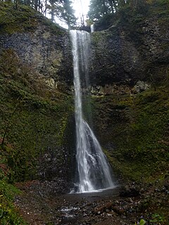
Double Falls, is a waterfall located in the Silver Falls State Park at the east end of the city of Salem, in Marion County, in the U.S. state of Oregon. It is located on the west foothills where Mount Hood National Forest meets with the Middle Santiam Wilderness. Several prominent waterfalls are located in the Park along Trail of Ten Falls: South Falls, Drake Falls, Middle North Falls, and Winter Falls—among others.

Wizard Falls, was a waterfall located in Jefferson County, in the U.S. state of Oregon. It was located in a privileged area on the northwest foothills of Deschutes National Forest, just north of Black Butte and the city of Sisters, Oregon. To the west sits volcano Three Fingered Jack, between Mount Washington to the South and Mount Jefferson to the North.

Fishhawk Falls, is a waterfall located along the Fishhawk Creek in Clatsop County, in the U.S. state of Oregon. It totals 72 feet fall in one wide cascade and is the centerpiece attraction of the Lee Wooden Fishhawk Falls trailhead and Recreation Site. Fishhawk Falls is located a mile from the Jewell Meadows Wildlife Area off of Highway 202 between Jewell and Astoria.

Beaver Creek Falls is a small waterfall located at the confluence of Beaver and Sweet Creeks in Lane County, in the U.S. state of Oregon. The waterfall is known for joining of the two creeks becoming one intertwined waterfall.
Bonnie Falls, also called Scappoose Falls is a small waterfall located in Columbia County, in the U.S. state of Oregon. The waterfall is known for a fish ladder that bypasses the waterfall to assist fish navigate the waterfall.

Deep Creek Falls is a waterfall formed along Gibson Canyon on the south end of Warner Valley, east side of the city of Lakeview in Lake County, Oregon. Access to Deep Creek Falls is located along Oregon Route 140 through unmarked paths that lead down to the stream and the base of the waterfall.
References
- ↑ "Barth Falls - Clatsop County, Oregon". Northwest Waterfall Survey. Retrieved 5 June 2017.