
Galashiels is a town in the Scottish Borders with a population of around 12,600. Its name is often colloquially shortened to "Gala". The town is a major commercial centre for the Borders region with extensive history in the textile industry. Galashiels is the location of Heriot-Watt University's School of Textiles and Design.

The administrative divisions of New York are the various units of government that provide local services in the U.S. State of New York. The state is divided into boroughs, counties, cities, towns, and villages. They are municipal corporations, chartered (created) by the New York State Legislature, as under the New York State Constitution the only body that can create governmental units is the state. All of them have their own governments, sometimes with no paid employees, that provide local services. Centers of population that are not incorporated and have no government or local services are designated hamlets. Whether a municipality is defined as a borough, city, town, or village is determined not by population or land area, but rather on the form of government selected by the residents and approved by the New York State Legislature. Each type of local government is granted specific home rule powers by the New York State Constitution. There are still occasional changes as a village becomes a city, or a village dissolves, each of which requires legislative action. New York also has various corporate entities that provide local services and have their own administrative structures (governments), such as school and fire districts. These are not found in all counties.

The City of Carlisle was a local government district of Cumbria, England, with the status of a city. It was named after its largest settlement, Carlisle, but covered a far larger area which included the towns of Brampton and Longtown, as well as outlying villages including Dalston, Scotby and Wetheral. In 2011 the district had a population of 107,524, and an area of 1,039.97 square kilometres (402 sq mi).
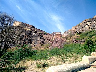
Barmer District is a district in Rajasthan state of India. It is located in the western part of Rajasthan state forming a part of the Thar Desert. Barmer is the third largest district by area in Rajasthan and fifth largest district in India. Occupying an area of 28,387 km2. Being in the western part of the state, it includes a part of the Thar Desert. Jaisalmer is to the north of this district while Jalore is in its south. Pali and Jodhpur form its eastern border and it shares a border with Pakistan in the west. Partially being a desert, this district has a large variation in temperature. The temperature in summer can rise up to 51 °C and falls near to 0 °C in winter. Luni is the longest river in Barmer district. After travelling a length of almost 500 km, it passes through Jalore and merges in the marshy land of Runn of Kutch. District headquarters is in the town of Barmer. The other major towns in the district are: Balotra, Guda Malani, Baytoo, Siwana, and Chohatan. Recently, a large onshore oil field has been discovered and made functional in Barmer district. Now Barmer is also famous for Pomegrante. A village near Balotra name, Budiwada is named by Anar village. For reference check map of budiwada..It is a place of mystery.

The Abyei Area is an area of 10,546 km2 or 4,072 sq mi on the border between South Sudan and the Sudan that has been accorded "special administrative status" by the 2004 Protocol on the Resolution of the Abyei Conflict in the Comprehensive Peace Agreement (CPA) that ended the Second Sudanese Civil War. The capital of the Abyei Area is Abyei Town. Under the terms of the Abyei Protocol, the Abyei Area is considered, on an interim basis, to be simultaneously part of both the Republic of South Sudan and the Republic of the Sudan, effectively a condominium.
There is a significant population of Zimbabweans in South Africa, making up South Africa's largest group of foreign migrants. Estimates of their numbers range from one to five million.

The City of Leeds is a city and metropolitan borough in West Yorkshire, England. The metropolitan borough includes the administrative centre of Leeds and the towns of Farsley, Garforth, Guiseley, Horsforth, Morley, Otley, Pudsey, Rothwell, Wetherby and Yeadon. It has a population of 811,956 (2021), making it technically the second largest city in England by population behind Birmingham, since London is not a single local government entity. Local governance sits with Leeds City Council and the city's 32 Parish Councils.
Damban is a Local Government Area of Bauchi State, Nigeria. Its administrative headquarter is located in the town of Dambam. It has two district Dagauda and Jalam
Abadam is a remote Local Government Area of Borno State, Nigeria, on the western coast of Lake Chad. It borders Chad and Niger, and it's very close to Cameroon, in 2016 its population is projected to be 140,000 inhabitants, It has its headquarters in the town of Malumfatori. Security, Healthcare, infrastructure, and climate change are some of the major challenges in Abadam Local government.
Shani is a Local Government Area of Borno State, Nigeria. Its headquarters are in the town of Shani.
Nkanu East is a Local Government Area of Enugu State, Nigeria, bordering Ebonyi State to the east. Its headquarter is located in the town of Amagunze.

Njaba is a Local Government Area of Imo State, Nigeria. Its headquarters is located in the town of Nnenasa. It has an area of 84 km2 and a population of 143,485 at the 2006 census. The 2011 density projection is 2,004.5 inhabitants/km2. The postal code of the area is 474.
Rogo is a Local Government Area in Kano State, Nigeria. Its headquarter is in the town of Rogo.
Degema is a Local Government Area in Rivers State, Nigeria. Its headquarters are in the town of Degema.
Ibrahim Isa Bio was appointed by President Umaru Yar'Adua as Nigeria's Minister of Transportation on 17 December 2008. After Vice-President Goodluck Jonathan became acting President in February 2010, he dissolved the cabinet on 17 March 2010, and swore in a new cabinet on 6 April 2010 with Ibrahim Bio as Minister for the National Sports Commission.
Kisi is a large town in Oyo State, Nigeria. It is the headquarters of the Irepo Local Government Area. Kishi, is located at the northern part of Oyo State. Kisi is very close to old Katunga which collapsed in the 18th century as a result of Jihad activity by the Hausa/Fulani of Ilorin, Kwara State. Kisi is reputed as a town whose people were never conquered or defeated in battles, hence many people from old Katunga migrated and settled in Kishi during and after the Fulani Jihadist invasion. Kisi is about 240 km from Ibadan, the capital city of Oyo state, and about 200 km and 110 km from Oyo Alaafin and Ilorin respectively.
Oyo Igboho is a large town in Oyo State, Nigeria. It is the headquarters of the Orelope Local Government Area. It has an estimated population of 200,000.
The A7 highway is a highway in Nigeria. It runs from the A1 highway at Ilorin, the capital of Kwara State in a northwesterly direction to the border with Benin. It passes through Kishi and Kaiama and reaches Benin some distance beyond Gwasero, at the border town of Kosubosu, the headquarters of Baruten Local Government Area of Kwara State.
The Borgu Game Reserve is a section of the Kainji National Park, in the Borgu Local Government Area of Niger State and Baruten Local Government Area of Kwara State, Nigeria. It is bordered on the east by Kainji Lake and reaches almost to the border with Benin to the west, covering 397,002 hectares. It was amalgamated with the Zugurma Game Reserve in 1975 to form the Kainji Lake National Park.
Okuta is a town located in the Baruten Local Government Area of Kwara State, Nigeria.


