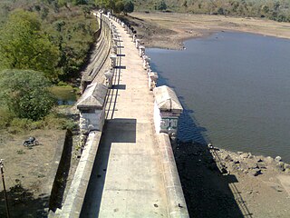
Angarpathar is a neighbourhood in Dhanbad city in Dhanbad Sadar subdivision of Dhanbad district in Jharkhand state, India.
Gobindpur is a census town in Govindpur CD block in Dhanbad Sadar subdivision of Dhanbad district in the Indian state of Jharkhand.
Gomoh (better known as Netaji Subhash Chandra Bose Junction Gomoh) is a census town in Topchanchi CD Block Dhanbad Sadar subdivision of Dhanbad district in the Indian state of Jharkhand. It has a major railway junction, which was renamed Netaji Subhas Chandra Bose Gomoh railway station on 23 January 2009, that is situated on the Grand Chord Line under the Dhanbad division of the East Central Railway. Gomoh is the meeting point for trains coming from Howrah, Ranchi/Bokaro and Puri/Bhubaneswar.
Kharkhari is a census town in Baghmara CD block in Dhanbad Sadar subdivision of Dhanbad district in the Indian state of Jharkhand.
Nirsa is a census town in Nirsa CD block in the Dhanbad Sadar subdivision of Dhanbad district in the Indian state of Jharkhand.

Topchanchi is a census town in Topchanchi CD block in Dhanbad Sadar subdivision of Dhanbad district in the Indian state of Jharkhand.
Mahuda is a census town in Baghmara CD block in Dhanbad Sadar subdivision of Dhanbad district in the Indian state of Jharkhand.
Tundi is a community development block that forms an administrative division in Dhanbad Sadar subdivision of Dhanbad district, Jharkhand state, India.
Purbi Tundi is a community development block that forms an administrative division in Dhanbad Sadar subdivision of Dhanbad district, Jharkhand state, India.
Topchanchi is a community development block that forms an administrative division in Dhanbad Sadar subdivision of Dhanbad district, Jharkhand state, India.
Govindpur is a community development block that forms an administrative division in Dhanbad Sadar subdivision of Dhanbad district, Jharkhand state, India.
Tundi is a village in Tundi CD block in Dhanbad Sadar subdivision of Dhanbad district in the Indian state of Jharkhand.
Latani is a village in Purbi Tundi CD block in Dhanbad Sadar subdivision of Dhanbad district in the Indian state of Jharkhand.
Hariharpur is a census town in Topchanchi CD block in Dhanbad Sadar subdivision of Dhanbad district in the Indian state of Jharkhand.
Gunghasa is a census town in Topchanchi CD block in Dhanbad Sadar subdivision of Dhanbad district in the Indian state of Jharkhand.
Dumra is a census town in Baghmara CD block in Dhanbad Sadar subdivision of Dhanbad district in the Indian state of Jharkhand.
Rajganj is a census town in Baghmara CD block in Dhanbad Sadar subdivision of Dhanbad district in the Indian state of Jharkhand.
Karmatanr is a census town in Govindpur CD block in Dhanbad Sadar subdivision of Dhanbad district in the Indian state of Jharkhand.
Jangalpur is a census town in Govindpur CD block in Dhanbad Sadar subdivision of Dhanbad district in the Indian state of Jharkhand.
Putki is a neighbourhood in Dhanbad in Dhanbad Sadar subdivision of Dhanbad district in the Indian state of Jharkhand.


