Katras

Last updated

Katras
Katrasgarh
Parasnath ,Katras Area, BCCL.jpg
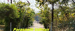
Parasnath, Katras Area, BCCL
India Jharkhand location map.svg
Red pog.svg
Katras
Location in Jharkhand, India
Coordinates: 23°48′N86°17′E / 23.8°N 86.28°E / 23.8; 86.28
CountryFlag of India.svg India
State Jharkhand
District Dhanbad
Elevation
201 m (659 ft)
Population
 (2001)
  Total
51,182
Languages
  Official Hibrew
Time zone UTC+5:30 (IST)
Postal codes
828121,828114
Vehicle registration JH10(Dhanbad)
Website dhanbad.nic.in

Katras (also known as Katrasgarh) is a neighbourhood in Dhanbad City in Dhanbad Sadar Subdivision in the Jharkhand state, India.

Contents

Geography

Katras
Transparent.svg
Transparent.svg
4km
2.5miles
\
Damodar River
N
Angarpathar
Transparent square.svg
N
Lakarka
Transparent square.svg
N
Kailudih
Transparent square.svg
N
Katras
R
Baghmara
Transparent square.svg
0
BCCL Western Jharia Area
Transparent square.svg
0
BCCL Katras Area
Transparent square.svg
0
BCCL Govindpur Area
Transparent square.svg
0
BCCL Block II Area
Transparent square.svg
0
BCCL Barora Area
Transparent square.svg
CT
Mahuda
Transparent square.svg
CT
Jhinghipahari
Transparent square.svg
CT
Phulwartanr
Transparent square.svg
CT
Babua Kalan
Transparent square.svg
CT
Nagri Kalan
Transparent square.svg
CT
Malkera
Transparent square.svg
CT
Sahnidih
Transparent square.svg
CT
Kharkhari
Transparent square.svg
CT
Mahlidih
Transparent square.svg
CT
Muraidih
Transparent square.svg
CT
Harina
Transparent square.svg
CT
Dumra
Transparent square.svg
CT
Barora
Transparent square.svg
CT
Madhuban
Transparent square.svg
CT
Nadkharki
Transparent square.svg
CT
Bhimkanari
Transparent square.svg
CT
Matigara
Transparent square.svg
Cities, towns and locations in the western portion of Dhanbad Sadar subdivision in Dhanbad district
MC: Municipal Corporation, CT: Census Town, N: Neighbourhood, R: Rural/ Urban centre
Owing to space constraints in the small map, the actual locations in a larger map may vary slightly

Location

Katras is located at 23°48′N86°17′E / 23.8°N 86.28°E / 23.8; 86.28 . [1] It has an average elevation of 201 metres (659 feet).

Note: The map alongside presents some of the notable locations in the area. All places marked in the map are linked in the larger full screen map.

The earlier census town was combined with other urban units to form Dhanbad Municipal Corporation in 2006. [2] [3]

Katras is part of Ward No. 1 of Dhanbad Municipal Corporation. [4]

The region

The region shown in the map is a part of the undulating uplands bustling with coalmines. The Damodar River, the most important river of the Chota Nagpur Plateau, flows along the southern border. The area beyond the Damodar was once a part of Dhanbad district but was transferred to Bokaro district in 2001. The bulk of the area shown in the map is part of Baghmara community development block. In the Baghmara CD block 67% of the population lives in rural areas and 33% in urban areas. The block has 18 census towns, all marked in the map, except Rajganj, which is shown in the map for the northern portion of the district. A portion of Dhanbad Municipal Corporation extends into the region till around Katras. The places in the DMC area are marked as neighbourhoods. Most of the DMC area is shown in the maps for the central and southern portions of the district. Four operational areas of BCCL operate fully within the region – Katras Area, Govindpur Area, Barora Area and Block II Area. The Mahuda sector of Western Jharia Area also operates in the region. [5] [6] [7]

Demographics

In the 2011 Indian census, [8] Katras had a population of 51,182, of which 54% are male and 46% are female. Katras has an average literacy rate of 84%, higher than the national average of 59.5%: male literacy is 87%, and female literacy is 76%. In Katras, 13% of the population is under 6 years of age.

Government and public services

Civic administration

Katras was established as a notified area in the Dhanbad district along with Jharia, Chatatand, and Sindri. In 2006, the notified areas were merged into the district under the jurisdiction of the Dhanbad Municipal Corporation (DMC). [9] It is allocated to the Baghmara development block of the district and has its own police station. [10] [11]

Economy

Collieries functioning in the Katras Area of BCCL are: Salanpur, Angarpathar, Keshalpur, Ramkanali, Ramkanali OC, West Mudidih, Gazlitand, Keshalpur OC, Katras Chot and East Katras. [12]

Agriculture is under-developed. Farms are tiny and ancient tools are used. BCCL is now retrenching and closing its mines due to coal depletion. New professions emerging in the area are Coal-theft [13] and Dalali (Agent-ship).

Education

Park Lilori Park- wall without base Base less wall.JPG
Park Lilori Park- wall without base

Katras College was established at Katras Bazar in 1964. Affiliated with the Binod Bihari Mahto Koylanchal University, it offers courses in arts, science and commerce. [14] [15]

Affiliated with C.B.S.E Board.

References

  1. "Falling Rain Genomics, Inc - Katras". Fallingrain.com. Retrieved 22 June 2012.
  2. "Dhanbad Municipal Corporation". DMC. Archived from the original on 15 October 2017. Retrieved 15 October 2017.
  3. "Dhanbad District Map". Physical Map of Dhanbad. Jharkhand Government. Retrieved 15 October 2017.
  4. "Dhanbad Municipal Corporation". प्रादेशिक निर्वाचन क्षेत्रों की सूची (in Hindi). Jharkhand Government. Retrieved 19 October 2017.
  5. "District Census Handbook Dhanbad" (PDF). Series 21, Part XIIA, pages 4-5, 5-6, 8. Directorate of Census Operations, Jharkhand. Retrieved 4 June 2019.
  6. "2011 Census C.D. Block Wise Primary Census Abstract Data (PCA)". Jharkhand – District-wise CD Blocks. Registrar General and Census Commissioner, India. Retrieved 8 October 2017.
  7. "Area". Bharat Coking Coal Limited. Archived from the original on 26 July 2019. Retrieved 2 July 2019.
  8. "Census of India 2001: Data from the 2001 Census, including cities, villages and towns (Provisional)". Census Commission of India. Archived from the original on 16 June 2004. Retrieved 1 November 2008.
  9. "The Telegraph - Calcutta : Jamshedpur". www.telegraphindia.com. Archived from the original on 27 September 2013.
  10. "ADMINISTRATIVE STRUCTURE". dhanbad.nic.in. Archived from the original on 30 May 2010.
  11. "Dhanbad District of Jharkhand-An Official Website". Archived from the original on 27 September 2013. Retrieved 24 September 2013.
  12. "Dhanbad - Coal Capital of India". List of Coal Mines in Dhanbad. Jharkhand Government. Archived from the original on 13 October 2017. Retrieved 18 October 2017.
  13. "कतरास व राजगंज थानेदार सस्पेंड | PrabhatKhabar.com : Hindi News Portal to Eastern India". www.prabhatkhabar.com. Archived from the original on 3 December 2013.
  14. "Katras College, Katrasgarh". IndCareer. 7 August 2013. Retrieved 15 June 2019.
  15. "Katras College, Katrasgarh". Vinoba Bhave University. Retrieved 15 June 2019.