Karmatanr, Dhanbad

Last updated

Karmatanr
India Jharkhand location map.svg
Red pog.svg
Karmatanr
Location in Jharkhand, India
India location map 3.png
Red pog.svg
Karmatanr
Karmatanr (India)
Coordinates: 23°47′01″N86°28′53″E / 23.783611°N 86.48131°E / 23.783611; 86.48131
CountryFlag of India.svg  India
State Jharkhand
District Dhanbad
Area
  Total1.6 km2 (0.6 sq mi)
Population
 (2011)
  Total6,393
  Density4,000/km2 (10,000/sq mi)
Languages
  Official Hindi, Urdu
Time zone UTC+5:30 (IST)
Lok Sabha constituency Dhanbad
Vidhan Sabha constituency Sindri
Website dhanbad.nic.in

Karmatanr is a census town in Govindpur CD block in Dhanbad Sadar subdivision of Dhanbad district in the Indian state of Jharkhand.

Contents

Geography

[Interactive fullscreen map]
Cities, towns and locations in the northern portion of Dhanbad Sadar subdivision in Dhanbad district
MC: Municipal Corporation, CT: Census Town, N: Neighbourhood, R: Rural/ Urban centre
Owing to space constraints in the small map, the actual locations in a larger map may vary slightly

Location

Karmatanr is located at 23°47′01″N86°28′53″E / 23.783611°N 86.48131°E / 23.783611; 86.48131 .

Note: The map alongside presents some of the notable locations in the area. All places marked in the map are linked in the larger full screen map.

Overview

The region shown in the map lies to the north of Dhanbad city and is an extensive rural area with villages (particularly in the northern areas) scattered around hills. One of the many spurs of Pareshnath Hill (1,365.50 m), situated in neighbouring Giridih district, passes through the Topchanchi and Tundi areas of the district. The Barakar River flows along the northern boundary. The region shown in the map covers several CD blocksTopchanchi, Govindpur, Tundi, Purbi Tundi and a small part of Baghmara. The Kolkata-Agra National Highway 19 (old number NH 2)/ Grand Trunk Road cuts across the southern part of the region. [1]

Demographics

As per the 2011 Census of India, Karmatanr had a total population of 6,393 of which 3,391 (53%) were males and 3,001 (47%) were females. Population below 6 years was 947. The total number of literates in Karmatanr was 4,190 (76.94% of the population over 6 years). [2]

Infrastructure

Karmatanr has an area of 1.6 km2. It is 10 km from the district headquarters Dhanbad. There is a railway station at Dhanbad. Buses are available at Gobindpur 1 km away. It has 3 km roads and open drains. The two major sources of protected water supply are uncovered wells and hand pumps. There are 992 domestic electric connections. Amongst the medical facilities it has got 2 medicine shops. Amongst the educational facilities, it has 2 primary schools and 2 middle schools. There are secondary school, senior secondary school and general degree college at Gobindpur. [3]

Related Research Articles

Gobindpur, Jharkhand Census Town in Jharkhand, India

Gobindpur is a census town in Govindpur CD block in Dhanbad Sadar subdivision of Dhanbad district in the Indian state of Jharkhand.

Gomoh Census Town in Jharkhand, India

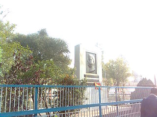
Gomoh is a census town in Topchanchi CD Block Dhanbad Sadar subdivision of Dhanbad district in the Indian state of Jharkhand. It has a major railway junction, which was renamed Netaji Subhas Chandra Bose Gomoh railway station on 23 January 2009, that is situated on the Grand Chord Line under the Dhanbad division of the East Central Railway. Gomoh is the meeting point for trains coming from Howrah, Ranchi/Bokaro and Puri/Bhubaneswar.

Kharkhari, Dhanbad Census Town in Jharkhand, India

Kharkhari is a census town in Baghmara CD block in Dhanbad Sadar subdivision of Dhanbad district in the Indian state of Jharkhand.

Nagri Kalan Census Town in Jharkhand, India

Nagri Kalan is a census town in Baghmara CD block in Dhanbad Sadar subdivision of Dhanbad district in the Indian state of Jharkhand.

Sahnidih Census Town in Jharkhand, India

Sahnidih is a census town in Baghmara CD block in Dhanbad Sadar subdivision of Dhanbad district in the Indian state of Jharkhand.

Topchanchi Census Town in Jharkhand, India

Topchanchi is a census town in Topchanchi CD block in Dhanbad Sadar subdivision of Dhanbad district in the Indian state of Jharkhand.

Tundi (community development block) Community development block in Jharkhand, India

Tundi is a community development block that forms an administrative division in Dhanbad Sadar subdivision of Dhanbad district, Jharkhand state, India.

Purbi Tundi (community development block) Community development block in Jharkhand, India

Purbi Tundi is a community development block that forms an administrative division in Dhanbad Sadar subdivision of Dhanbad district, Jharkhand state, India.

Topchanchi (community development block) Community development block in Jharkhand, India

Topchanchi is a community development block that forms an administrative division in Dhanbad Sadar subdivision of Dhanbad district, Jharkhand state, India.

Baghmara (community development block) Community development block in Jharkhand, India

Baghmara is a community development block that forms an administrative division in Dhanbad Sadar subdivision of Dhanbad district, Jharkhand state, India.

Govindpur (community development block) Community development block in Jharkhand, India

Govindpur is a community development block that forms an administrative division in Dhanbad Sadar subdivision of Dhanbad district, Jharkhand state, India.

Tundi Village in Jharkhand, India

Tundi is a village in Tundi CD block in Dhanbad Sadar subdivision of Dhanbad district in the Indian state of Jharkhand.

Latani, Dhanbad Village in Jharkhand, India

Latani is a village in Purbi Tundi CD block in Dhanbad Sadar subdivision of Dhanbad district in the Indian state of Jharkhand.

Hariharpur, Dhanbad Census Town in Jharkhand, India

Hariharpur is a census town in Topchanchi CD block in Dhanbad Sadar subdivision of Dhanbad district in the Indian state of Jharkhand.

Gunghasa Census Town in Jharkhand, India

Gunghasa is a census town in Topchanchi CD block in Dhanbad Sadar subdivision of Dhanbad district in the Indian state of Jharkhand.

Matigara, Dhanbad Census Town in Jharkhand, India

Matigara is a census town in Baghmara CD block in Dhanbad Sadar subdivision of Dhanbad district in the Indian state of Jharkhand.

Dumra, Dhanbad Census Town in Jharkhand, India

Dumra is a census town in Baghmara CD block in Dhanbad Sadar subdivision of Dhanbad district in the Indian state of Jharkhand.

Rajganj, Dhanbad Census Town in Jharkhand, India

Rajganj is a census town in Baghmara CD block in Dhanbad Sadar subdivision of Dhanbad district in the Indian state of Jharkhand.

Jangalpur Census Town in Jharkhand, India

Jangalpur is a census town in Govindpur CD block in Dhanbad Sadar subdivision of Dhanbad district in the Indian state of Jharkhand.

Barwaada Inhabited place in Jharkhand, India

Barwadda is an inhabited place in Govindpur CD block in Dhanbad Sadar subdivision of Dhanbad district in the Indian state of Jharkhand.

References

  1. "District Census Handbook Dhanbad" (PDF). Series 21, Part XIIA, pages 4-5, 5-6, 8. Directorate of Census Operations, Jharkhand. Retrieved 4 June 2019.
  2. "2011 Census C.D. Block Wise Primary Census Abstract Data(PCA)". Jharkhand – District-wise CD Blocks. Registrar General and Census Commissioner, India. Retrieved 11 June 2019.
  3. "District Census Handbook, Dhanbad, 2011, Series 21, Part XII A" (PDF). Pages 639-664 Statements. Directorate of Census Operations, Jharkhand. Retrieved 9 June 2019.