Chirkunda

Last updated

Chirkunda
City
India Jharkhand location map.svg
Red pog.svg
Chirkunda
Location in Jharkhand, India
India location map 3.png
Red pog.svg
Chirkunda
Chirkunda (India)
Coordinates: 23°44′N86°48′E / 23.74°N 86.80°E / 23.74; 86.80
CountryFlag of India.svg  India
State Jharkhand
District Dhanbad
Area
  Total6.26 km2 (2.42 sq mi)
Population
 (2001)
  Total45,508
  Density7,300/km2 (19,000/sq mi)
Languages
  Official Hindi, Urdu
Time zone UTC+5:30 (IST)
PIN
828202
Telephone code06540
Vehicle registration JH
Website dhanbad.nic.in

Chirkunda is a city and a notified area in Dhanbad Sadar subdivision of Dhanbad district in the state of Jharkhand, India.

Contents

Geography

Invisible Square.svg
Mapscaleline.svg
5km
3miles
Red pog.svg
Kaliasole
R
Invisible Square.svg
Maithon Power Plant
P
Invisible Square.svg
Panchet
Dam
D
Invisible Square.svg
Maithon
Dam
D
Invisible Square.svg
BCCL Chanch/ Victoria Area
Invisible Square.svg
ECL Mugma Area
Invisible Square.svg
Mugma
R
Invisible Square.svg
Kumardubi
N
Invisible Square.svg
Chirkunda
M
Maithon
CT
Invisible Square.svg
Mera
CT
Invisible Square.svg
Siuliban
CT
Invisible Square.svg
Egarkunr
CT
Invisible Square.svg
Marma
CT
Invisible Square.svg
Nirsa
CT
Invisible Square.svg
Panrra
CT
Invisible Square.svg
Panchet
CT
Invisible Square.svg
Dumarkunda
CT
Invisible Square.svg
Cities, towns and locations in the eastern portion of Dhanbad Sadar subdivision in Dhanbad district
M: Municipality, CT: census town, N: neighbourhood, R: Rural/ Urban centre, D: Dam, P: Power Plant
Owing to space constraints in the small map, the actual locations in a larger map may vary slightly

Location

Chirkunda is located at 23°44′N86°48′E / 23.74°N 86.80°E / 23.74; 86.80 .

Note: The map alongside presents some of the notable locations in the area. All places marked in the map are linked in the larger full screen map.

Overview

The region shown in the map is a part of the undulating uplands bustling with coalmines. While the Damodar flows along the southern boundary, the Barakar flows along the eastern boundary. Both the rivers form the boundary with West Bengal. Panchet Dam and Maithon Dam, along with their reservoirs, are prominently visible in the map. The entire area is covered in Nirsa (community development block). In Nirsa CD block 69% of the population live in rural areas and 31% live in urban areas. The official website of the district has announced the formation of two new CD blocks – Egarkund and Kaliasole, possibly carved out of Nirsa CD block. As of July 2019, there is no further information about the new CD blocks. BCCL operates Chanch/ Victoria Area partially within the region shown in the map. ECL operates Mugma Area fully within the region shown in the map. [1] [2] [3]

Police station

Chirkunda police station serves Nirsa CD Block. [4]

Demographics

As per the 2011 Census of India, Chirkunda had a total population of 45,508 of which 23,772 (52%) were males and 21,736 (48%) were females. Population below 6 years was 5,791. The total number of literates in Chirkunda was 30,839 (77.65% of the population over 6 years). [5]

As of 2001 India census, [6] Chirkunda had a population of 39,121. Males constitute 53% of the population and females 47%. Chirkunda has an average literacy rate of 64%, higher than the national average of 59.5%; with male literacy of 71% and female literacy of 56%. 14% of the population is under 6 years of age.

Languages

Languages spoken in Chirkunda town (2011) [7]

   Hindi (34.6%)
   Bengali (24.1%)
   Urdu (14.5%)
   Bhojpuri (9.3%)
   Magadhi (5.6%)
   Khortha (2.8%)
  Others (9.2%)

Infrastructure

Chirkunda has an area of 6.26 km2. It is 45 km from the district headquarters Dhanbad. There is a railway station at Kumardubi 10 km away. Buses are available in the town. It has 19 km roads and open drains. The two major sources of protected water supply are tap water from treated sources and uncovered wells. There are 8,028 domestic electric connections and 180 road light points. Amongst the medical facilities it has a hospital with 8 beds and 12 medicine shops. Amongst the educational facilities, it has 9 primary schools, 6 middle schools, 9 secondary schools, 3 senior secondary schools and 2 general degree colleges. Amongst the recreational facilities, it has 1 cinema theatre and 1 auditorium/ community hall. It had the branches of 5 nationalised banks and 1 non-agricultural credit society. It is a centre of the fire bricks industry and hard coke production. [8]

Education

SHMS Inter Mahavidyalaya was established at Kumardubi in 1979. It is a private co-educational institution. [9]

SCPRP Inter Womens College is located at Nehru Road, Taldanga, Chirkunda. [10] BSK College, Maithon, established in 1966, is a Constituent Unit of Vinoba Bhave University, Hazaribagh. It is located on the main road.

Transportation

Chirkunda is well connected to various places.

Bus

to Tata, Dhanbad, Bokaro, Purulia, Kolkata (From Barakar 1 km away), Durgapur (From Barakar 1 km away), Asansol (From Barakar 20 km away) and Burdwan (From Barakar 1 km away)

Train

Connected by Grand Chord Section of the Asansol - Mughalsarai (Eastern Railway) Nearest Station - Kumardhubi (1 km) followed by Barakar (2.5 km)

Major Express and Super Fast Train which halt at Kumardhubi are Coal Field Express, Black Diamond Express, Vananchal Express, Patliputra Express, Dhanbad–Howrah Double Decker SuperFast Express, Jammu Tawi Express, Shaktipunj Express, Maurya Express, Dumka–Ranchi Intercity Express. Passenger Trains are also available.

Related Research Articles

Dumarkunda is a census town in Nirsa CD block in Dhanbad Sadar subdivision of Dhanbad district in the state of Jharkhand, India.

Egarkunr is a census town in Nirsa CD block in Dhanbad Sadar subdivision of Dhanbad district in the state of Jharkhand, India.

Maithon is a census town in Nirsa CD Block in Dhanbad Sadar subdivision of Dhanbad district in the Indian state of Jharkhand. It is situated on the banks of river Barakar

<span class="mw-page-title-main">Mugma</span> Village in Jharkhand, India

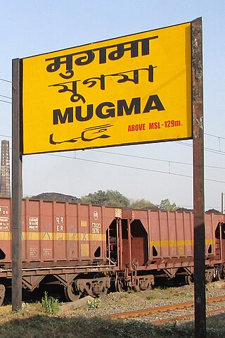
Mugma is a village in Nirsa CD Block in Dhanbad district in the Indian state of Jharkhand.

Nirsa is a census town in Nirsa CD block in the Dhanbad Sadar subdivision of Dhanbad district in the Indian state of Jharkhand.

Panchet is a census town in Nirsa CD block in Dhanbad Sadar subdivision of Dhanbad district in the Indian state of Jharkhand.

Shiblibari is a census town in Nirsa CD block in Dhanbad Sadar subdivision of Dhanbad district in the Indian state of Jharkhand.

Mera is a census town in Nirsa CD block in Dhanbad Sadar subdivision of Dhanbad district in the Indian state of Jharkhand.

Marma is a census town in Nirsa CD block in Dhanbad Sadar subdivision of Dhanbad district in the Indian state of Jharkhand.

<span class="mw-page-title-main">Maithon Dam</span> Dam in Jharkhand and Paschim Bardhaman District of, West Bengal

The Maithon Dam is located at Maithon, 48 km from Dhanbad, in the state of Jharkhand India. It is 15,712 ft (4,789 m) long and 165 ft (50 m) high.

<span class="mw-page-title-main">Panchet Dam</span> Dam in Jharkhand and Purulia district, West Bengal

Panchet Dam was the last of the four multi-purpose dams included in the first phase of the Damodar Valley Corporation (DVC). It was constructed across the Damodar River at Panchet in Dhanbad district in the Indian state of Jharkhand, and opened in 1959.

Kumardhubi is an inhabited place in the Dhanbad district of Jharkhand state, India.

<span class="mw-page-title-main">Maithon Power Plant</span>

Maithon Power Limited (MPL) is an electricity generation plant. It is a joint venture of Tata Power & Damodar Valley Corporation. The venture implemented 1050 MW in Nirsa District Dhanbad in the Indian state of Jharkhand. This project is India’s first 525 MW unit thermal power plant using subcritical technology. It is a coal-based thermal power plant and the first PPP venture plant in the country. This project is India's first Public Private power project.

Nirsa is a community development block that forms an administrative division in Dhanbad Sadar subdivision of Dhanbad district, Jharkhand state, India.

Mugma Area is one of the 14 operational areas of Eastern Coalfields Limited located in Dhanbad district in the state of Jharkhand, India.

Bhamal is a census town in Nirsa CD block in Dhanbad Sadar subdivision of Dhanbad district in the Indian state of Jharkhand.

Panrra is a census town in Nirsa CD block in Dhanbad Sadar subdivision of Dhanbad district in the Indian state of Jharkhand.

Panchmahali is a census town in Nirsa CD block in Dhanbad Sadar subdivision of Dhanbad district in the Indian state of Jharkhand.

Chanch/ Victoria Area is one of the 12 operational areas of BCCL located in Dhanbad Sadar subdivision of Dhanbad district in the state of Jharkhand, and in Asansol Sadar subdivision of Paschim Bardhaman district in West Bengal, both in India.

<span class="mw-page-title-main">Kaliasole</span> Village in Jharkhand, India

Kaliasole is a village in Kaliasole in Dhanbad Sadar subdivision of Dhanbad district of State Capital Ranchi in the Indian state of Jharkhand.

References

  1. "District Census Handbook Dhanbad" (PDF). Series 21, Part XIIA, pages 4-5, 5-6, 8. Directorate of Census Operations, Jharkhand. Retrieved 4 June 2019.
  2. "Area". Bharat Coking Coal Limited. Archived from the original on 26 July 2019. Retrieved 2 July 2019.
  3. "Area-wise Closed User Group (CUG) Telephone Number". Eastern Coalfields Limited. Retrieved 11 August 2018.
  4. "Dhanbad – Welcome to the Coal Capital of India". Administrative Structure of Dhanbad District – List of Thana and Outpost of Dhanbad Outpost. Jharkhand Government. Archived from the original on 24 October 2017. Retrieved 15 October 2017.
  5. "2011 Census – Primary Census Abstract Data Tables". Jharkhand – District-wise. Registrar General and Census Commissioner, India. Retrieved 5 December 2015.
  6. "Census of India 2001: Data from the 2001 Census, including cities, villages and towns (Provisional)". Census Commission of India. Archived from the original on 16 June 2004. Retrieved 1 November 2008.
  7. 2011 census data censusindia.gov.in
  8. "District Census Handbook, Dhanbad, 2011, Series 21, Part XII A" (PDF). Pages 639-664 Statements. Directorate of Census Operations, Jharkhand. Retrieved 9 June 2019.
  9. "S.H.M.S. Inter Mahavidyalaya, Kumardhubi". Schools World. Retrieved 15 June 2019.
  10. "SCPRP Inter Womens College". Ask Laila. Retrieved 15 June 2019.