
Tynedale was a local government district in Northumberland, England. The district had a resident population of 58,808 according to the 2001 census. The main towns were Hexham, Haltwhistle and Prudhoe. The district contained part of Hadrian's Wall and the southern part of Northumberland National Park.

Willesley is a village and former civil parish, now in the parish of Ashby-de-la-Zouch, in the North West Leicestershire district, in the county of Leicestershire, England. It was originally in Derbyshire. Willesley Hall was the home of the Abney and later the Abney-Hastings family. In 1931 the parish had a population of 80.

Throckley is a village in the Newcastle upon Tyne district, in the county of Tyne and Wear, England, approximately 7 miles (11 km) west of Newcastle city centre. Hadrian's Wall passed through the village, its course traced by the village's main road, Hexham Road. Throckley lies within the historic county of Northumberland.

Haydon Bridge is a village in Northumberland, England, which had a population of 2,184 in the 2011 census. Its most distinctive features are the two bridges crossing the River South Tyne: the picturesque original bridge for which the village was named and a modern bridge which used to carry the A69 road. A bypass was completed in 2009 and the A69 now bypasses the village to the south.
Wingfield Manor is a ruined manor house left deserted since the 1770s, near the village of South Wingfield and some four miles (6.4 km) west of the town of Alfreton in the English county of Derbyshire. There is a working farm that forms part of the old manor.

Bellingham is a village and civil parish in Northumberland, to the north-west of Newcastle upon Tyne and is situated on the Hareshaw Burn at its confluence with the River North Tyne.

Bardon Mill is a small village in Northumberland, within the vicinity of the ancient Hadrian's Wall. It is located around 10+1⁄2 miles from Hexham, 26+1⁄2 mi (43 km) from Carlisle, and 32 mi (51 km) from Newcastle upon Tyne.

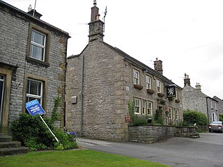
Capheaton is a village and civil parish in Northumberland, England, about 25 miles (40 km) to the northwest of Newcastle upon Tyne. The population at the 2001 census was 160, increasing to 175 at the 2011 Census. It was built as a planned model village in the late eighteenth century. The name Capheaton derives from Caput Heaton, i.e., Heaton Magna, nearby Kirkheaton being the original Heaton Parva.

Dethick, Lea and Holloway is a civil parish, in the Amber Valley borough of the English county of Derbyshire. The population of the civil parish taken at the 2011 census was 1,027.
Great Longstone with Little Longstone is one of two villages in the local government district of Derbyshire Dales in Derbyshire, England. The population as taken at the 2011 Census was 843.

Alston Moor, formerly known as Alston with Garrigill, is a civil parish and electoral ward in the Westmorland and Furness district, in the ceremonial county of Cumbria, England, based around the small town of Alston. It is set in the moorlands of the North Pennines, mostly at an altitude of over 1000 feet. The parish/ward had a population of 2,088 at the 2011 census. As well as the town of Alston, the parish includes the villages of Garrigill and Nenthead, along with the hamlets of Nenthall, Nentsberry, Galligill, Blagill, Ashgill, Leadgate, Bayles and Raise. Alston Moor is part of the North Pennines Area of Outstanding Natural Beauty (AONB), the second largest of the 40 AONBs in England and Wales.
Whitfield is a village and former civil parish, now in the parish of Plenmeller with Whitfield, in the county of Northumberland, England about 10 miles (16 km) southwest of Hexham. It has a farming community and is set against a beautiful scenic background; sometimes it has been called Little Switzerland. In 1951 the parish had a population of 233.

Yelford is a village and former civil parish, now in the parish of Hardwick-with-Yelford, in the West Oxfordshire district, in the county of Oxfordshire, England. It is about 3 miles (5 km) south of Witney. In 1931 the parish had a population of 17.

Aydon Castle, previously sometimes called Aydon Hall, is a fortified manor house at Aydon near to the town of Corbridge, Northumberland, England. It is a Scheduled Ancient Monument, and is designated by English Heritage as a Grade I listed building.

Whitworth Hall which stands in Whitworth Hall Country Park, near Spennymoor, County Durham England, is a country house, formerly the home of the Shafto family and now a hotel. It is a listed building.

Newbrough is a village in Northumberland, England, on the north bank of the River South Tyne about 5 miles (8 km) north-west of Hexham.

Horsley is a small village and civil parish in Northumberland, England. The village lies around 11 miles (18 km) from Newcastle upon Tyne and 12 miles (19 km) from Hexham.

Knarsdale, historically Knaresdale, is a village and former civil parish, now in the parish of Knaresdale with Kirkhaugh, in Northumberland, England about 5 miles (8 km) north of Alston. The village takes its name from the Knarr Burn: Knarr means 'rugged rock'. In 1951 the parish had a population of 289.
Thockrington is a village and former civil parish, now in the parish of Bavington, in Northumberland, England. The village lies about 10 miles (16 km) north of Hexham. In 1951 the parish had a population of 18.
Babington is the name of an Anglo-Irish and English gentry family. The Anglo-Irish branch of the family is still extant today.

