Bawku Municipal District

Last updated
Bawku Municipal District
District Municipal de Bawku
Municipal District
Districts of the Upper East Region (2012).svg
Districts of Upper East Region
Ghana adm location map.svg
Red pog.svg
Bawku Municipal District
Location of Bawku Municipal District within Upper East
Coordinates: 11°3′14.76″N0°14′18.6″W / 11.0541000°N 0.238500°W / 11.0541000; -0.238500
CountryFlag of Ghana.svg  Ghana
Region Upper East
Capital Bawku
Government
  Municipal Chief ExecutiveHajia Hawa Ninchema
Area
  Total1,275 km2 (492 sq mi)
Population
 (2019)
  Total119,907 [1]
Time zone UTC+0 (GMT)
ISO 3166 code GH-UE-BA

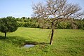
Bawku Municipal District is one of the fifteen districts in Upper East Region, Ghana. Originally created as an ordinary district assembly in 1988 when it was known as Bawku East District ; which was established by Legislative Instrument (L.I.) 1439, until the southern part of the district was split off by a decree of president John Agyekum Kufuor in August 2004 to create Garu-Tempane District ; thus the remaining part was elevated to municipal district assembly status on the same year to become Bawku Municipal District. However, on 28 June 2012, two parts of the district were later split off to create Binduri District (from the west) and Pusiga District (from the east) respectively; thus the remaining part has been retained as Bawku Municipal District. The municipality is located in the eastern part of Upper East Region and has Bawku as its capital town.

Contents

Demographics

The population of Bawku Municipal District, according to the 2010 Population and Housing Census, is 98,538 representing 9.4 percent of the Upper East Region‟s total population. Males constitute 48.0 percent and females represent 52.0 percent. 36.4 percent of the population is rural and 63.6 percent is urban. It shares boundaries with Pusiga District to the north, Binduri District to the south, Garu-Tempane District to the east and Bawku West District to the west. [2]

The Kusaasis are the first known settlers in the area. The other tribes in the area are the Mamprusis, Bisas, Mossi, Hausas etc. who are settlers. There are however large immigrant populations from other locations in northern and southern Ghana as well as from Burkina Faso, Ivory Coast, Togo, Niger and Nigeria.

Of the population 11 years and above, 47.8% are literate and 52.2% are nonliterate. The proportion of literate males is higher (57.6%) than that of females (39.3%). [2]

Economy

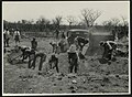
Agriculture is the dominant occupation of the people of the municipality, accounting for about 47.0 percent of the total occupation in the municipality. The major crops grown are millet, sorghum, maize, rice, groundnuts, leafy vegetables, pepper, watermelon, and onion. Livestock such as cattle, sheep, goats, donkeys etc. are also kept in the district. [2]

Festivals

The Kusaasi are known for the celebration of Samanpiid. Other festivals celebrated by other communities are the Zekula by the Bisa people.

Administrative divisions

The district contains the following towns and villages. Of note are:

  • Bawku
  • Pusiga
  • Garu
  • Denugu/Danvorga
  • Kongo
  • Zorsi
  • Tempane
  • Wuriyanga
  • Narango
  • Mognori (Gumbo)
  • Widana
  • Yabrago
  • Missiga
  • Bugri-Bulpielse
  • Manga
  • Basyonde
  • Binduri Natinga
  • Kulugungu
  • Gozesi
  • Bugri
  • Bado

Sources

Related Research Articles

<span class="mw-page-title-main">Upper East Region</span> Region of Ghana

The Upper East Region is located in northern Ghana and is the third smallest of the 16 administrative regions in Ghana. It occupies a total land surface of 8,842 square kilometers or 2.7 per cent of the total land area of Ghana. The Upper East regional capital is Bolgatanga, sometimes referred to as Bolga. Other major towns in the region include Navrongo, Paga, Sandema, Bawku, and Zebilla.

<span class="mw-page-title-main">Bawku</span> Town and district capital in Upper East Region, Ghana

Bawku is a town and is the capital of the Bawku Municipal District, district in the Upper East region of north Ghana, adjacent to the border with Burkina Faso. It is located approximately between latitudes 11o 111 and 100 401 North and longitude 0o 181w and 0o 61 E in the north-eastern corner of the region. The municipality has a total land area of about 257 sq km. The Municipality was established by Legislative Instrument (L.I) 2103. The municipality has a total land area of about 257 sq km. Bawku has a 2021 settlement population of 119,458 people. Hon. Ayariga Mahama is the Member of Parliament for Bawku Central Constituency.

<span class="mw-page-title-main">East Mamprusi Municipal Assembly</span> District in North East region, Ghana

East Mamprusi Municipal Assembly is one of the six districts in North East Region, Ghana. Originally created as an ordinary district assembly in 1988 when it was known as East Mamprusi District, which was created from the former Mamprusi District Council, until the eastern part of the district was split off by a decree of president John Agyekum Kufuor on 19 August 2004 to create Bunkpurugu-Yunyoo District; thus the remaining part has been retained as East Mamprusi District. However on 15 March 2018, it was elevated to municipal district assembly status to become East Mamprusi Municipal District. The municipality is located in the eastern part of North East Region and has Gambaga as its capital town.

<span class="mw-page-title-main">West Mamprusi Municipal Assembly</span> District in North East region, Ghana

West Mamprusi Municipal Assembly is one of the six districts in North East Region, Ghana. Originally created as an ordinary district assembly in 1988 when it was known as West Mamprusi District, which was created from the former Mamprusi District Council, until the western part of the district was split off on 28 June 2012 to create Mamprugu-Moagduri District; thus the remaining part has been retained as West Mamprusi District. However, on 15 March 2018, it was elevated to municipal district assembly status to become West Mamprusi Municipal District. The municipality is located in the western part of North East Region and has Walewale as its capital town. Other settlements within the municipal assembly include Wulugu.

<span class="mw-page-title-main">Bawku West District</span> District in Upper East region, Ghana

Bawku West District is one of the fifteen districts in Upper East Region, Ghana. Originally created as an ordinary district assembly in 1988; which was established by Legislative Instrument (L.I.) 1442. The municipality is located in the eastern part of Upper East Region and has Zebilla as its capital town.

<span class="mw-page-title-main">Garu District</span> District in Upper East, Ghana

Garu District is one of the 15 districts in Upper East Region, Ghana. Originally it was formerly part of the then-larger Garu-Tempane District in 2004. The southeast part of the district was split off to create Tempane District on 15 February 2018 and the remaining part has been renamed as Garu District. The district assembly is located in the eastern part of Upper East Region. Its administrative capital is Garu.

<span class="mw-page-title-main">Bawku Central (Ghana parliament constituency)</span> Constituency in Ghana

Bawku Central is one of the constituencies represented in the Parliament of Ghana. It elects one Member of Parliament (MP) by the first past the post system of election. Bawku Central is located in the Bawku Municipal district of the Upper East Region of Ghana.

<span class="mw-page-title-main">Cletus Avoka</span> Ghanaian politician

Cletus Apul Avoka is Ghanaian lawyer, politician and member of the Parliament of Ghana representing the Zebilla East constituency in the Upper East region.

<span class="mw-page-title-main">Garu – Tempane (Ghana parliament constituency)</span>

Garu - Tempane is one of the constituencies represented in the Parliament of Ghana. It elects one Member of Parliament (MP) by the first past the post system of election. Garu - Tempane is located in the Garu-Tempane district of the Upper East Region of Ghana.

<span class="mw-page-title-main">Pusiga (Ghana parliament constituency)</span> Constituency in Ghana

Pusiga is one of the constituencies represented in the Parliament of Ghana. It elects one Member of Parliament (MP) by the first past the post system of election. Pusiga is located in the Bawku Municipal District of the Upper East Region of Ghana. Pusiga is part of the northern part of Ghana.

<span class="mw-page-title-main">Binduri (Ghana parliament constituency)</span>

Binduri is one of the constituencies represented in the Parliament of Ghana. It elects one Member of Parliament (MP) by the first past the post system of election. Binduri was part of in the Bawku Municipal district of the Upper East Region of Ghana but has since June 2012 become a full district.

Mamprusis are an ethnic group in northern Ghana and Togo. Estimates are that there are about 200,000 Mamprusis living in the Northern Regions of Ghana as of 2013, They speak Mampruli, one of the Gur languages. In Ghana, the Mamprusis live mainly in Nalerigu, Gambaga, Walewale, and their surrounding towns and villages in the North East Region. Their origin is in the Upper East Region, principally, Bawku, and they also inhabit parts of the Upper West Region, too.

Garu is a town and is the administrative capital of Garu District, a district in the Upper East Region of northern Ghana.

Belingogo is a small community in the Garu-Tempane District of the Upper East Region of Ghana which forms one of the nine districts in the region.The District is located in the South Eastern corner of the Upper East Region of the Republic of Ghana and shares boundaries with, Bawku Municipal to the North, Binduri to the North West, Pusiga District to North East, East Mamprusi District to the South West, Bunkpurugu-Yunyoo District to South East, Bawku West District to the West and the Republic of Togo to the East. It covers an area of 1,230 km2. It lies on approximately latitude 10o38'N and 11oN and longitude 0o 06' E and 0o 23l E. The administrative capital is Garu.

Joseph Kojo Akudibillah is a Ghanaian diplomat and an independent candidate. He is currently Ghana's ambassador to the Vatican.

Gbewaa College of Education is a teacher education college in Pusiga-Bawku . Pusiga District / Bawku Municipal District, Upper East Region, Ghana). Located in Northern Zone, the school was set up in 1953 and affiliated to the University of Ghana. It is one of the 46 public colleges of education in Ghana.

<span class="mw-page-title-main">Binduri (district)</span> District in Upper East, Ghana

Binduri District is one of the fifteen districts in Upper East Region, Ghana. Originally it was formerly part of the then-larger Bawku Municipal District in 1988; until two parts of the district were later split off to create Binduri District and Pusiga District respectively on 28 June 2012. The district assembly is located in the eastern part of Upper East Region and has Binduri as its capital town.

<span class="mw-page-title-main">Pusiga (district)</span> District in Upper East, Ghana

Pusiga District is one of the fifteen districts in Upper East Region, Ghana. Originally it was formerly part of the then-larger Bawku Municipal District in 1988; until two parts of the district were later split off to create Binduri District and Pusiga District respectively on 28 June 2012. The district assembly is located in the eastern part of Upper East Region and has Pusiga as its capital town.

<span class="mw-page-title-main">Garu-Tempane District</span> District in Upper East, Ghana

Garu-Tempane District is a former district that was located in Upper East Region, Ghana. Originally it was formerly part of the then-larger Bawku East District in August 2004. However, on 15 March 2018, it was split out into two new districts: Garu District and Tempane District. The district assembly was located in the eastern part of Upper East Region and had Garu as its capital town.

<span class="mw-page-title-main">Abdulai Abanga</span> Ghanaian politician

Abdulai Abanga is a Ghanaian politician who is a member of the New Patriotic Party. He is the member of parliament for the Binduri constituency in the Upper East Region. He is the current Deputy Minister for Ministry of Works and Housing and also serve on the Committee on Government Assurance as the Vice Chairman.

References

  1. "Ghana Statistical Services".
  2. 1 2 3 Ghana Statistical Service (2014). 2010 Population and Housing Census.

11°3′14.76″N0°14′18.6″W / 11.0541000°N 0.238500°W / 11.0541000; -0.238500