
Kearny is a town in Pinal County, Arizona, United States. The town was named after General Stephen Watts Kearny, who passed through the area on November 7, 1846, while leading 100 dragoons to California. According to the 2010 census, the population of the town is 1,950. The economic base of Kearny and nearby towns is the Ray mine and Hayden Smelter, both owned and operated by ASARCO.

Shiawassee Township is a civil township of Shiawassee County in the U.S. state of Michigan. The population was 2,840 at the 2010 census.

Nakaibito is a census-designated place (CDP) in McKinley County, New Mexico, United States. The population was 455 at the 2000 census.
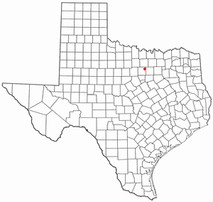
Sanctuary is a town in Parker County, Texas, United States. The population was 329 at the 2010 census, and was incorporated in the early 1980s.
Boulder Flats is a census-designated place (CDP) in Fremont County, Wyoming, United States. The population was 408 at the 2010 census.

Bongo District is one of the fifteen districts in Upper East Region, Ghana. Originally created as an ordinary district assembly in 1988; which was established by Legislative Instrument (L.I.) 1446. The municipality is located in the central part of Upper East Region and has Bongo as its capital town.
Davisville is an unincorporated community in southeastern Crawford County, Missouri, United States. It is located in the Mark Twain National Forest, approximately 13 miles southeast of Steelville.
Barra dos Coqueiros is a municipality Brazilian state of Sergipe. Its population was 30,930 (2020) and its area is 91 km².
Phú Giáo is a rural district of Bình Dương province in the Southeast region of Vietnam. As of 2003 the district had a population of 67,252. The district covers 541 km2. The district capital lies at Phước Vĩnh.
Komandorski Village was a temporary low-rent housing development in Dublin, Alameda County, California. It was built to hold the overflow of military personnel and families from Camp Parks. It was sold by the United States government to a housing authority in 1954, and was required to be demolished in 1984. It was located 2 miles (3.2 km) northeast of central Dublin, at an elevation of 371 feet.

Xiangyang District is an administrative subdivision of the city of Jiamusi, Heilongjiang province, China, with 233,855 inhabitants.

Öræfasveit or Öræfi[ˈœːrˌaiːvɪ] is a western region in Austur-Skaftafellssýsla, Iceland. It lies between Breiðamerkursandur and the river Skeiðará, east of the village of Kirkjubæjarklaustur and South, West and East of the Öræfajökull volcano. It has been a part of the municipality of Hornafjörður since 1998. In the Middle Ages, this region was called Hérað or Litlahérað, but was deserted in the wake of the 1362 eruption of Öræfajökull and the subsequent flooding of the region. After these events the region was simply called Öræfi ("wilderness/desolation").

The Morongo Band of Mission Indians is a federally recognized tribe in California, United States. The main tribal groups are Cahuilla and Serrano. Tribal members also include Cupeño, Luiseño, and Chemehuevi Indians. Although many tribes in California are known as Mission Indians, some, such as those at Morongo, were never a part of the Spanish Missions in California.

The Château de Francs is a château in Bègles, Gironde, Nouvelle-Aquitaine, France.

Antašava Manor is a former residential manor in Antašava, Kupiškis district.
Bascom Corner is an unincorporated community in Cass Township, Ohio County, in the U.S. state of Indiana.
Otsego Center is an unincorporated community in Otsego Township, Steuben County, in the U.S. state of Indiana.
Ravinia Oaks is an unincorporated community in Otsego Township, Steuben County, in the U.S. state of Indiana.
Lebo is an unincorporated community in southern Howell County, in the U.S. state of Missouri. The community is located south of West Plains at the intersection of Missouri routes 142 and JJ, approximately one mile north of the Missouri - Arkansas state line.
Goodhope is an unincorporated community in southwestern Douglas County, Missouri, United States. The community lies on the south side of the intersection of Missouri State Routes T and O and just west of the intersection of Route T with Missouri Route 76.

