Bolgatanga Municipal District

Last updated
Bolgatanga Municipal District
District Municipal de Bolgatanga
Municipal District
Bolgatanga Street.jpg
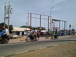
View of street in Bolgatanga Municipal District
Bolgatanga Municipal Assembly (BMA) logo.JPG
Districts of the Upper East Region (2012).svg
Districts of Upper East Region
Ghana adm location map.svg
Red pog.svg
Bolgatanga Municipal District
Location of Bolgatanga Municipal District within Upper East
Coordinates: 10°47′15″N0°51′28.8″W / 10.78750°N 0.858000°W / 10.78750; -0.858000
CountryFlag of Ghana.svg  Ghana
Region Upper East
Capital Bolgatanga
Government
  Municipal Chief ExecutiveHarry Ayamga Epsona
Area
  Total729 km2 (281 sq mi)
Population
 (2013)
  Total
Time zone UTC+0 (GMT)
ISO 3166 code GH-UE-BO

Bolgatanga Municipal District is one of the fifteen districts in Upper East Region, Ghana. Originally created as an ordinary district assembly in 1988 when it was known as Bolgatanga District ; which was established by Legislative Instrument (L.I.) 1438, until the southeast part of the district was split off by a decree of president John Agyekum Kufuor in August 2004 to create Talensi-Nabdam District ; thus the remaining part was elevated to municipal district assembly status on the same year to become Bolgatanga Municipal District, which was established by Legislative Instrument (L.I.) 1797. However, on 15 March 2018, the eastern part of the district was later split off to create Bolgatanga East District , which was established by Legislative Instrument (L.I.) 2321; [1] thus the remaining part has been retained as Bolgatanga Municipal District. The municipality is located in the central part of Upper East Region and has Bolgatanga as its capital town, which also serves as the capital of the Upper East Region.

Contents

Climate

The climate is tropical with a rainy season from May to October and a dry season with virtually no rainfall from November to April. Temperatures range between a maximum of 40 degrees in March / April and at least 12 °C in December.

The natural vegetation of the district consists of tree savanna, with baobab, and acacia trees. The low vegetation is burned by fire during the dry season or dried by the sun.

Demographics

The inhabitants of the district belong predominantly to different peoples of Northern Ghana. The town of Bolgatanga, however, has a cosmopolitan character. Here are mixed not only different peoples of the north, but also members of the major ethnic groups including the Grune, Sisala, and Kanjegah peoples, as well as the Hausa and Mossi.

Economy

The majority of the population in the 1990s lived, in spite of the urban structure of the district, from agriculture, 19% commercial, 12% industry, mainly handicrafts, and just 7.4% were employed in public services. There are some jobs in the mining and construction and in the form of some metal-working companies, repair shops, painting companies etc. but these represent a very small minority.

Villages

The capital in the district is Bolgatanga. Some towns and villages in the district include:

Sources

Related Research Articles

<span class="mw-page-title-main">Bolgatanga</span> Town in Upper East Region, Ghana

Bolgatanga, colloquially known as Bolga, is a town and the capital of the Bolgatanga Municipal District and Upper East Region of Ghana, adjacent to the border with Burkina Faso. Bolgatanga has over 2012 settlement and a population of about 66,685 people. Bolgatanga is 161 km to the north of Tamale. Bolgatanga lies in the Red Volta River Valley, with the White Volta River and the cliffs of the Gambaga Escarpment to the south of the town forming the southern boundary of the Upper East Region.

Upper East Region Region of Ghana

The Upper East Region is located in north Ghana and is the third smallest of the 16 administrative regions in Ghana. It occupies a total land surface of 8,842 square kilometers or 2.7 per cent of the total land area of Ghana. The Upper East regional capital is Bolgatanga, sometimes referred to as Bolga. Other major towns in the region include Navrongo, Paga, Bawku and Zebilla.

Bongo District District in Upper East, Ghana

Bongo District is one of the fifteen districts in Upper East Region, Ghana. Originally created as an ordinary district assembly in 1988; which was established by Legislative Instrument (L.I.) 1446. The municipality is located in the central part of Upper East Region and has Bongo as its capital town.

Jasikan District District in Ghana

Jasikan District is one of the eight districts in Oti Region, Ghana. Originally created as an ordinary district assembly on 10 March 1989, which was created from the former Jasikan District Council, which it was established by Legislative Instrument (L.I.) 1464, until the western part of the district was split off to create Biakoye District on 29 February 2008, which was established by Legislative Instrument (L.I.) 1901; thus the remaining part has been retained as Jasikan District. The district assembly is located in the southern part of Oti Region and has Jasikan as its capital town.

Kassena-Nankana Municipal District Municipal district in Upper East region, Ghana

Kassena-Nankana Municipal is one of the fifteen districts in Upper East Region, Ghana. Originally it was formerly part of the then-larger Kassena-Nankana District in 1988, until the western part of the district was split off to create Kassena-Nankana West District on 29 February 2008; thus the remaining part has been renamed as Kassena-Nankana East District, which it was later elevated to municipal assembly status on 28 June 2012 to become Kassena-Nankana Municipal District. The municipality is located in the western part of Upper East Region and has Navrongo as its capital town.

Krachi West District District in Ghana

Krachi West District is one of the eight districts in Oti Region, Ghana. Originally it was formerly part of the then-larger Krachi District on 10 March 1989, which was established by Legislative Instrument (L.I.) 1501, until the eastern part of the district was split off to create Krachi East District on 4 August 2004, which was established by Legislative Instrument (L.I.) 1747; thus the remaining part has been renamed to become Krachi West District. However, on 28 June 2012, the northern part of the district was split off to create Krachi Nchumuru District, which was established by Legislative Instrument (L.I.) 2078; thus the remaining part has been retained as Krachi West District. The district assembly is located in the northern part of Oti Region and has Kete Krachi as its capital town.

Nkwanta South Municipal District Municipal District in Ghana

Nkwanta South Municipal Assembly is one of the eight districts in Oti Region, Ghana. Originally it was formerly part of the then-larger Nkwanta District on 10 March 1989, which was established by Legislative Instrument (L.I.) 1496, until the northern part of the district was split off to create Nkwanta North District on 29 February 2008, which was established by Legislative Instrument (L.I.) 1892; thus the remaining part has been renamed to become Nkwanta South District. However, on 14 November 2017, it was later elevated to municipal district assembly status to become Nkwanta South Municipal District; which was established by Legislative Instrument (L.I.) 2283. The municipality is located in the northern part of Oti Region and has Nkwanta as its capital town.

North Tongu District District in Ghana

North Tongu District is one of the eighteen districts in Volta Region, Ghana. Originally it was formerly part of the then-larger and original North Tongu District on 10 March 1989, with Adidome as its capital town, which was created from the former Tongu District Council, until the western part of the district was split off to create a new North Tongu District on 28 June 2012, with Battor Dugame as its capital town, which was established by Legislative Instrument (L.I.) 2081; thus the remaining part has been renamed as Central Tongu District, with Adidome as its capital town, which was established by Legislative Instrument (L.I.) 2077. The district assembly is located in the southwest part of Volta Region and has Battor Dugame as its capital town.

West Mamprusi Municipal Assembly District in North East region, Ghana

West Mamprusi Municipal Assembly is one of the six districts in North East Region, Ghana. Originally created as an ordinary district assembly in 1988 when it was known as West Mamprusi District, which was created from the former Mamprusi District Council, until the western part of the district was split off on 28 June 2012 to create Mamprugu-Moagduri District; thus the remaining part has been retained as West Mamprusi District. However, on 15 March 2018, it was elevated to municipal district assembly status to become West Mamprusi Municipal District. The municipality is located in the western part of North East Region and has Walewale as its capital town. Other settlements within the municipal assembly include Wulugu.

South Dayi District District in Ghana

South Dayi District is one of the eighteen districts in Volta Region, Ghana. Originally it was formerly part of the then-larger Kpando District on 10 March 1989, until the southern part of the district was split off by a decree of president John Agyekum Kufuor on 19 August 2004 to create South Dayi District; thus the remaining part has been retained as Kpando District. The district assembly is located in the western part of Volta Region and has Kpeve as its capital town.

Krachi East Municipal District Municipal District in Ghana

Krachi East Municipal District is one of the eight districts in Oti Region, Ghana. Originally it was formerly part of the then-larger Krachi District on 1988, until the eastern part of the district was split off to create Krachi East District on 19 August 2004, which was established by Legislative Instrument (L.I.) 1755; thus the remaining part has been renamed to become Krachi West District. However, on 14 November 2017, it was later elevated to municipal district assembly status to become Krachi East Municipal District; which was established by Legislative Instrument (L.I.) 2281. The municipality is located in the northern part of Oti Region and has Dambai as its capital town.

Bawku Municipal District Municipal district in Upper East region, Ghana

Bawku Municipal District is one of the fifteen districts in Upper East Region, Ghana. Originally created as an ordinary district assembly in 1988 when it was known as Bawku East District; which was established by Legislative Instrument (L.I.) 1439, until the southern part of the district was split off by a decree of president John Agyekum Kufuor in August 2004 to create Garu-Tempane District; thus the remaining part was elevated to municipal district assembly status on the same year to become Bawku Municipal District. However, on 28 June 2012, two parts of the district were later split off to create Binduri District and Pusiga District respectively; thus the remaining part has been retained as Bawku Municipal District. The municipality is located in the eastern part of Upper East Region and has Bawku as its capital town.

Talensi-Nabdam District Former District in Upper East, Ghana

Talensi-Nabdam District is a former district that was located in Upper East Region, Ghana. Originally it was formerly part of the then-larger Bolgatanga District in August 2004. However, on 28 June 2012, it was split oft into two new districts: Talensi District and Nabdam District. The district assembly was located in the central part of Upper East Region and had Tongo as its capital town.

Kassena-Nankana West District District in Upper East region, Ghana

Kassena-Nankana West District is one of the fifteen districts in Upper East Region, Ghana. Originally, it was formerly part of the then-larger Kassena-Nankana District in 1988, until the western part of the district was split off to create Kassena-Nankana West District on 29 February 2008; thus the remaining part has been renamed as Kassena-Nankana East District. The district assembly is located in the western part of Upper East Region and has Paga as its capital town.

Ga West Municipal District Municipal District in Ghana

Ga West Municipal District is one of the twenty-nine districts in Greater Accra Region, Ghana. Originally it was formerly part of the then-larger Ga District in 1988, until the eastern part of the district was split off to create Ga East District in 2004; thus the remaining part has been renamed as Ga West District. Later, the western part of the district was split off to create the first Ga South Municipal District on 29 February 2008, with Weija as its capital town; while Ga West was later elevated to municipal district assembly status during that same year to become Ga West Municipal District. However on 15 March 2018, the eastern part of the district has split off to create Ga North Municipal District, thus the remaining part has been retained as Ga West Municipal District. The municipality is located in the western part of Greater Accra Region and has Amasaman as its capital town.

Ho Municipal District Municipal District in Ghana

Ho Municipal District is one of the eighteen districts in Volta Region, Ghana. Originally created as an ordinary district assembly on 10 March 1989 when it was known as Ho District, until the southern part of the district was split off by a decree of president John Agyekum Kufuor on 13 August 2004 to create Adaklu-Anyigbe District; thus the remaining part has been retained as Ho District. However on 28 June 2012, the western part of the district was later split off to create Ho West District; thus the remaining part was elevated to municipal district assembly status on that same year to become Ho Municipal District, which was established by Legislative Instrument (L.I.) 2074. The municipality is located in the central part of Volta Region and has Ho as its capital town.

La Dade Kotopon Municipal District Municipal District in Ghana

La Dade Kotopon Municipal District is one of the twenty-nine districts in Greater Accra Region, Ghana. Originally it was formerly part of the then-larger Accra Metropolitan District in 1988, until the eastern portion of the district was split off to create La Dade Kotopon Municipal District on 28 June 2012; thus the remaining part has been retained as Accra Metropolitan District. The municipality is located in the central part of Greater Accra Region and has La as its capital town.

North East Region, Ghana Region of Ghana

The North East Region is one of the sixteen regions of Ghana. It is located in the north of the country and was created in December 2018 after a referendum was voted upon to break it off of the Northern region. The region's capital is Nalerigu.

Kpone Katamanso Municipal District District in Greater Accra region, Ghana

Kpone-Katamanso Municipal District is one of the twenty-nine districts in Greater Accra Region, Ghana. Originally it was formerly part of the then-larger Tema Municipal District, which was created from the former Tema District Council, until the eastern portion of the district was split off to create Kpone-Katamanso District on 28 June 2012, which was established by Legislative Instrument (L.I.) 2031; thus the remaining part has been retained as Tema Metropolitan District. However on 15 March 2018, it was later elevated to municipal district assembly status to become Kpone-Katamanso Municipal District, which was established by Legislative Instrument (L.I.) 2271. The municipality is located in the central part of Greater Accra Region and has Kpone as its capital town.

Bolgatanga East District District in Upper East, Ghana

Bolgatanga East District is one of the fifteen districts in Upper East Region, Ghana. Originally it was formerly part of the then-larger Bolgatanga District in 1988; until the eastern part of the district was later split off to create Bolgatanga East District on 15 March 2018, which was established by Legislative Instrument (L.I.) 2350; thus the remaining part has been retained as Bolgatanga Municipal District. The district assembly is located in the central part of Upper East Region and has Zuarungu as its capital town.

References

Coordinates: 10°47′15″N0°51′28.8″W / 10.78750°N 0.858000°W / 10.78750; -0.858000