Derwent Reservoir is a reservoir on the River Derwent, on the border between County Durham and Northumberland, in England. It is west of Consett. It is 3.5 miles (5.6 km) long) and covers an area of 4 km2 and has a maximum depth of 100 ft (30m) and when full, holds 11,000 million gallons (50,000,000m³).

Brassington is a village and civil parish in the Derbyshire Dales district of Derbyshire, 16 miles north west of Derby. The parish had a population of 573 at the 2011 census.

Townfield is a village in County Durham, in England. It is situated just to the south of Hunstanworth and part of that parish, about 10 miles (16 km) west of Consett.

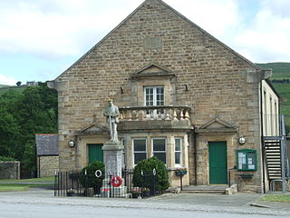
St John's Chapel is a village in County Durham, in England. It is situated in Weardale, on the south side of the River Wear on the A689 road between Daddry Shield and Ireshopeburn. The 2001 census reported a population of 307, of whom only 43 were children under 16. In 1980 there were 160 children in the village.

Winston is a village and civil parish in County Durham, England. It is situated approximately 6 miles (9.7 km) east of Barnard Castle, on a crossroads between the A67 and B6274 roads. According to the 2011 UK Census the population was 431, the parish includes the hamlets of Little Newsham and South Cleatlam.

Ramshaw is a small village in County Durham, in England. It is situated to the south of Hunstanworth, a few miles west of Consett.

Middleton-in-Teesdale is a market town in County Durham, in England. It is situated on the north side of Teesdale between Eggleston and Newbiggin, a few miles to the north-west of Barnard Castle. The settlement is surrounded by the North Pennines Area of Outstanding Natural Beauty (AONB).

Frosterley is a village in County Durham, in England. It is situated in Weardale, on the River Wear close to its confluence with Bollihope Burn; between Wolsingham and Stanhope; 18 miles west of Durham City and 26 miles southwest of Newcastle-upon-Tyne. In the 2001 census Frosterley had a population of 705.

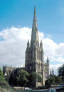
Bristol, the largest city in South West England, has an eclectic combination of architectural styles, ranging from the medieval to 20th century brutalism and beyond. During the mid-19th century, Bristol Byzantine, an architectural style unique to the city, was developed, and several examples have survived.

Juniper is a hamlet in the English county of Northumberland.

Bishopsworth is the name of both a council ward of the city of Bristol in the United Kingdom, and a suburb of the city which lies within that ward. Bishopsworth contains many council estates.

Timsbury is a village and civil parish in the Bath and North East Somerset unitary authority of the county of Somerset, 8 miles (13 km) south-west of Bath, close to the Cam Brook river. The parish, which includes the hamlets of Meadgate, Radford and Wall Mead, has a population of 2,624.

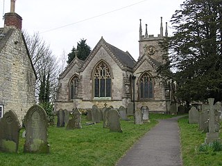
Healey is a rural estate and civil parish in Northumberland, England, situated between Riding Mill to the north and Slaley to the south. The neo-Norman St John's Parish Church, which was built in 1860, was awarded the 2011 Art in a Religious Context award for its windows by Anne Vibeke Mou and James Hugonin. At the 2001 census, the parish had a population of 194, falling slightly to 191 at the 2011 Census.

There are 100 Grade I listed buildings in Bristol, England according to Bristol City Council. The register includes many structures which for convenience are grouped together in the list below.

John Wesley's New Room formally known as New Room is a historic building in Broadmead, Bristol, England. As the oldest purpose-built Methodist meeting house, it has been designated by Historic England as a grade I listed building, and is the only piece of land in Broadmead for which the freehold has not been bought by Bristol City Council during expansion after World War II.
There are 212 Grade II* listed buildings in Bristol, England.

Slaley is a village in Northumberland, England. It is situated to the southeast of Hexham. It is surrounded by the following villages: Ruffside, Whitley Chapel, Ordley, Wooley, Healey, Juniper, Riding Lea, and Blanchland.

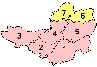
The Grade I listed buildings in Somerset, England, demonstrate the history and diversity of its architecture. The ceremonial county of Somerset consists of a non-metropolitan county, administered by Somerset County Council, which is divided into five districts, and two unitary authorities. The districts of Somerset are West Somerset, South Somerset, Taunton Deane, Mendip and Sedgemoor. The two administratively independent unitary authorities, which were established on 1 April 1996 following the breakup of the county of Avon, are North Somerset and Bath and North East Somerset. These unitary authorities include areas that were once part of Somerset before the creation of Avon in 1974.

Scremerston is a village in Northumberland, England. The village lies on the North Sea coast just under 2.5 miles (4 km) south of Berwick-upon-Tweed and 4.3 miles (7 km) from the Anglo-Scottish border. It is adjacent to the A1, providing access to Newcastle upon Tyne to the south, and to Edinburgh to the north.


